IJkdijk
Most dikes never want to collapse. This one was built to. At exactly 16:02 on Saturday, 27 September 2008, a hundred meters of test dike in the open countryside near Bellingwolde, in the eastern Dutch province of Groningen, gave way as cameras and sensors recorded every second of its failure. There were no farms behind it, no houses, no one to evacuate. The experiment was the whole point. The Dutch had built the IJkdijk - literally the 'calibration dike' - to find out, in honest detail, how dikes actually die. About 1.2 million kilometers of dikes hold back water somewhere in the world, including the ones that keep a quarter of the Netherlands from being North Sea. Until the IJkdijk, no one had ever instrumented one to destruction at this scale.
Why a Country Builds a Dike to Break It
The Netherlands has been failing dikes the hard way since the eleventh century. The big medieval floods were memorized by name: the All Saints' Flood, the St. Lucia's Flood, the 1953 North Sea flood that killed nearly two thousand people. After 1953 the country built the Delta Works, one of the largest civil-engineering systems on Earth. But even the Delta Works rests on assumptions about how dikes behave - assumptions calibrated mostly from disasters and from small-scale laboratory tests. With climate change raising sea levels and storm intensities, with land subsidence dropping the polders lower year by year, and with the value of what sits behind the dikes climbing into trillions of euros, those assumptions stopped being good enough. Dutch engineers wanted to know what was really happening inside an embankment in its last hours. The only way to find out was to build embankments specifically to lose them.
The Calibration Dike
The IJkdijk facility opened in November 2007 near the village of Booneschans, between Bellingwolde and the German border. The name carries the joke: dijk means dike, ijken means to calibrate. Calibration Dike. The plan was to build approximately eighty test dikes over the project's lifetime, each one engineered to fail under a specific scenario - overtopping waves, internal piping erosion, slope instability, saturation collapse - while a forest of sensors recorded what happened. The project was led by the Dutch research institutes TNO and Deltares, together with the water-board research foundation STOWA and a consortium that eventually included around fifty companies developing dike-monitoring technology. The whole site was wired with fiber-optic cables, lidar scanners, infrared and visual cameras, weather stations, and experimental sensor arrays buried inside the dike body itself.
Sixteen Hours to Failure
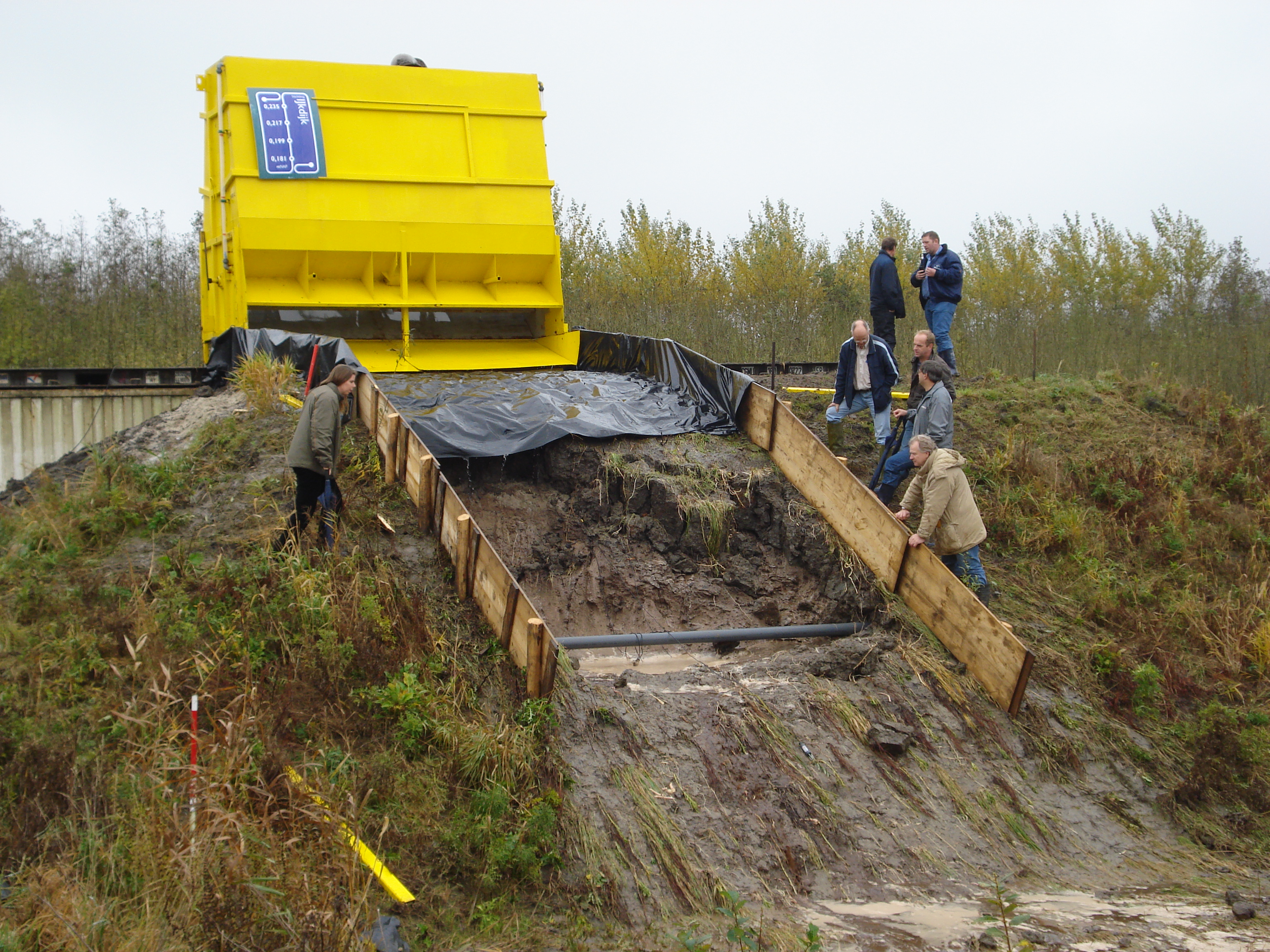
The macrostability experiment of September 2008 was the IJkdijk's first scientific triumph. The test dike was roughly a hundred meters long, thirty meters wide, and six meters high, with a core of white sand wrapped in a clay shell. A drainage system at the base allowed water to be added or removed on command. Steel containers were placed on top to load it. Sensors of every available type were embedded throughout, and the subsoil underneath was carefully mapped. On Friday, 26 September, a trench was cut in the soil at the dike's toe to simulate a weak point. Sixteen hours later, at 08:00 on Saturday morning, the water level inside the dike was raised. The whole structure was now being asked to fail in slow motion while every instrument the consortium owned was pointed at it. The collapse came eight hours after that, at 16:02. More than a terabyte of data was captured - at the time, a globally unique dataset on internal dike failure.
What the Wires Heard
What the IJkdijk has consistently shown is something counterintuitive: most dike failures are not failures of height. They are failures of saturation and internal erosion. Water flowing through a dike, finding a sandy seam, working it wider over hours or days, undermines the embankment from the inside. By the time anything visible appears on the outside, the failure has already happened internally. Traditional dike inspection - a person walking the crest with eyes - cannot see this. Sensor networks can. Fiber-optic strain cables along the dike body detect millimeter movements before the eye can. Pore-pressure sensors register saturation hours before slumping starts. The IJkdijk experiments are how those technologies earned the field credibility they could not earn in a laboratory. Some of them have since been deployed on real Dutch dikes, watching for failures that have not yet started.
The Field Where Embankments Die
From altitude, the IJkdijk site is unremarkable: a patch of polder ground east of Bellingwolde with some earthworks scattered across it, looking less impressive than the farms around it. That modesty is the point. The dikes built here are the kind of dikes built everywhere - clay over sand, modest in height, ordinary in profile - precisely so that what is learned from their destruction can transfer to the millions of kilometers of similar embankments elsewhere. Developing countries, in particular, may benefit most: dikes in expanding river-delta cities cost a fortune to build conservatively, and sensor-based monitoring can let them be built more sparingly without sacrificing safety. The Dutch have always exported their water expertise. The IJkdijk added a new product to the catalog: not just how to build a dike, but how to know, in real time, when one is starting to fail. And the proof of that knowing arrived on a Saturday afternoon at 16:02, when an embankment did exactly what it was asked to do.
From the Air
The IJkdijk test field sits at 53.15°N, 7.19°E in the polder country east of Bellingwolde, near the village of Booneschans in Westerwolde municipality. From altitude the site appears as an open agricultural area with scattered earthwork test embankments and instrumentation buildings - much less visually striking than the cruise-ship shipyard at Papenburg about 18 km to the east. Recommended viewing altitude 2,000-4,000 feet. Nearest airports: Groningen Eelde (EHGG) about 50 km west, Bremen (EDDW) about 100 km southeast. The Dutch-German border lies immediately east; the river Ems and the Meyer Werft yard at Papenburg are clearly visible to the east-southeast.