Imperial City, Beijing
Between the Forbidden City and the streets where ordinary people lived, there was a buffer zone. Not a wall -- though walls surrounded it -- but an entire layer of the city, a ring of imperial gardens, ancestral shrines, government offices, and service buildings that separated the emperor's private universe from the capital he ruled. This was the Imperial City of Beijing, a zone within a zone, accessible only through seven gates and reserved for those whose business required proximity to power. Today its boundaries are largely invisible, its walls mostly demolished, its sacred groves converted to public parks. But its footprint still shapes how Beijing breathes.
Built on Mongol Bones
The Imperial City's origins reach back to the Yuan dynasty, when Beijing was Dadu, the winter capital of the Mongol Empire. The Yuan imperial precinct occupied the city's center, and when Ming armies conquered Dadu in 1368, most of the Imperial City survived the war intact. The following year, however, the Hongwu Emperor ordered it demolished -- not because it was damaged, but because it was Mongol. His fourth son, Zhu Di, created Prince of Yan, built a princely palace on the same site in 1379. When Zhu Di seized the throne in a coup and became the Yongle Emperor in 1402, he remade Beijing as his capital. Construction of the Forbidden City began in 1406, and the Imperial City expanded around it, swallowing the lakes of Zhongnanhai and Beihai and stretching well beyond the old Yuan boundaries. Earth excavated from the palace moat was piled north of the Forbidden City to create Jingshan Hill, an artificial mountain that served as a scenic backdrop and a geomantic barrier.
Seven Gates, Two Dynasties
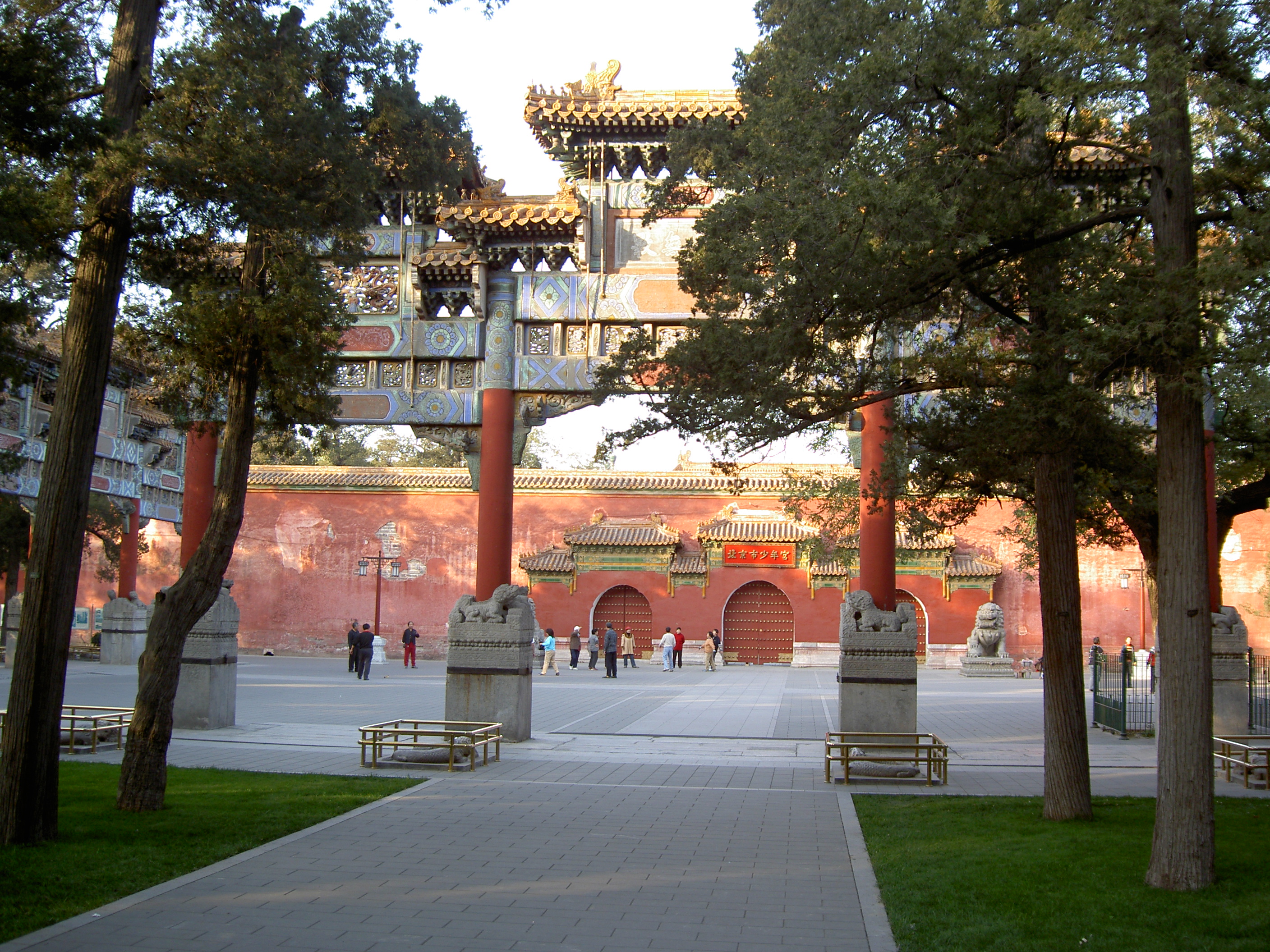
The Imperial City's seven gates each carried symbolic weight. The Great Ming Gate -- later renamed the Great Qing Gate, and finally the Gate of China -- stood at the southern approach, marking the formal entrance to imperial territory. Behind it rose Chengtianmen, which the Qing renamed Tian'anmen, the Gate of Heavenly Peace. The Left and Right Chang'an Gates flanked the southern approach; Dong'anmen guarded the east; Xi'anmen the west; and Di'anmen, the Gate of Earthly Peace, closed the northern circuit. Inside these walls during the Ming dynasty stood the Corridor of a Thousand Steps, government ministry offices, Taoist temples, warehouses, and a palace for the Imperial Grandson. When the Qing took power, they cleared most service buildings and distributed residential land in the western and eastern sections to Manchu princes and members of the Eight Banners military system.
Dismantled Into a Modern City
The twentieth century stripped the Imperial City down to fragments. After the fall of the Qing in 1912, the Republic converted Zhongnanhai into a presidential palace. In 1914, the Corridor of a Thousand Steps was demolished to create Zhongshan Park, named after Sun Yat-sen. The following year, most of the Imperial City wall was torn down to improve traffic flow, leaving only the southern stretch along Chang'an Avenue. After 1949, the People's Republic demolished the Gate of China, both Chang'an Gates, and Di'anmen. Zhongnanhai became the headquarters of the Chinese Communist Party and the State Council. The Department of Defence occupied land west of Beihai Park. Military units took over temples. Some of those buildings remain occupied and in disrepair. In recent decades, the Beijing government has begun restoring surviving temples and establishing parks along remnant wall sections, while height restrictions enacted in 2004 protect the Imperial City area as a buffer zone for the Forbidden City's World Heritage status.
From the Air
Located at 39.9169N, 116.3972E, the Imperial City encompasses the area surrounding the Forbidden City in central Beijing. From the air, the zone is defined by the Forbidden City at its center, with Beihai Park and its distinctive White Dagoba to the northwest, Jingshan Hill directly north, Zhongnanhai's lakes to the west, and Tiananmen Square to the south. The former Imperial City boundary roughly corresponds to the area between the Second Ring Road and the palace complex. Beijing Capital International Airport (ZBAA) is approximately 28 km to the northeast. Best viewed at 3,000-6,000 ft AGL for the full extent.