Inca Trail to Machu Picchu
The pass is called Warmiwanusqa -- Dead Woman's Pass. At 4,200 meters, the air thins to the point where each step requires a conscious act of will, and the trail that seemed like a reasonable idea in Cusco becomes an argument between ambition and altitude. This is the highest point on the Inca Trail to Machu Picchu, the place where the Andes remind trekkers that the ancient road they are walking was built for people who lived their entire lives above three thousand meters. The trail drops from here through cloud forest and past stone ruins before delivering hikers to the Sun Gate, where Machu Picchu appears below like a revelation the mountains have been keeping secret.
Three Routes, One Destination
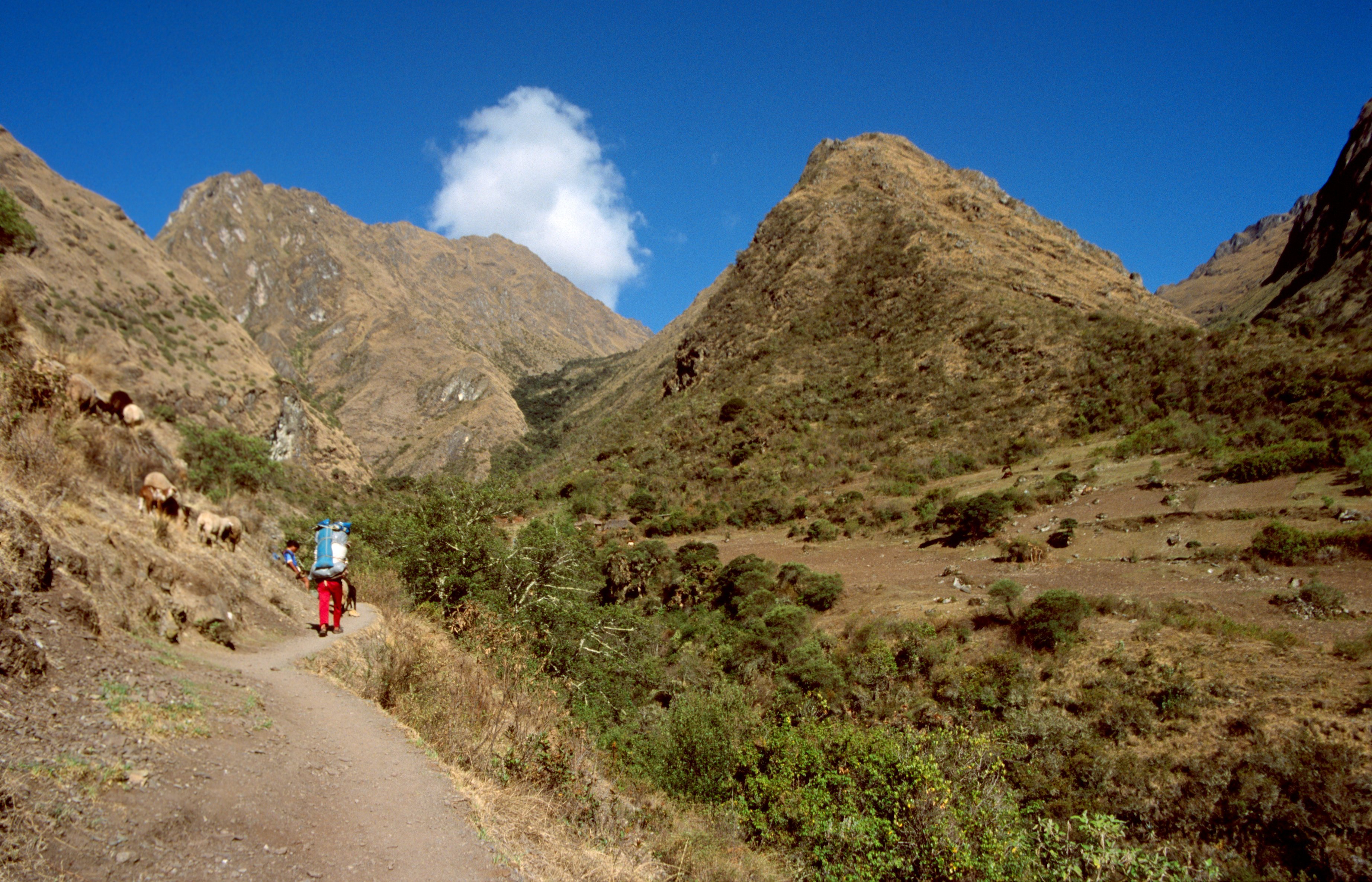
The Inca Trail is not a single path but three overlapping routes. The Classic trail takes four or five days, starting either 82 or 88 kilometers from Cusco along the Urubamba River at roughly 2,600 meters elevation. The Mollepata route is the longest, with the highest mountain pass, and joins the Classic trail before Dead Woman's Pass. For those short on time or altitude tolerance, a one-day trek beginning at Kilometer 104 covers the final stretch in six or seven hours. All three routes converge on the same destination: the Sun Gate on Machu Picchu mountain, the ancient entrance through which the Inca themselves would have approached the citadel.
Cities in the Clouds
The trail is not wilderness. It is an archaeological corridor, a road that connected a chain of settlements, religious sites, and way stations across the high Andes. At Patallaqta, trekkers pass a site used for crop production, ceremonies, and housing for soldiers stationed at the hilltop fortress of Willkaraqay -- a site first inhabited around 500 BC, centuries before the Inca. Higher up, Sayaqmarka -- "steep-place town" -- clings to a ridge, followed by the ruins of Phuyupatamarka, "cloud-level town," where five stone fountains and a sacrificial altar sit at 3,650 meters, their design following the mountain's natural contours. Explorer Hiram Bingham III found the site but left most of it buried under vegetation; a later expedition uncovered and named the ruins.
The Descent Through Green
After crossing the high passes, the trail drops roughly a thousand meters through an irregular staircase of approximately 1,500 steps, some carved directly into solid granite. The landscape transforms as the altitude falls. Sparse alpine tundra gives way to dense cloud forest, the air thickens with moisture, and butterflies appear alongside an increasing chorus of birdsong. Two Inca tunnels -- hand-carved passages through solid rock -- punctuate the descent. Through gaps in the canopy, views of the Willkanuta River appear for the first time since leaving Patallaqta, and eventually the town of Aguas Calientes becomes visible below, with the sound of trains running along the river valley drifting upward through the forest. Near the trail's end, the terraced ruins of Winay Wayna and the agricultural site of Intipata offer a final preview of the stonework waiting at Machu Picchu.
Five Hundred Per Day
The trail's popularity nearly destroyed it. Unchecked foot traffic eroded ancient stonework and damaged fragile ecosystems along the route. Since 2001, the Peruvian government has limited access to 500 people per day -- of whom only 200 are trekkers, with the remainder being licensed guides and porters. Permits for the entire year are released each October and sell out rapidly, particularly for the dry season months. The restrictions transformed the Inca Trail from an open hiking path into one of the most regulated trekking experiences on Earth, requiring advance booking months ahead. Camping is no longer permitted at many traditional sites along the route. The controls have slowed erosion and preserved the archaeological sites, but they have also created a system where walking an ancient road requires the kind of advance planning the Inca road-builders could never have imagined.
From the Air
Located at 13.26S, 72.26W in the Andes of southeastern Peru. The trail runs through the Sacred Valley between Cusco and Machu Picchu, crossing terrain that ranges from 2,430 meters at Machu Picchu to 4,200 meters at Dead Woman's Pass. From the air, the trail corridor follows the Urubamba River valley through dramatically steep terrain with cloud forest covering the lower elevations. Cusco's Alejandro Velasco Astete International Airport (SPZO) is the nearest major airport. The terrain is extremely mountainous with limited visual landmarks above the cloud layer.