Industrial Heritage Trail
By the 1980s, the question facing the Ruhr was what to do with the corpse. Mile after mile of dead steelworks and shuttered collieries stretched between the cities of Duisburg, Essen, Bochum, and Dortmund, an industrial landscape that had once produced the bulk of German steel and now produced almost nothing. The choice was either to bulldoze it all and pretend it had not happened, or to admit that this rusting infrastructure was the history of a region with five million people in it, and treat the remains the way other parts of Europe treated cathedrals. The Ruhr chose the cathedrals. In 1999 the Route der Industriekultur opened - a four-hundred-kilometer signposted loop through coal pits and gasometers and water towers and blast furnaces, the largest single project of industrial tourism ever attempted.
Twenty-Five Anchors
The route is built around twenty-seven Ankerpunkte - anchor points - each one a major industrial site that has been opened to the public. The Zeche Zollverein coking plant in Essen, a UNESCO World Heritage site since 2001, is the symbolic flagship; its winding tower silhouette appears on every brochure. The Gasometer Oberhausen, once a hundred-meter-tall storage tank for blast-furnace gas, hosts art exhibitions inside its dimly lit cylindrical hull. Landschaftspark Duisburg-Nord is a former steel mill where you can climb the blast furnace at sunset and rappel down through the bunkers at night. The Henrichshutte at Hattingen still has its 1854 blast furnace standing. The Zeche Nachtigall in Witten was the cradle of Ruhr coal mining. Henrichenburg's boat lift, Ewald's headframes, the Innenhafen at Duisburg with its Aquarius water museum housed in a former water tower - twenty-five sites, each one big enough to be a day trip on its own, none of them visitable in a single weekend.
Twenty-Six Themed Sub-Routes
Layered on top of the anchor points are twenty-six themed sub-routes that connect smaller sites by topic rather than geography. The Krupp und die Stadt Essen route walks you through the residences, factory yards, and parks of the steel dynasty that built much of imperial Germany. The Dreiklang in Dortmund - Coal, Steel, and Beer - threads a route through the city that takes in the Westfalen brewery alongside the pit headframes and steel skeletons. Arbeitersiedlungen takes you through the worker settlements, the company-built terraces and gardens where four generations of Ruhr families lived. Industriekultur am Rhein follows the river. Bahnen im Revier follows the rails. There is a route for sacred buildings - the cathedrals miners built when they thought God might be listening - and one for entrepreneur villas, the homes the mine owners gave themselves. Mythos Ruhrgebiet is the route about the Ruhr's mythology of itself.
Tips That Used to Be Pits
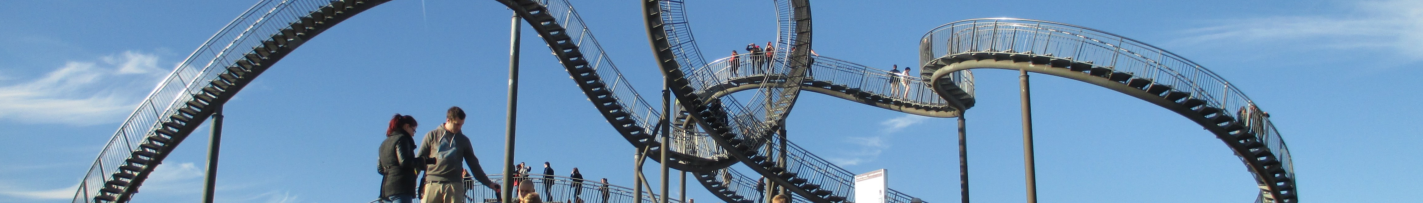
Some of the strangest stops on the route are not factories at all. The Ruhr made spoil. Two centuries of mining produced mountains of waste rock, and after closure the Ruhr realized those tips were the only hills the region had. Many of them were terraced, planted, and topped with sculptures. The Halde Hoheward near Herten carries a sundial obelisk and a horizon observatory of welded steel. The Halde Rheinpreussen in Moers has a giant glowing mine lamp on top. The Tetraeder in Bottrop is a forty-meter steel pyramid you climb by stair through open trusswork, looking out over a smoke-stack horizon. These are the Panoramapunkte, the panorama points, and they exist because someone realized the slag heaps were the new mountains of the Ruhr - artificial, ugly, and beloved.
How the Region Changed Its Mind
The Ruhr was, until the 1970s, one of the most important zones of coal and heavy industry in Europe. Then competition from cheaper coal-producing countries and falling demand began closing pits, one after another, year after year. The steel mills followed. Within thirty years the basis of the local economy was gone. Hundreds of thousands of jobs disappeared. The first instinct was to clear the ruins and try to attract any business that would replace them. By the 1980s, the IBA Emscher Park initiative had begun arguing the opposite: that the towers and gantries and pit baths were worth preserving, not as monuments but as functioning spaces. The blast furnaces could be climbed. The cokeries could be flooded for a public swimming pool, as happened at Zollverein. The gasometers could become galleries. The trail formalized that change of mind in 1999, knitting the separate sites into a single circuit that lets visitors understand the region as a single industrial story instead of a collection of museum corpses.
Grumpy on the Outside
The Wikivoyage entry for the trail offers some practical wisdom about the people who live in the Ruhr. The locals, it explains, may seem a little rough around the edges, but most are grumpy on the outside and friendly on the inside, if a little direct and blunt sometimes. That is fair. The Ruhr is a region of working-class cities that have spent the last forty years figuring out what they are after the work ended, and the conversation is still ongoing. ICE high-speed trains stop in Duisburg, Essen, Bochum, Dortmund, and Hamm. The brown information signs along the route are inconsistent - some are missing - but the central information point at Zeche Zollverein will hand you a map that makes sense of the whole thing. A car will take you between three or four anchor points in a day. A bike or a slow week will take you through what the Ruhr is actually trying to tell you about itself.
From the Air
The Industrial Heritage Trail circulates through the entire central Ruhr Area at roughly 51.5 degrees North, between Duisburg in the west (51.4N, 6.8E) and Hamm in the east (51.7N, 7.8E). The anchor reference point given for the route is roughly 51.5184 degrees North, 7.3340 degrees East, near the Waltrop-Henrichenburg site. From altitude the Ruhr is a dense web of overlapping cities with green fingers of canal and the Emscher river running east-west between them. Major airports include Dortmund (EDLW / DTM) at the eastern end, Dusseldorf (EDDL / DUS) just to the south, and Cologne Bonn (EDDK / CGN) about 60 km south of the trail.