Inuvik
Inuvik exists because Aklavik was sinking. The old trading post on the Mackenzie Delta was disappearing into unstable permafrost, and in the 1950s, the Canadian government decided to build a replacement - a modern town designed from scratch for Arctic conditions. The result is Inuvik: a planned community of 3,500 people perched on pilings above the frozen ground, connected by utilidors (above-ground insulated utility corridors) because buried pipes would thaw the permafrost. The town sits at 68°N, 200 kilometers north of the Arctic Circle, at the end of the Dempster Highway - the only public road in North America to cross the Arctic Circle. For 56 days in summer, the sun never sets. For 30 days in winter, it never rises. Inuvik is frontier civilization, a place where humans have insisted on living where perhaps they shouldn't, engineering solutions to problems the Arctic constantly creates.
The Construction
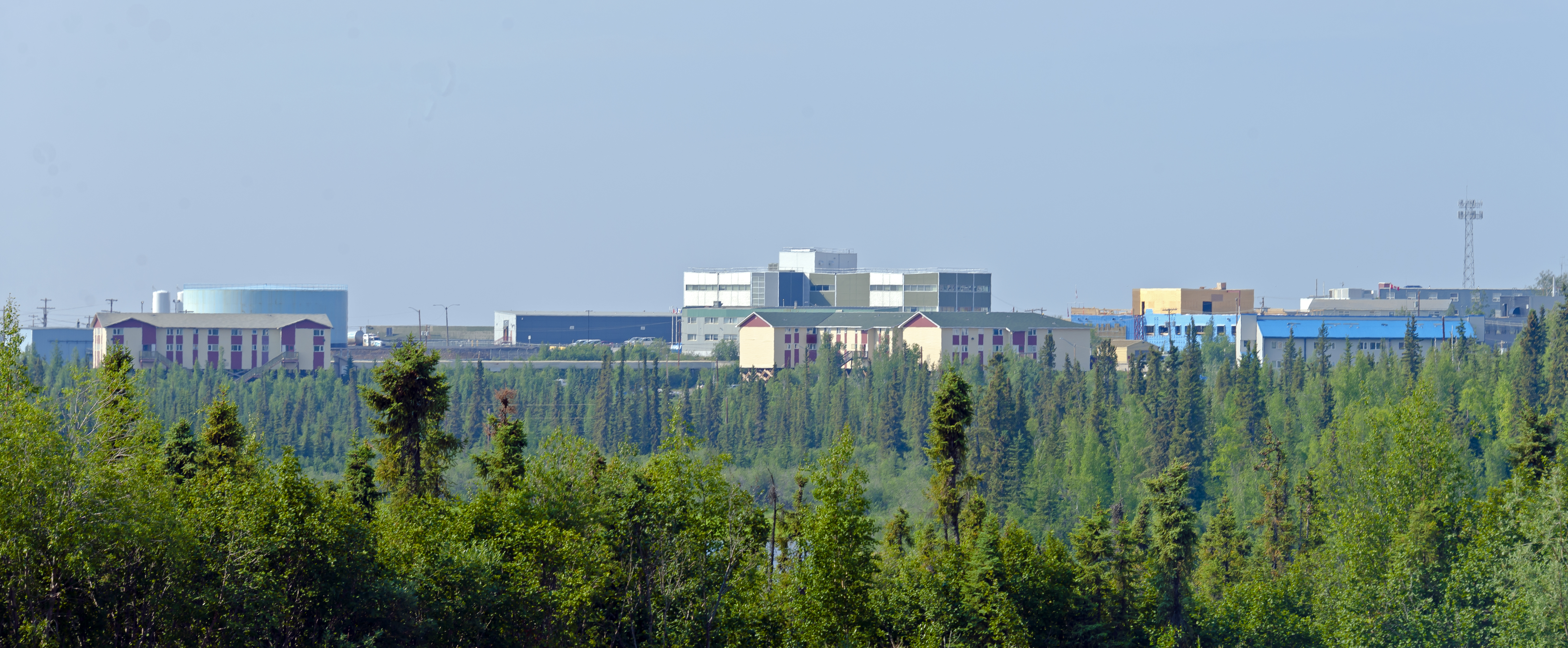
Building Inuvik required rethinking everything about construction. The permafrost - frozen ground that never thaws - would melt under any heated building, turning into mush and swallowing structures. So every building sits on pilings driven deep into the permafrost, with an air gap beneath to prevent heat transfer. Water and sewage can't be buried (pipes would freeze or thaw the ground), so they run through utilidors - insulated box-corridors that snake through town on stilts, connecting buildings to the central utilities. The entire town was designed before construction began, with housing, schools, hospital, and churches planned together. Construction began in 1955; the first residents arrived in 1958.
The Culture
Inuvik sits at the meeting point of three indigenous cultures: the Inuvialuit (western Inuit), the Gwich'in, and the Métis. The town was designed to provide services to the scattered communities of the Mackenzie Delta, and it remains a regional hub. Indigenous languages are spoken alongside English; traditional hunting and trapping continue despite the modern town infrastructure. The Igloo Church (Our Lady of Victory), shaped like a traditional igloo with a distinctive dome, has become an iconic symbol. The town hosts the Great Northern Arts Festival each July, when the midnight sun allows round-the-clock celebrating.
The Isolation
Inuvik is remote by any standard. The Dempster Highway, the only road connection, runs 736 kilometers south to Dawson City through some of Canada's wildest country, crossing the Arctic Circle, the Ogilvie Mountains, and the Richardson Mountains. The highway is unpaved, closes periodically for weather, and requires ice bridges across the Peel and Mackenzie rivers in winter. The Inuvik-Tuktoyaktuk Highway, completed in 2017, extended the road to the Arctic Ocean, making Inuvik the gateway to Canada's northernmost road-accessible point. Air service connects to Yellowknife and Edmonton. Most supplies arrive by barge during the brief summer navigation season.
The Extremes
Living in Inuvik means adapting to extremes. Summer brings 56 days when the sun never sets - the 'midnight sun' that allows 24-hour outdoor activities but disrupts sleep patterns. Winter brings 30 days of polar night when the sun never rises above the horizon, though twilight provides some light around midday. Temperatures can drop to -50°C. The aurora borealis is visible throughout the dark months. Residents celebrate the return of the sun with the Sunrise Festival in January. The adaptations required - extreme insulation, plug-in block heaters for every vehicle, utilidors, blackout curtains - make daily life a constant negotiation with the environment.
Visiting Inuvik
Inuvik is accessible by air (Mike Zubko Airport) from Yellowknife or Edmonton, or by the Dempster Highway from Dawson City (full day drive, summer only). Visitors come for the midnight sun (June-July), the aurora (September-March), the drive itself (the Dempster is one of North America's great wilderness roads), or as a gateway to Arctic adventures. The Igloo Church is a must-see. The Western Arctic Regional Visitor Centre provides orientation. Tours to Tuktoyaktuk and the Arctic Ocean are popular. Accommodation is limited; book ahead. Summer is bug season - bring repellent. Winter requires serious cold-weather gear. This is genuine frontier travel, not a polished tourist experience.
From the Air
Located at 68.36°N, 133.72°W in the Mackenzie Delta, Northwest Territories, Canada, 200 km north of the Arctic Circle. From altitude, Inuvik appears as a small grid of buildings connected by the distinctive lines of utilidors, surrounded by the vast, braided channels of the Mackenzie Delta. The Mackenzie River flows north to the Beaufort Sea. The Dempster Highway approaches from the south through empty wilderness. The permafrost polygons of the surrounding tundra are visible as geometric patterns.