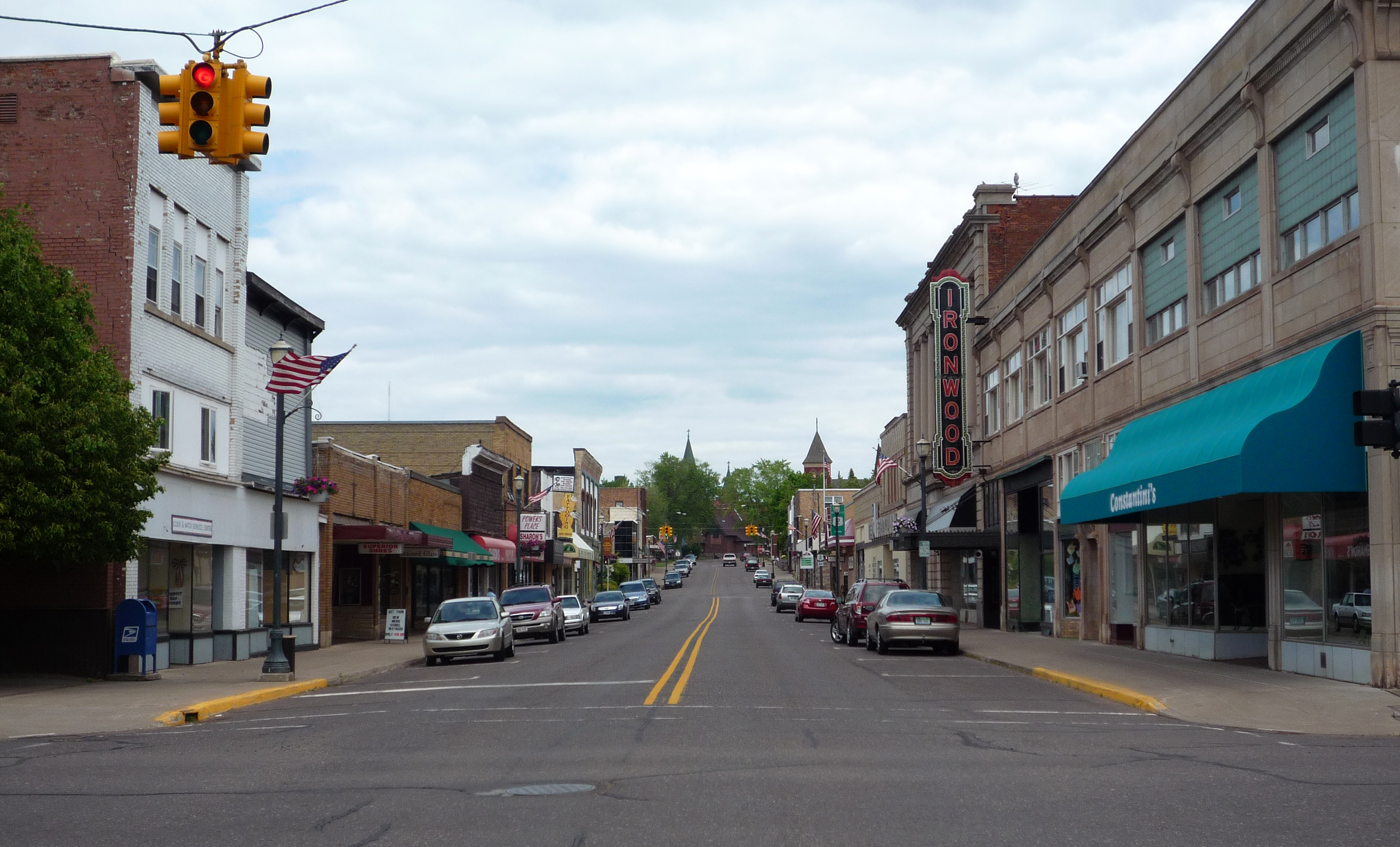
Ironwood, Michigan
A 52-foot fiberglass statue of Hiawatha towers over a small city in Michigan's Upper Peninsula, visible long before the town itself comes into focus. The "World's Tallest Indian" is a roadside attraction, yes, but it also serves as a kind of sentinel for Ironwood -- a place that has reinvented itself more than once. Founded as a mining camp in the spring of 1885, Ironwood is the westernmost city in Michigan, sitting at 90.2 degrees west longitude, the same meridian as St. Louis, Missouri. It straddles the Montreal River from Hurley, Wisconsin, and it has always been a border town: between states, between booms and busts, between the underground economy that built it and the snow-covered slopes that sustain it today.
Iron and the Railroad
Iron ore was discovered in the Gogebic Range in the 1870s, but the deposits slumbered until the railroad arrived in the mid-1880s. Frederic W. Rhinelander, president of the Milwaukee Lake Shore and Western Railroad, reportedly named the settlement for mining captain James "Iron" Wood -- though the name also matches Ostrya virginiana, a common hardwood in the Upper Midwest. The coincidence was too good to resist. Mines opened rapidly: the Norrie, Aurora, Ashland, Newport, and Pabst all sank shafts into the Gogebic Range. Workers flooded in from England, Finland, Germany, Italy, Poland, and Sweden, building twelve churches by the early 1890s. By 1900, the population had reached 10,000. Then, on September 17, 1887, fire swept through half the business district. The buildings went up quickly -- and were rebuilt just as fast. This was a town accustomed to starting over.
The Pabst Mine and Cold War Bombers
In 1926, disaster struck underground. The Pabst Mine flooded, killing three electricians and trapping forty-three miners for up to five days before rescuers could reach them. The Pabst Mine Disaster became the defining tragedy of Ironwood's mining era, a reminder that the wealth beneath the surface came at a cost. Decades later, the Cold War brought a different kind of activity. In the early 1960s, the U.S. Air Force established a Strategic Air Command Radar Bomb Scoring site atop Norrie hill. B-52s and B-47s flew simulated bombing runs over the Ironwood area at both high altitude and treetop level, their paths tracked and scored from the hilltop installation. A monument south of Hurley commemorates crew members killed during two low-level B-47 runs. The site relocated to Charlevoix, Michigan, in the mid-1960s, but for a brief period, the skies above this quiet mining town doubled as Cold War training ground.
From Ore to Powder
When the mines closed, Ironwood pivoted to what the Gogebic Range had always offered in abundance: snow. The city is one of the snowiest places in Michigan, and ski resorts now anchor the local economy. Big Powderhorn, Snowriver, Mount Zion, and Whitecap draw downhill skiers, while the Wolverine Nordic Trail System and ABR Nordic Center serve cross-country enthusiasts. The Iron Belle Trail, Michigan's cross-state hiking and biking route, uses Ironwood as one of its termini. The population has settled to about 5,045 as of the 2020 census, down from the mining-era peak, but the town maintains an outsized cultural footprint. Ironwood is the only place in the Upper Peninsula known to have hosted a professional sports team -- the Northwest Football League's Gogebic Panthers, who in 1935 posted a 6-1 record, their sole defeat coming at the hands of the eventually champion La Crosse Old Style Lagers.
A Runway in the Range
Gogebic-Iron County Airport sits seven nautical miles northeast of town, a modest field with a 6,502-foot asphalt runway featuring ILS, GPS, and VOR/DME approaches. Commercial service connects Ironwood to Chicago O'Hare and Minneapolis-Saint Paul, service that began expanding in 2020. The airport handles roughly 5,500 operations per year, split between general aviation, commercial flights, and air taxi service. For a city of five thousand people in the remote Upper Peninsula, this connectivity is a lifeline. Ironwood also sits on US Highway 2, which stretches from Duluth, Minnesota, in the west to St. Ignace, Michigan, in the east -- one of the great American road trips, tracing the shore of Lake Superior through some of the most sparsely populated territory in the eastern United States.
From the Air
Located at 46.456N, 90.159W in Michigan's Upper Peninsula, just south of Lake Superior. Gogebic-Iron County Airport (IWD/KIWD) is 7 nm northeast with a 6,502-foot runway (9-27), ILS/GPS/VOR-DME approaches. The city sits on the Michigan-Wisconsin border along the Montreal River -- Hurley, WI is immediately across. Look for the cluster of ski resorts (Big Powderhorn, Whitecap) on the surrounding hills and the distinctive 52-foot Hiawatha statue near downtown. US Highway 2 is visible running east-west through the city. Lake Superior's shoreline is visible to the north. Best viewed at 3,000-5,000 feet to see the transition from the forested Gogebic Range to the lakeside terrain.