Isla de Cabras
From the ramparts of El Morro, you can see it across the water: a low, rocky islet sitting squarely in the mouth of San Juan Bay. Isla de Cabras -- Goat Island -- is small enough to overlook and layered enough to demand attention. Spanish engineers placed a fort here to create a crossfire with El Morro against incoming ships. Colonial authorities built a facility here to isolate people with Hansen's disease from the mainland. The U.S. Army mounted 12-inch coastal guns here during World War II. And today, families spread out across a recreational park with gazebos, a swimming beach, and views of one of the most fortified harbors in the Western Hemisphere.
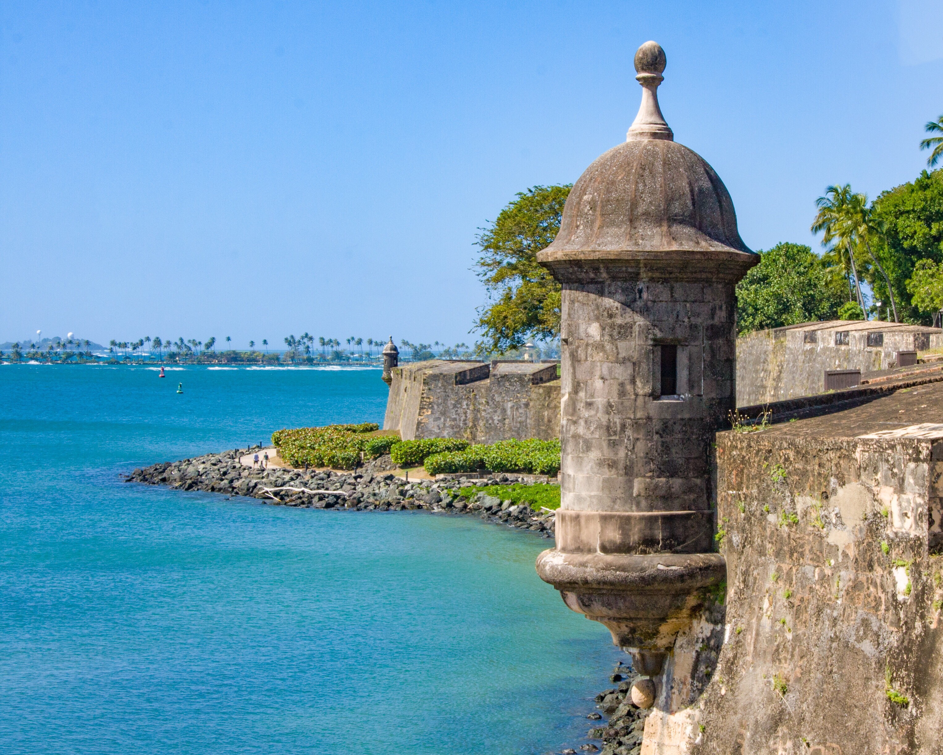
The Crossfire at the Bay's Mouth
Isla de Cabras owes its military significance to geography. Positioned at the entrance to San Juan Bay, the islet offered the Spanish a second firing position to complement Fort San Felipe del Morro on the opposite shore. Together, the two positions created a crossfire that could rake any ship attempting to enter the harbor. El Canuelo, the small fort built on the islet, also defended the entrance to the Bayamon River on the islet's far side. The original landmass was just a rocky headland in the north, naturally connected to El Canuelo by a submerged shoal called the Bajo del Canuelo. The islet as it exists today is partly artificial: in 1943, the U.S. military landfilled that narrow sandbank, raising the partially underwater fort above sea level and creating a road connecting the islet to the main island of Puerto Rico at Punta Palo Seco in the Toa Baja municipality.
The People They Sent Away
In the late 19th century, colonial authorities chose this isolated islet for a different purpose. On December 17, 1876, Governor Segundo de la Portilla laid the first stone for a building to house people with leprosy -- Hansen's disease patients who were forcibly separated from their families and communities. The building was completed in 1883, though the colony likely predated the formal structure. These were real people living under conditions of enforced isolation, their illness making them outcasts in a society that understood contagion better than compassion. When American troops took control of Puerto Rico in 1898, management of the facility transferred to the island's government. The 1910 U.S. Census recorded 35 people living on the island. In 1926, a new facility was built in Trujillo Alto on the main island, and the residents were relocated. The original building still stands on Isla de Cabras, its ruins a quiet memorial to the people who lived and suffered there.
Guns from Delaware
World War II brought one more transformation. In the 1940s, the United States built Fort Amezquita -- named for Juan de Amezqueta, the Puerto Rican militia captain who helped defend San Juan against the Dutch in 1625 -- a few hundred feet from El Canuelo. Initially called the Cabras Island Military Reservation, the fort served as a concrete gun battery for the U.S. Army Coast Artillery Corps. In November 1940, the Army transferred the barrels of three 12-inch coastal guns from Fort Delaware in the state of Delaware; two were mounted as Battery Reed, named for Brigadier General Henry A. Reed, with the third kept as a spare. These were serious weapons, designed to deny any Axis naval approach to one of the Caribbean's most strategic harbors. The guns never fired in combat, but their presence testified to how seriously the military took the defense of San Juan Bay -- the same strategic calculation the Spanish had made four centuries earlier.
Gazebos Where Guns Once Stood
Since 1957, Isla de Cabras has been a national park and recreational area. Families come for the beach, the fishing, and the gazebos scattered across the islet. A police firing range, established in 1950, occupies part of the island -- a faint echo of its military past. Immediately south, in the adjacent municipality of Catano, stands Bacardi's Cathedral of Rum, a landmark of an entirely different character. The juxtaposition captures something essential about Puerto Rico's relationship with its history: fortresses become parks, hospitals become ruins, military reservations become picnic grounds. From the islet, El Morro looms across the water, its massive walls a reminder of the centuries when this small piece of land was not a place for leisure but a link in a chain of defenses that guarded an empire's most valuable Caribbean port.
From the Air
Located at 18.471N, 66.136W in the mouth of San Juan Bay, part of Toa Baja municipality, Puerto Rico. Isla de Cabras is clearly visible from altitude as a small islet connected to the mainland by a causeway, sitting directly across the bay entrance from El Morro fortress. El Canuelo fort is visible on the southern end. Nearest airports: Fernando Luis Ribas Dominicci (TJIG) approximately 2 nm east-southeast, San Juan Luis Munoz Marin International (TJSJ) approximately 9 nm east. Best viewed at 2,000-4,000 ft AGL to appreciate the islet's position guarding the bay mouth alongside El Morro.