Isla del Sol
According to Inca legend, the creator god Viracocha rose from the waters of Lake Titicaca and made the sun right here, on this island. It is a bold origin story for a modest piece of land -- roughly fourteen square kilometers of terraced hillside, scattered stone ruins, and a handful of villages where donkeys outnumber motor vehicles because motor vehicles do not exist here at all. Isla del Sol sits at 3,812 meters above sea level in the Bolivian portion of Lake Titicaca, the highest navigable lake in the world. The thin air, the enormous sky, and the snow-capped peaks of the Cordillera Real visible across the water create a landscape that feels more like the setting for a creation myth than a place you can reach by two-hour boat ride from the town of Copacabana.
Where the Sun Was Made
The Inca did not choose this island casually. In their cosmology, the son and daughter of Inti, the sun god, were sent from a cave on Isla del Sol carrying a golden staff. Manco Capac, the legendary first Inca, took that staff across the water and drove it into the earth at Cusco, founding what would become the most powerful empire in pre-Columbian South America. The Rock of the Puma -- Titi Kharka in Aymara, from which Lake Titicaca takes its name -- anchors the northern end of the island. Nearby sits the Inca Table, a low stone platform where, according to tradition, sacrifices were offered. The Footsteps of the Sun, impressions in rock that may be natural or may be something else entirely, complete a trio of sacred sites that drew pilgrims long before they drew tourists. Whether you see a puma in the rock formation depends on your guide and your imagination.
Two Villages, One Fracture
The island's two main settlements occupy opposite ends and, for several years, opposite sides of a bitter dispute. Yumani in the south has the better tourist infrastructure -- hostels, restaurants, the famous Inca Steps descending to the water where the Fountain of Youth trickles from the hillside. Cha'llapampa in the north holds the Gold Museum, displaying Inca treasures recovered from the lakebed. In 2017, the relationship between these communities and the central village of Cha'lla fractured. Tourism huts built near an archaeological site in the north provoked concerns about preservation. When those concerns were ignored, residents of Cha'llapampa destroyed the buildings. Cha'lla retaliated by blockading access to the north by land and water. The conflict turned violent -- injuries, burned boats, and in 2018, foreign tourists detained until the Bolivian Navy intervened. For years, the northern ruins remained closed, the Gold Museum unreachable. The dispute laid bare a tension familiar across the Andes: who controls the economic benefits of a sacred landscape, and who bears the cost of its preservation?
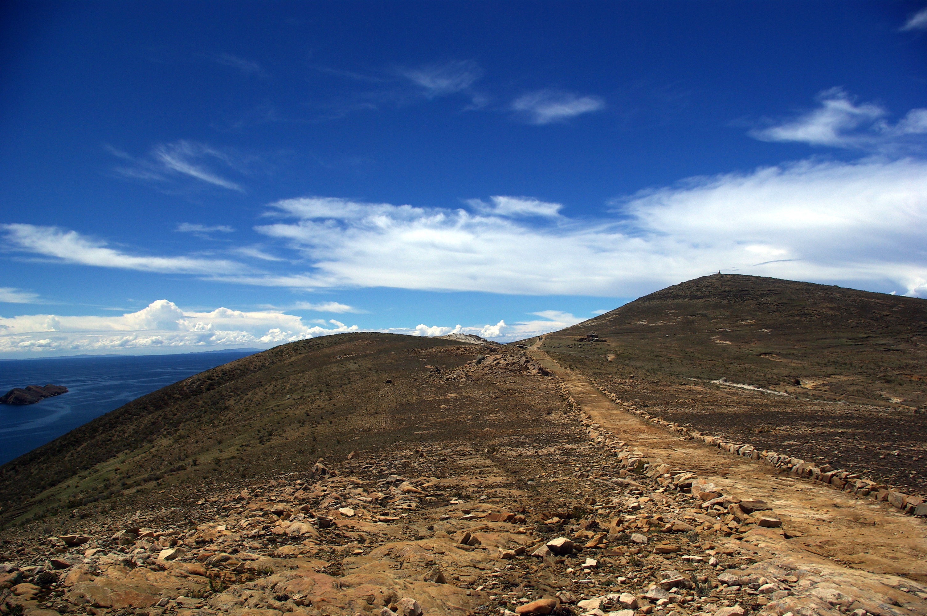
The Climb at Altitude
Arriving by boat from Copacabana, most visitors land at Yumani and face the Inca Steps immediately -- a steep stone stairway climbing from the dock to the village above. At nearly four thousand meters, every step reminds you of the altitude. The air is thin enough to make a healthy person pause halfway, hands on knees, breathing hard. There are no cars, no motorcycles, no paved roads. Getting around means walking, and the island's spine runs north to south for about nine kilometers of trail with views that justify every labored breath. The water below shifts between deep blue and almost black depending on the light. Terraced agricultural plots line the hillsides, and the few trees bend permanently from wind. The Temple of Pilcocaina sits on the southern portion, its stone walls still standing after centuries. At night, with no generators running and no city glow to wash out the sky, the stars over Isla del Sol are startling in their density.
Island Economy, Island Time
Life on Isla del Sol follows rhythms that tourism has altered but not replaced. Fishing and small-scale farming remain, though the economy has shifted substantially toward visitors. Basic lodgings in Cha'llapampa charge as little as a few dollars per night. Yumani's restaurants serve trout from the lake alongside pizza -- a concession to foreign appetites that some find charming and others find telling. Fruit is limited to bananas and apples trucked in from the mainland. The shops stock little. Each arriving passenger pays ten bolivianos to step onto the island, a fee collected at the dock. Some travelers find the combination of entrance fees, tourist infrastructure, and pizzerias at odds with the island's sacred reputation. Others see a community doing what communities everywhere do: adapting to economic reality while holding onto what they can. The sunset over the Cordillera Real, visible from any western-facing slope, does not charge admission.
From the Air
Located at 16.02S, 69.18W in the southern portion of Lake Titicaca, Bolivia. The island is clearly visible from altitude as the largest landmass in the lake, roughly 14 square kilometers. The snow-capped Cordillera Real forms a dramatic backdrop to the east. No airport on the island; nearest airfield is El Alto International Airport (SLLP) serving La Paz, approximately 140 km southeast. Copacabana, the main departure point for boats to the island, sits on the southeastern shore of the lake.