Isle de Jean Charles, Louisiana
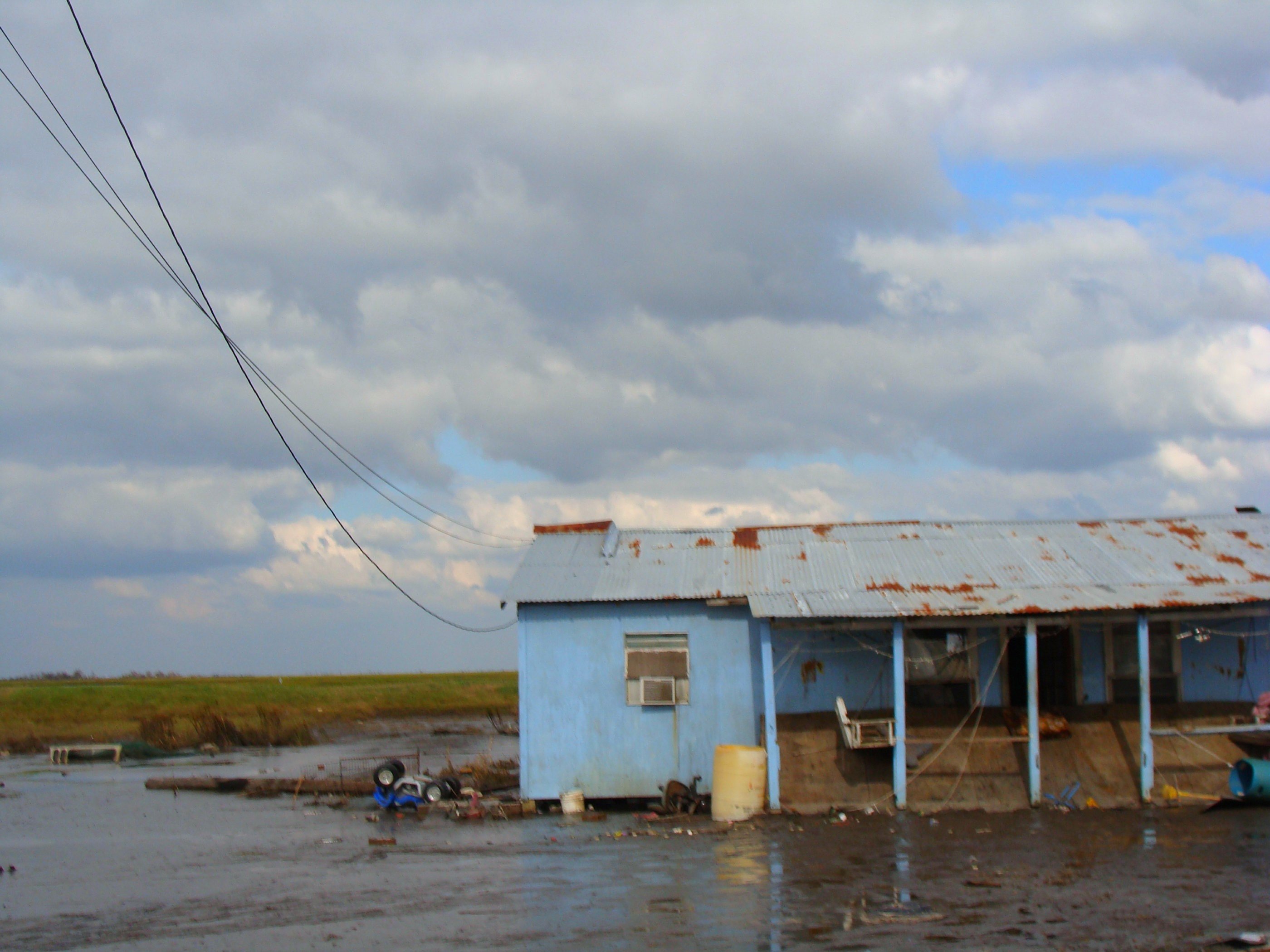
How much land can you lose before a place stops being a place? In 1955, Isle de Jean Charles covered more than 22,000 acres of bayou country in Terrebonne Parish, Louisiana. Today, roughly 98 percent of that land is gone, swallowed by saltwater intrusion, subsidence, and the relentless chewing of the Gulf. What remains is a narrow ridge barely wide enough for the single road that connects it to the mainland, a road that floods so often it frequently becomes impassable. For the Biloxi-Chitimacha-Choctaw people who have called this island home for over 170 years, the disappearance is not an abstraction measured in satellite imagery. It is the burial ground going under, the fishing grounds turning to open water, the neighbors leaving one family at a time. Isle de Jean Charles holds the unwanted distinction of producing what many call America's first climate refugees.
Refuge at the Edge of the World
The story of Isle de Jean Charles begins with displacement. In the 1830s, ancestors of the Biloxi-Chitimacha-Choctaw tribe fled to this remote sliver of marshland to escape the Indian Removal Act and the Trail of Tears. The island's very remoteness was its appeal: surrounded by bayous and accessible only by boat, it offered sanctuary from federal authorities. The tribe grew from 16 families to 77 by 1910, sustaining themselves through fishing, oyster farming, trapping, and subsistence agriculture. A missionary grade school was eventually built on the mainland for nearby Indigenous peoples, and in 1959, Daigleville Indian High School in Houma became the first Indigenous high school in Louisiana. It was not until 1953 that a road finally connected the island to the mainland, ending generations of boat-only access.
Death by a Thousand Cuts
The island's undoing arrived in stages. In the 1940s, oil companies began offshore drilling projects and dredging near Isle de Jean Charles. Every canal cut for pipeline access and every well pad cleared for extraction weakened the fragile marsh substrate. Fracking hastened land subsidence as the extraction of subsurface materials removed the structural support beneath the land, causing it to gradually sink. Levees built to protect other communities redirected sediment away from the island, further starving its marshes of the material they needed to survive. Around 90 percent of land in Terrebonne Parish belongs to non-local manufacturing and oil companies. The Army Corps of Engineers left Isle de Jean Charles out of its levee protection projects, citing an additional $100 million cost, making the island even more vulnerable to hurricanes and storm surge than the surrounding areas it was excluded from.
The Impossible Choice
By the early 2000s, only 25 families remained on Isle de Jean Charles. Chief Albert Naquin of the Biloxi-Chitimacha-Choctaw began a campaign to relocate the entire community as one, preserving their traditions, governance, and cultural identity on higher ground. It was not an easy sell. When the Army Corps of Engineers first proposed relocation in 2002 and hired architects for the effort, the majority of residents voted against it. The land was their identity. Some suspected the government simply wanted them gone so the oil industry could operate without political conflict. The tribe insisted on a collective move, not a scattering of individuals, because dispersal would kill their culture as surely as the rising water. For sixteen years, Chief Naquin and the Tribal Council built partnerships, developed plans, and conducted outreach.
Forty-Eight Million Dollars and a Partial Victory
On January 25, 2016, the State of Louisiana received $48 million from the Department of Housing and Urban Development as part of the National Disaster Resilience Competition, earmarked for the resettlement of Isle de Jean Charles. It was a landmark moment: the first federally funded climate relocation in American history. But the victory was partial. The government's plan did not fully align with the tribe's vision of moving as a unified cultural community. Tensions persisted over whether the resettlement would truly preserve the cohesive social fabric the Biloxi-Chitimacha-Choctaw had fought so hard to protect. The tribe had been working since 2010 with the Lowlander Center and experts in hazard mitigation, climate adaptation, and community planning to develop their own resettlement blueprint. The gap between bureaucratic process and tribal self-determination remained a source of friction.
What the Water Remembers
Isle de Jean Charles has become a symbol that extends far beyond its shrinking borders. Director Benh Zeitlin cited the island as the geographic inspiration for 'The Bathtub,' the fictional community in his 2012 film Beasts of the Southern Wild. The 2013 documentary Can't Stop the Water captured years of tribal life on the island as it contended with environmental devastation. These stories brought national attention, but for the families who fished these bayous and buried their dead in this soil, the island is not a symbol. It is home. Coastal Louisiana loses a landmass the size of Manhattan every year. Isle de Jean Charles is where that statistic has a face, a language, a cemetery, and a name. Oil was first discovered in Terrebonne Parish in 1929, and in the century since, the parish's landscape has been reshaped by forces its original inhabitants never invited and could not control.
From the Air
Isle de Jean Charles sits at approximately 29.39N, 90.48W in Terrebonne Parish, visible as a thin sliver of land amid open water and eroding marsh. The single road connecting it to the mainland is a striking visual feature. Nearest airports include Houma-Terrebonne Airport (KHUM) roughly 30 nm to the north. At low altitude (1,000-3,000 feet AGL), the dramatic land loss and isolated structures are clearly visible. The surrounding oil infrastructure, canals, and pipeline corridors are evident from the air.