Isthmus of Panama
Three million years ago, give or take a few million depending on which geologist you ask, underwater volcanoes broke the surface of the Central American Seaway. Sediment piled between them, and slowly, grain by grain, the Atlantic and Pacific Oceans lost their direct connection. The consequences were staggering. Ocean currents rerouted. The Gulf Stream intensified, pushing warm water north and setting in motion the climatic machinery that would build the northern polar ice cap. Animals that had evolved separately for tens of millions of years suddenly had a land bridge to cross. The Isthmus of Panama, barely 50 miles wide at its narrowest, had changed the planet.
The Great Swap
Geologists call what happened next the Great American Biotic Interchange, a name that undersells the chaos. Armadillos, opossums, and ground sloths lumbered northward. Horses, camels, and saber-toothed cats moved south. Marine species that had been a single population split into Atlantic and Pacific cousins, diverging genetically on opposite sides of the new barrier. Fossils excavated from the Canal Zone in 2007 revealed an even older menagerie: bear-dogs, miniature horses, rhinoceroses, and at least one chalicothere, a bizarre knuckle-walking herbivore that looked like something assembled from leftover parts. The isthmus didn't just connect two continents. It reshuffled the biological deck on both of them, and the ocean currents it diverted would eventually power the Atlantic trade winds that carried European ships to the Americas.
Gold, Ruins, and the Camino Real
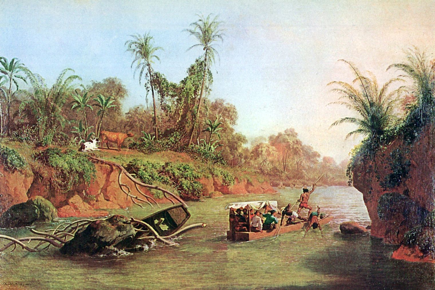
Long before Europeans arrived, the isthmus was home to Chibchan- and Chocoan-speaking peoples whose trade networks stretched from the Yucatan to South America. Ceramics at the Monagrillo archaeological site date to 2500 BCE, among the earliest in Central America. Gold crafted in the Gran Cocle tradition has been found as far north as Chichen Itza. Vasco Nunez de Balboa crossed the isthmus on foot in 1513 and became the first European to see the Pacific from the Americas, calling it the South Sea because it lay on the southern side of his route. Spain built the Camino Real across the isthmus, and silver from Peru's mines traveled overland by mule train to the port of Portobelo, where treasure fleets carried it to Seville. In 1671, the Welsh privateer Henry Morgan crossed from the Caribbean side and burned Panama City to the ground. The ruins of the old city, Panama Viejo, became a UNESCO World Heritage Site in 1997.
The Cost of Conquest
European colonization devastated the indigenous Cueva people of the isthmus through warfare, forced labor, and disease. A regional slave trade operated across Central America in the early 16th century. By 1550, fewer than 300 indigenous people remained in the cities of Panama, Nombre de Dios, and Nata combined. The destruction was thorough enough that entire communities and their cultural infrastructure simply vanished from the most heavily colonized areas. Scotland's Darien scheme of 1698, an attempt to establish a colony and overland trade route in the Darien Gap, collapsed just as brutally for its participants: over 80 percent of the colonists died within a year, bankrupting many of the investors and contributing to Scotland's eventual union with England in 1707.
The Crossing That Built Empires
When gold was discovered at Sutter's Mill in 1848, the fastest route from the American East Coast to California ran across the isthmus. Steamships deposited fortune seekers at the mouth of the Chagres River, where they paid for hammock space in riverside villages and endured dangerous barge rides and overland mule treks to reach Panama City. The Panama Railroad, completed in 1855, reduced the crossing to hours instead of days. Ferdinand de Lesseps, flush from building the Suez Canal, launched a sea-level canal project in 1880. It collapsed in 1889, bankrupting thousands of French investors and killing an estimated 20,000 workers, many from yellow fever and malaria. The United States bought the remaining assets, engineered Panama's independence from Colombia in 1903, and finished a lock-based canal in 1914. The isthmus that plate tectonics had spent millions of years closing, human engineering reopened in a decade.
A Seam in the Earth
From the air, the isthmus reveals its improbability. A spine of mountains runs its length, wringing rain from Caribbean trade winds on the Atlantic slope while the Pacific side cycles between wet and dry seasons. Tropical forest covers the lowlands in a density of green that hosts some of the planet's richest biodiversity: brilliantly colored frogs, toucans, howler monkeys, and thousands of insect species still being cataloged. The geological debate over when the isthmus fully closed remains unsettled. Zircon crystals in Colombian bedrock suggest a land bridge may have existed as early as 10 million years ago, while ocean sediment records indicate marine exchange continued until roughly 3 million years ago. Army ant genomics have added another data point suggesting earlier closure. Whatever the exact timeline, the narrow strip of land at 9 degrees north latitude remains one of the most consequential landforms on Earth, a geological accident that redirected evolution, climate, and human history.
From the Air
The Isthmus of Panama is centered near 9.00N, 79.00W. At cruising altitude the narrowest section between the Caribbean and Pacific is visible on clear days. The Panama Canal cutting through the isthmus is the dominant landmark, with Gatun Lake clearly visible as a large body of water in the canal's midsection. Tocumen International Airport (MPTO) serves Panama City on the Pacific side; Enrique Adolfo Jimenez Airport (MPEJ) at Colon on the Caribbean side. Expect tropical moisture, frequent afternoon convective activity, and low visibility in heavy rain. The mountainous spine reaches modest elevations but creates turbulence and orographic cloud on the Caribbean slope.