Iturralde Crater
Nobody noticed it from the ground. For millennia, an almost perfectly circular depression eight kilometers across sat hidden beneath the canopy of the Bolivian Amazon, invisible to anyone standing inside it. Then, in 1985, a Landsat satellite passed overhead, and the circle leapt out of the imagery like a bullseye painted on the forest floor. The Iturralde Crater, also called the Araona Crater, sits in one of the most remote corners of Madidi National Park in Bolivia's La Paz Department. Getting there requires days of river travel. Understanding what created it has taken decades, and the answer may involve one of the most violent events in the Western Hemisphere's recent geological past.
Spotted from Space
The structure was first identified from Landsat satellite imagery in 1985. Its near-perfect circularity immediately drew attention: natural geological processes rarely produce such symmetry. Located in the Abel Iturralde Province, the crater sits in an area of active river sedimentation, which means the feature must be geologically young. If rivers had been depositing sediment across this landscape for millions of years, any ancient crater would have been buried and erased long ago. Estimates of the structure's age range between 11,000 and 30,000 years, placing its formation squarely in the Late Pleistocene, when ice-age megafauna still roamed South America. Two expeditions reached the site, but neither found the kind of smoking-gun evidence, such as shocked quartz or shatter cones, that would confirm a classical meteorite impact.
Millions of Glass Beads
The breakthrough came from laboratory analysis of soil samples collected during a 2002 expedition. Researchers discovered tiny clusters of glass beads, millions of them per kilogram of soil, at specific depths. About 90 percent of these beads are rich in aluminum, silicon, calcium, and iron oxides, with titanium dioxide concentrations reaching 4.4 percent. The remaining beads are iron-rich with trace amounts of aluminum and calcium. These are not the products of ordinary geological processes. Glass beads form when extreme heat melts surface material and the molten droplets resolidify in mid-air. The chemical signatures point to temperatures far beyond anything a volcanic eruption or lightning strike could produce. Something turned the ground itself into a spray of molten glass and scattered it across the landscape.
The Air Burst Hypothesis
The leading explanation is an air burst: a meteorite or comet fragment that entered the atmosphere at roughly 20 kilometers per second but never reached the ground intact. If the object was porous enough, composed of ice or loosely consolidated stone, the atmosphere would have torn it apart before impact, releasing its kinetic energy in a single catastrophic explosion above the surface. The energy released would have been comparable to or greater than any nuclear detonation in human history. The 1908 Tunguska event in Siberia, which flattened 2,000 square kilometers of forest, offers a smaller-scale comparison. At Iturralde, the blast would have created extreme convection cells, lifting loose soil into a fireball hot enough to melt it into glass. The molten material then settled back as the millions of beads now found in the sediment. The downward-directed pressure wave excavated the bowl-shaped depression visible today.
Still Waiting for Proof
Despite the compelling evidence, the Iturralde structure remains on the list of possible, rather than confirmed, impact sites. The remoteness of the location makes every expedition a major logistical undertaking, and the tropical environment degrades evidence quickly. Thick vegetation covers the rim and interior, making ground-level geological surveys extraordinarily difficult. From the air, the circle is unmistakable, a geometric anomaly in an otherwise chaotic landscape of meandering rivers and dense canopy. Whether future expeditions will find the definitive proof, perhaps shocked minerals deeper in the sediment column, remains an open question. For now, the Iturralde Crater sits in scientific limbo: too circular to be coincidence, too remote to be easily studied, and too fascinating to be ignored.
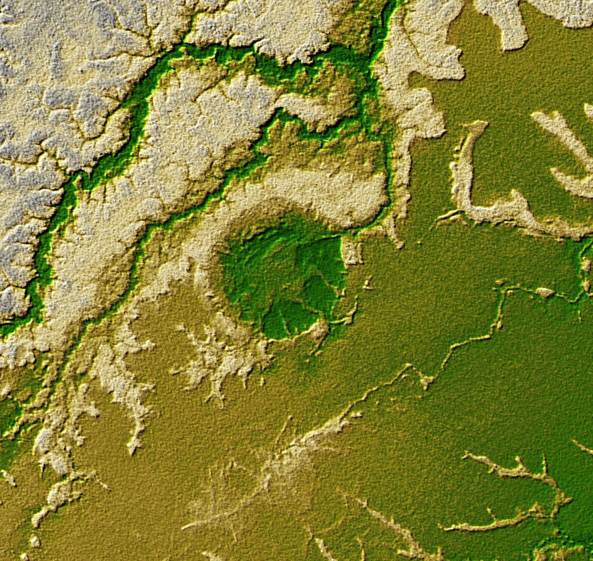
From the Air
Located at 12.59S, 67.68W in the Bolivian Amazon, within Madidi National Park. No nearby airports; the closest paved strip is in Rurrenabaque (SLRI), approximately 150 km east. From cruising altitude, the crater is visible as a distinct circular clearing or depression in otherwise unbroken rainforest canopy, approximately 8 km in diameter. Best spotted in clear conditions with low sun angle for shadow contrast. The surrounding terrain is flat Amazonian lowland with numerous river meanders.