Iya Valley
The tofu made in the Iya Valley is so dense they call it stone tofu. A brick-sized piece can be carried by wrapping a single rope around it. This small detail says something larger about the place: everything in this remote valley on Japan's island of Shikoku has been shaped by isolation, by steep terrain, by the necessity of making do with what the mountains provide. The Iya Valley -- whose kanji characters translate to "ancestor valley" -- has been a refuge for the defeated and a holdout for the traditional. Members of the Taira clan fled here after losing the Genpei War in the late 12th century, and some of their descendants never left.
A Valley of Fugitives
The remoteness that defines Iya was exactly the point for the warriors who first sought shelter here. After the Genpei War (1180-1185), members of the defeated Taira clan -- also known as the Heike -- are said to have retreated deep into these mountains rather than submit to the victorious Minamoto clan, who went on to found the Kamakura Shogunate. The valley became a haven for fugitives, its steep gorges and limited access routes providing natural defense. The vine bridges that have become the valley's most famous feature are said to have been first constructed by the Taira, designed to be quickly cut in case of pursuit. Today only three of the original thirteen vine bridges survive, woven from several tons of hardy kiwi vines harvested from surrounding mountains. The main Iya-no-Kazurabashi, 45 meters long, is classified as an important Tangible Folk Culture Property, its vines replaced every three years and reinforced with steel cables.
Living Architecture
The traditional houses of the Iya Valley are built without a single nail. Massive red pine and hemlock logs form interlocking horizontal beams, while squared chestnut posts serve as verticals, the entire frame designed to expand and contract with the seasons. The foundations -- also chestnut, prized for its rot resistance -- sit simply on piles of stone, secured to the ground by nothing but gravity. At the center of each house burns the irori, a sunken floor hearth whose constant low fire served to cook food, heat the home, and slowly cure the roof thatch from below, extending its life to 25 or 30 years. The oldest surviving house, the Kimura-ke, dates to 1699 and was declared an Important Cultural Property in 1976. Nearby, the Asa-ke House was home to the leader of the Heike descendants, its present structure dating from 1862.
Flavors of the Steep Country
Farming in the Iya Valley means terraced plots carved into hillsides, tilled largely by hand. Rice proved difficult here; the staples are buckwheat and potatoes. The famed Iya potatoes are small and dense, shaped by the rocky soil, and appear in a local dish of whole-boiled potatoes mixed with miso paste and garlic. A roadside treat called dekomawashi skewers an Iya potato, a square of stone tofu, and a wedge of konnyaku on a bamboo stick, slathered in miso and roasted slowly over coals. The valley's signature dish, hirara-yaki, is unique to Iya: fish, potatoes, tofu, and konnyaku cook on a large stone or iron griddle in a sake broth, ringed by walls of red and white miso paste. River trout called amego is encrusted in salt, skewered on bamboo, and roasted over charcoal -- the whole fish eaten intact.
The Valley Now
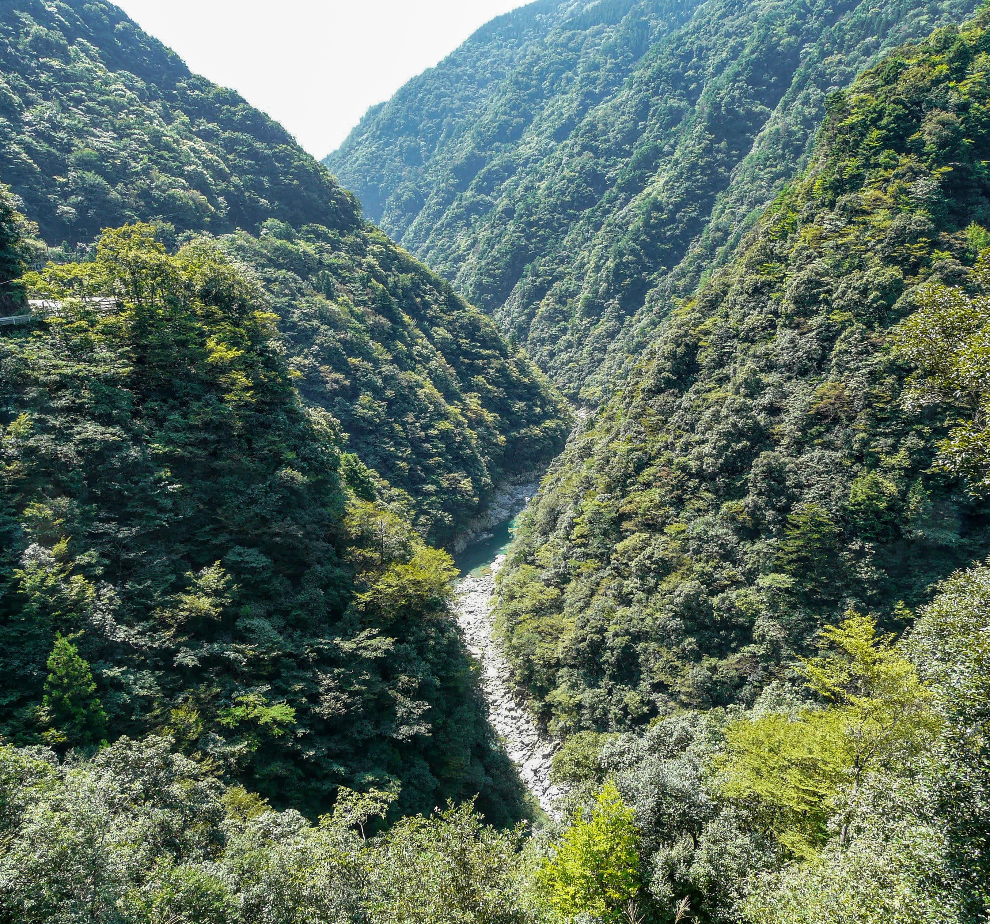
The Iya River flows roughly 50 kilometers from the springs of Mount Tsurugi -- Shikoku's second-highest peak -- down through the valley to where it joins the Yoshino River at about 90 meters elevation. The original road through the lower gorge, built between 1902 and 1920, is a single-lane cliffside route where, halfway along, a small statue stands of a boy relieving himself over the precipice -- the Peeing Boy, erected in honor of the young daredevils who once did exactly that. The valley's population has been declining for decades, and some of the old customs -- shrine festivals where men carry portable shrines accompanied by drummers and bamboo staff-throwers -- are growing rare. But writer Alex Kerr's restoration of the thatched-roof Chiiori house, built around 1700, has sparked a broader rural revival. Eight restored houses in the hillside hamlet of Ochiai, designated an Important Group of Traditional Structures in 2005, now welcome visitors as "Shangrila Iya."
From the Air
Located at 33.875N, 133.835E in the mountainous interior of Shikoku island, Tokushima Prefecture. The valley is a deep, narrow gorge cut by the Iya River, flanked by steep, forested mountains. Mount Tsurugi (1,955m) is visible at the eastern end. Nearest airports: Tokushima Airport (RJOS) approximately 70 km east, Takamatsu Airport (RJOT) approximately 60 km north. The Yoshino River gorge at Oboke-Koboke is a distinctive aerial landmark nearby. Best viewed from 5,000-7,000 feet to see the valley's depth and the surrounding mountain terrain.