Izu Peninsula
Three tectonic plates converge beneath your feet on the Izu Peninsula, and you can feel it. The hot springs that bubble up through every valley, the earthquake swarms that rattle windowpanes, the volcanic peaks worn smooth by millennia of wind and rain -- all of it traces back to the Philippine Sea Plate grinding northward into mainland Honshu at the Nankai Trough. This mountainous finger of land jutting southwest of Tokyo is, in geological terms, a slow-motion collision in progress. The plates meet precisely at Mount Fuji, which looms over the peninsula's northern horizon like a reminder that the forces shaping this landscape are anything but finished.
Born from the Deep
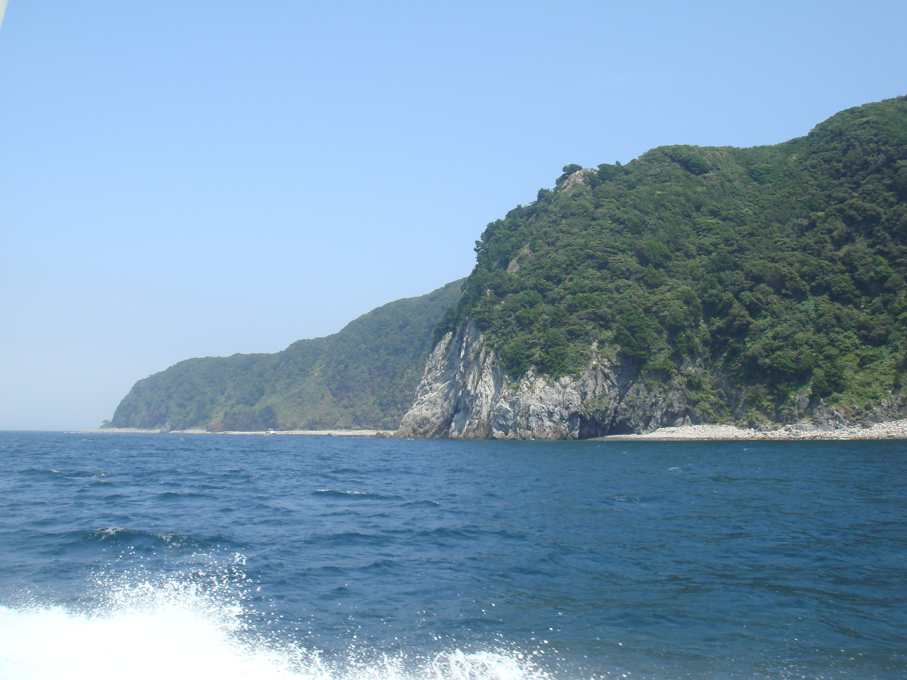
The Izu Peninsula exists because an oceanic plate refused to simply slide beneath its neighbor. Instead of subducting cleanly, the Philippine Sea Plate has been pushing a chunk of volcanic island arc directly into the Okhotsk Plate, crumpling the coastline and building mountains. The southern half of the peninsula is composed largely of breccia -- angular rock fragments welded together by volcanic heat -- while the central and northern portions are studded with the eroded remains of ancient volcanoes. The Amagi Mountain Range dominates the interior, its ridgelines extending underwater into both Sagami Bay to the east and Suruga Bay to the west. Through the north, the Kano River winds through a graben valley, a sunken block of crust dropped between parallel faults by the same tectonic forces that built everything around it. The result is a landscape where geology is not a subject you study but a reality you walk through.
Steam and Wasabi
All that geological violence has its rewards. The fractured rock and volcanic heat produce hot springs in extraordinary abundance, and the Izu Peninsula has built an entire economy around them. The onsen resorts at Atami, Shuzenji, and Ito have drawn visitors from the Kanto region for centuries, turning the peninsula into Tokyo's backyard retreat. The southwest coast -- spanning the municipalities of Matsuzaki, Nishiizu, and Minamiizu -- earned designation as a National Place of Scenic Beauty in 1937, and one stretch of shoreline near Matsuzaki has been dubbed the 'Izu Cote d'Azur' for its Mediterranean quality of light. Beyond tourism, the peninsula's shaded mountain streams create ideal conditions for growing wasabi, and Izu ranks among Japan's largest producers of the fiery root. Local restaurants serve it grated fresh over rice, mixed into ice cream, and tucked into soba -- a reminder that agriculture here is shaped by the same terrain that attracts the tourists.
The Skyline Roads
Two ridge-running roads -- the Izu Skyline and the Western Izu Skyline -- trace the peninsula's mountainous spine and offer some of the most dramatic driving in Japan. On clear days, Mount Fuji fills the windshield to the north while the Pacific stretches endlessly to the south. Motorcycle riders and sports car enthusiasts treat these roads as pilgrimage routes, drawn by sweeping curves and elevation changes that reveal new panoramas around every bend. The Tokaido Shinkansen connects the northern towns of Atami and Mishima to Tokyo in under an hour, but the western coast remains wild and relatively undeveloped, with no rail service at all. This imbalance gives the peninsula its particular character: a sophisticated resort strip along the east and north, fading into fishing villages, rocky coves, and forested ridgelines as you move south and west.
Shadows Over the Airspace
The Izu Peninsula occupies a somber place in aviation history. On August 12, 1985, Japan Airlines Flight 123, a Boeing 747 carrying 524 people from Tokyo to Osaka, suffered an explosive decompression of its aft pressure bulkhead while crossing the peninsula's airspace. The crew fought to control the aircraft for over thirty minutes before it crashed into Mount Osutaka in Gunma Prefecture. Five hundred and twenty people died, making it the deadliest single-aircraft accident in history. The peninsula below, oblivious to the struggle overhead, continued its quiet business of hot springs and fishing boats -- a contrast that underscores how the ordinary and the catastrophic can share the same sky.
A Peninsula in Flux
The Izu Peninsula is losing its young. The same forces that make it a weekend escape for Tokyoites -- its distance from urban centers, its mountainous terrain, its dependence on tourism and fishing -- make it difficult for young people to build careers. The population, estimated at roughly 474,000 in 2005, has been steadily declining as residents migrate toward Greater Tokyo and Shizuoka city. Yet the peninsula endures, shaped by forces far older than any demographic trend. The plates beneath it continue their grinding convergence. The hot springs continue to steam. The earthquake swarms continue their periodic rattling. The Izu Peninsula has been building itself for millions of years, one volcanic eruption and one tectonic shove at a time, and it shows no signs of stopping.
From the Air
Centered at 34.90N, 138.95E. The peninsula is unmistakable from altitude -- a mountainous protrusion extending south from the Honshu coastline between Suruga Bay (west) and Sagami Bay (east), with Mount Fuji prominently visible to the north. Nearest airports: RJTO (Oshima Airport) to the east, RJNS (Mt. Fuji Shizuoka Airport) to the northwest. Atami Station area visible as concentrated urban development on the northeast coast. The Izu Skyline ridge road and volcanic peaks of the Amagi Range provide strong visual references at 3,000-5,000 feet.