Jacques Cartier Bridge
Every night, the Jacques Cartier Bridge listens to Montreal. Sensors track the weather. Cameras measure traffic flow. Software scrapes social media for the city's trending conversations. Then 2,807 luminaires translate all of it into color -- society glows red, the environment pulses green, technology shimmers light blue, culture blooms purple -- and the 96-year-old steel superstructure becomes a living data visualization stretching across the Saint Lawrence River. It is a startling second act for a bridge that opened in 1930 as a straightforward piece of Depression-era infrastructure, and it captures something essential about Montreal itself: a city that never stops finding new uses for old bones.
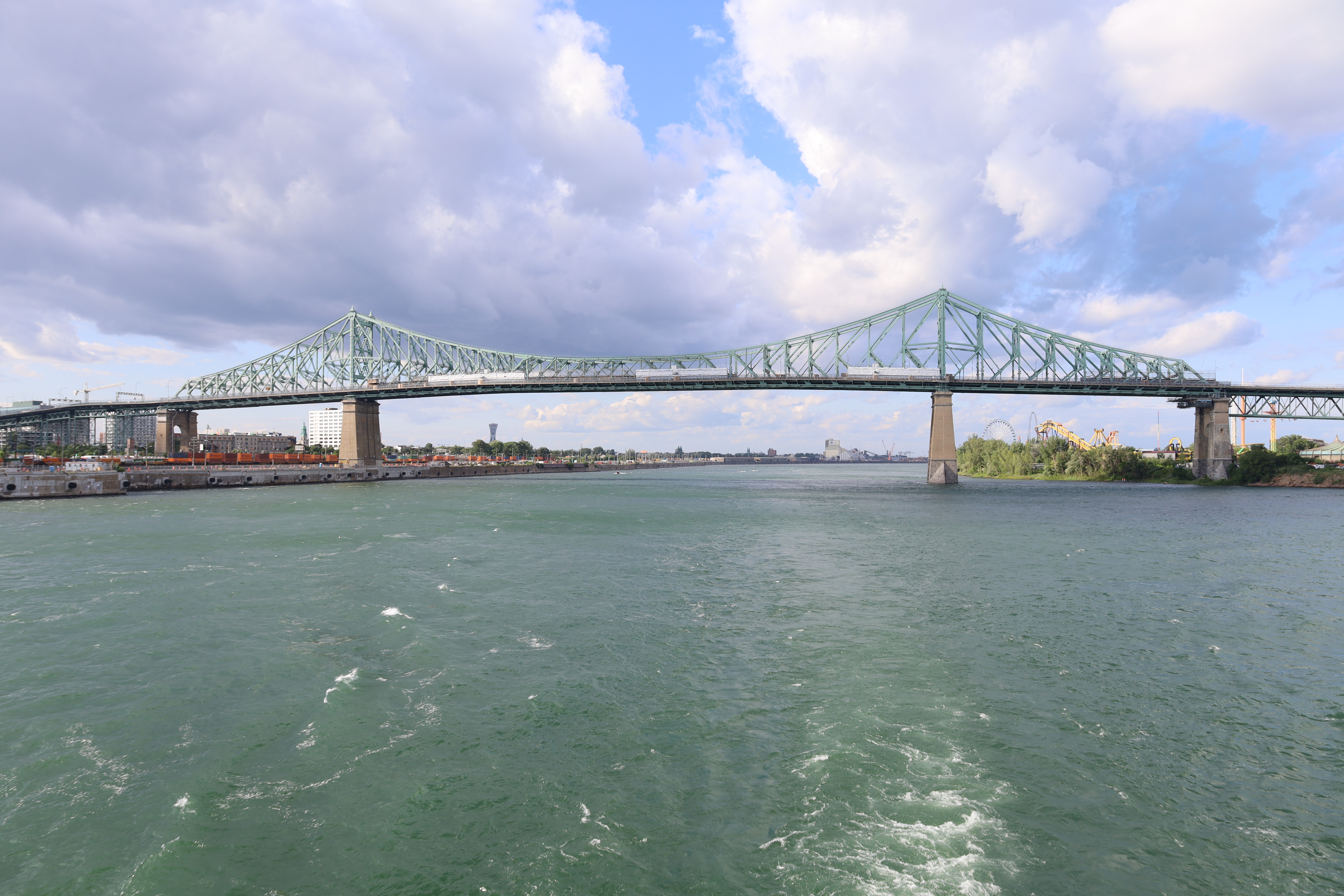
Steel Across the Saint Lawrence
The decision to build the bridge came in 1924, driven by a practical problem: Victoria Bridge, the only fixed crossing to Montreal's south shore, carried only rail traffic, and the wintertime ice bridge and ferry services could not keep pace with the automobile age. Construction moved fast. Workers finished a year and a half ahead of schedule without disrupting river traffic, and the bridge opened to vehicles on May 14, 1930, with the formal inauguration following on May 24. Originally christened the Montreal Harbour Bridge, the steel truss cantilever structure crosses Saint Helen's Island midstream, where offramps now connect to Parc Jean-Drapeau and the La Ronde amusement park. The bridge was renamed in 1934 after citizens petitioned to honor Jacques Cartier, the French-Breton explorer who first described and mapped the Saint Lawrence valley in 1534, on the 400th anniversary of that voyage.
Tramways That Never Ran
The original design reveals ambitions that never fully materialized. Engineers laid out three lanes of road traffic, two sidewalks, and reserved space in each direction for tramway lines. Tracks were actually installed -- but no tram ever crossed the bridge. That ghostly infrastructure lingered for decades, a parallel emptiness through which you could peer down at the bridge's massive steel girders. The roadway gradually consumed the unused space: an additional lane was added on the east side in 1956 and the west side in 1959, expanding the crossing to its current five lanes. Four tall finials crown the bridge's high points as architectural ornaments, giving the structure an unexpected elegance. The design followed the general concept of the Quebec Bridge and in turn influenced the Story Bridge in Brisbane, Australia, completed in 1940, and likely the J. C. Van Horne Bridge spanning the Restigouche River between New Brunswick and Quebec, built in 1958.
A Bridge That Breathes Data
The transformation began on May 17, 2017 -- a date chosen deliberately, as it marks the founding of Montreal in 1642 -- when the bridge lit up for the first time to kick off the city's 375th anniversary celebrations. The illumination system, designed by Realisations Inc. Montreal, tracks 53 types of data across 11 categories: weather, traffic, noise, social media activity, and more. The exterior lighting network translates this information in real time, making the Jacques Cartier Bridge the first "connected" bridge in the world. The colors tell a story. Red signals society. Green means the environment. Light blue marks technology. Gray represents business. Blue is for sports, pink for institutions, purple for culture. The intensity, speed, and density of light movements respond to how actively Montreal is being discussed online. Beyond the data-driven exterior, the interior lighting follows a chromatic calendar of 365 colors, shifting gradually from the energizing green of spring to radiant summer orange, voluptuous autumn red, and the icy blue of winter.
Fifteen Thousand Tonnes of Light
The numbers behind the illumination project hint at its scale. The bridge's steel superstructure weighs 15,650 tonnes. Installing the lighting required 10,000 fastening systems to secure luminaires to steel supports, plus 10.4 kilometers of cabling for data transfer and power supply. More than 200 professionals -- creatives, engineers, programmers, rope access technicians, electricians, steel erectors, and traffic officers -- contributed to the project. The system is scheduled to remain active until 2027. Today the Jacques Cartier Bridge carries approximately 35.8 million vehicle crossings annually, making it the third busiest bridge in Canada. It was a toll bridge from its opening until 1962, when the tolls were finally removed. For decades, it was simply infrastructure -- essential, heavy, functional. Now it is something more: a 96-year-old steel skeleton that has become Montreal's most visible piece of public art, translating the hum and chatter of an entire city into rivers of colored light above the dark water of the Saint Lawrence.
From the Air
The Jacques Cartier Bridge crosses the Saint Lawrence River at 45.52N, 73.54W, connecting Montreal Island to Longueuil on the south shore via Saint Helen's Island. The steel truss cantilever structure is a prominent visual landmark from any altitude -- its distinctive silhouette is easy to spot, especially at night when the LED illumination system turns it into a ribbon of color. Best viewed from 1,500-3,000 feet AGL. Montreal/Pierre Elliott Trudeau International Airport (CYUL) is 14 nm to the west. Montreal/Saint-Hubert Airport (CYHU) is 7 nm to the southeast. Habitat 67 and the Old Port of Montreal lie just to the southwest.