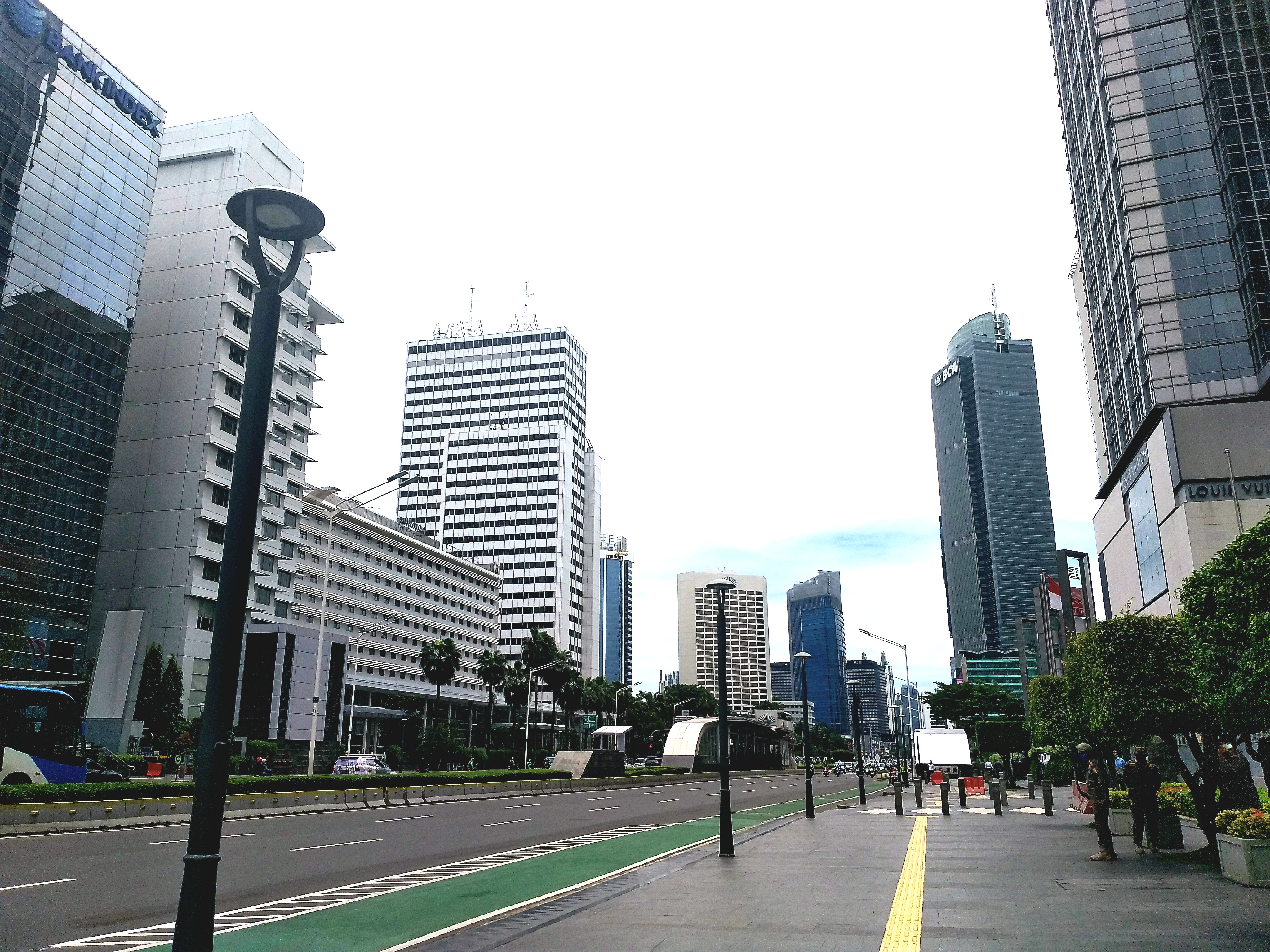
Jalan M.H. Thamrin
Before it was an avenue, it was a footpath called Gang Timboel -- a narrow lane threading between a 19th-century Armenian church and the colonial offices near Koningsplein West. The church is gone now, its former grounds absorbed into the Bank Indonesia complex, and the lane has become six lanes of traffic, bus rapid transit corridors, and an underground metro line. Jalan M.H. Thamrin, named in January 1951 for Mohammad Husni Thamrin, the nationalist politician who challenged Dutch rule from within its own councils, cuts through the center of Jakarta from the Arjuna Wijaya Statue roundabout in the north to the Hotel Indonesia roundabout in the south. Every piece of post-independence Indonesia has left its mark on this stretch of road: Sukarno's grand ambitions, the Asian Games' cosmopolitan debut, the Reformasi protests, and a city still arguing with itself about how to move twelve million people through a corridor barely two kilometers long.
A Highway for a New Republic
The suburb of Kebayoran Baru, developed in 1949 as a planned residential district, needed a connection to central Jakarta. Work on the link road began that same year, and by January 1951 the northern half had been named after Thamrin, who had died in 1941 after years of advocating for indigenous Indonesians in the colonial Volksraad. The government, anxious about squatters occupying the newly opened land, sold plots cheaply to anyone who committed to building within three to six months. Even so, extensions had to be granted -- buyers struggled to arrange financing or find building materials in a country still assembling the machinery of independence. By 1953 the road was largely complete, flanked by landmarks that would define Jakarta's skyline for decades: the Sarinah department store, Wisma Nusantara, and the Hotel Indonesia, whose roundabout became the avenue's southern anchor.
Sukarno's Stage Set
When Jakarta won the right to host the 1962 Asian Games, President Sukarno choreographed the visitor experience down to the last detail. VIPs would land at Kemayoran Airport, be driven south along Thamrin Road, pass the Welcome Monument at Bundaran HI, check into Hotel Indonesia, and then continue along Sudirman Road over the Semanggi cloverleaf to the Gelora Bung Karno sports complex. It was theater as urban planning. Both Thamrin and Sudirman were widened in the early 1960s, and a regulation mandated that buildings along the avenue stand at least five stories tall. The requirement proved difficult to enforce -- lack of funding and commercial construction expertise meant that several two-story government buildings stubbornly remained. But by the early 1970s, the skyline had caught up with the ambition. ICA towers, the Hotel Asoka, the Australian Embassy, and state-owned offices formed the corridor Sukarno had imagined, even if he was no longer in power to see it.
Seventeen Years of Negotiation
A 1985 study proposed redeveloping the pedestrian infrastructure along Thamrin -- widening sidewalks, integrating transit stops, connecting buildings to the TransJakarta corridor that would open in 2004. What followed was not construction but conversation: seventeen years of it, spanning five different master plans. Landowners worried about security; the 2003 Marriott Hotel bombing, which struck a building on the avenue itself, forced a complete renegotiation of agreements already painstakingly reached. Governor Sutiyoso led the process, supported by the urban design consultancy PSUD. The eventual solution became a model for Jakarta's public-private partnerships: landowners who contributed strips of their property for public pathways received incentives, and gold-colored metal strips embedded in the pavement marked the boundary between private land and public walkway. The lesson was characteristically Jakartan -- nothing about this city changes quickly, but it does change.
Buses, Bans, and the Battle for Space
Until the 2000s, Thamrin consisted of four carriageways with local and express lanes, three lanes for express traffic and two for local. The arrival of TransJakarta in 2004 -- Jakarta's first bus rapid transit system -- claimed one express lane for dedicated BRT use. Eventually the local-express separation was removed entirely, creating a simpler dual carriageway. In December 2014 the city banned motorcycles from the road altogether, an experiment in prioritizing larger vehicles and public transit over the motorbikes that dominate Jakarta's streets. Governor Anies Baswedan reversed the ban in 2018. Today four TransJakarta stops line the avenue, the Jakarta MRT runs beneath it, and Sudirman commuter rail and the airport rail link connect at its southern end. On Sundays, none of it matters: from six in the morning until eleven, the road closes entirely for Car-Free Day, and joggers, cyclists, and families with strollers claim the asphalt.
The Avenue Reclaimed
The tension along Thamrin has always been between spectacle and utility. Sukarno designed it for parades -- Independence Day processions, Jakarta anniversary celebrations, motorcades for visiting heads of state. But Jakartans have repurposed it for their own rituals. The Sunday Car-Free Day, which also spans the adjoining roads, transforms one of Southeast Asia's most congested corridors into an open-air gymnasium and food market. Temporary vendors set up where buses usually idle. Street musicians play where horns usually blare. The MRT station at Bundaran HI disgorges passengers into a space that, for a few hours, resembles less a business district than a neighborhood park. Thamrin Avenue carries its namesake's legacy in this contradiction: a road built to impress the world, used most joyfully when it forgets that ambition and simply becomes a place for the city to breathe.
From the Air
Located at 6.19S, 106.82E in Central Jakarta. Jalan M.H. Thamrin runs roughly north-south for about 2 km, connecting the Bank Indonesia roundabout (north) to the Hotel Indonesia roundabout (Bundaran HI) at the south. Identifiable from the air by its wide, tree-lined boulevard flanked by high-rise towers, with the distinctive circular Bundaran HI fountain at the southern terminus and Merdeka Square with the Monas obelisk visible approximately 500 m to the northeast. Nearest major airport is Soekarno-Hatta International (WIII), about 25 km northwest. Halim Perdanakusuma Airport (WIHH) is approximately 12 km southeast. Best viewed at low altitude in clear conditions.