James River and Kanawha Canal
George Washington was barely out of his twenties when the idea took hold. Surveying the mountains of western Virginia in the early 1770s, the young Virginian saw not wilderness but opportunity: a water route that could link the James River to the Kanawha, cross the Allegheny Mountains, and connect the Atlantic coast to the Ohio River and the vast interior beyond. By 1772, he had identified the James as the most promising corridor, preferring it over the Potomac because the Potomac would benefit Maryland equally. The James would serve only Virginia. It was a characteristically strategic calculation from a man who would soon command armies and then a nation, but this particular vision would outlive him by decades and never be completed.
A Nation's First Commercial Canal
In 1785, the James River and Kanawha Company was chartered with Washington himself as honorary president. Promoted by luminaries including Edmund Randolph and John Marshall, the company opened what became the first commercial canal in the United States, a stretch paralleling the James from Richmond to Westham. Flat-bottomed bateaux floated downriver to Richmond laden with tobacco hogsheads and returned carrying French and English imports, furniture, dishes, and clothing. Mules and horses pulled larger packet boats along the towpaths. But progress was agonizingly slow. The American Revolution and the War of 1812 each interrupted construction. The work was brutal through Virginia's rocky Piedmont, a transitional zone between the coastal plain and the mountains. Irish immigrants dug much of the early canal. After many died of hypothermia, they were replaced by enslaved Africans hired from plantation owners along the route. Eventually the canal company went broke and gave up.
Resurrection and the Push West
In 1820, the Commonwealth of Virginia took control and resumed construction with state funds from the Virginia Board of Public Works. Work stalled again, then restarted in 1835 under a new charter, with Judge Benjamin Wright as Chief Engineer. By 1840, the canal reached Lynchburg. President William Henry Harrison, elected that same year, inaugurated the service. The canal pushed on, reaching Buchanan in Botetourt County by 1851, roughly halfway to its goal. French capitalists from Bordeaux proposed to finance the remaining stretch to the Ohio River, but the deal never materialized. The plan called for linking the canal to the James River and Kanawha Turnpike for a portage over the most rugged mountain crossings. But by the 1830s, a faster technology was already emerging, and the portage problem that bedeviled canal engineers was no obstacle at all for locomotives.
Iron Horses on the Towpath
Railroads began overtaking canals as the preferred mode of transport just as the James River and Kanawha Canal was mid-construction. The canal struggled on, but the Civil War delivered a wound it could not survive. Despite the appointment of former Confederate general Armistead Lindsay Long as Chief Engineer after the war, damage from the conflict was never fully repaired. By 1873, the Chesapeake and Ohio Railway had built all the way through to the Ohio River, accomplishing by rail what the canal had spent seven decades failing to achieve by water. Massive flooding in 1877 dealt the final blow. The Richmond and Allegheny Railroad bought the canal's right-of-way and laid tracks along the old towpaths. That railroad was eventually absorbed by the Chesapeake and Ohio, which used the gentle water-level grade of the former canal route as its main line for hauling West Virginia bituminous coal eastbound to the port at Newport News on Hampton Roads.
What the Water Left Behind
Today, CSX coal trains still follow the old canal route through the Virginia mountains, rolling along grades that were engineered for water, not steel. The canal's legacy stretches beyond its roadbed. George Washington gave $20,000 in canal company stock to Liberty Hall Academy in the Shenandoah Valley. That endowment prompted the school to rename itself Washington College. It is now Washington and Lee University in Lexington, Virginia. The Lock-Keeper's House near Cedar Point in Goochland County, built around 1836 to serve Lock Number 7, is the last surviving lock-keeper's residence from the entire canal system. A restored lock sits in the village of Big Island off the James River where the Blue Ridge Parkway crosses overhead.
Walking Where the Barges Ran
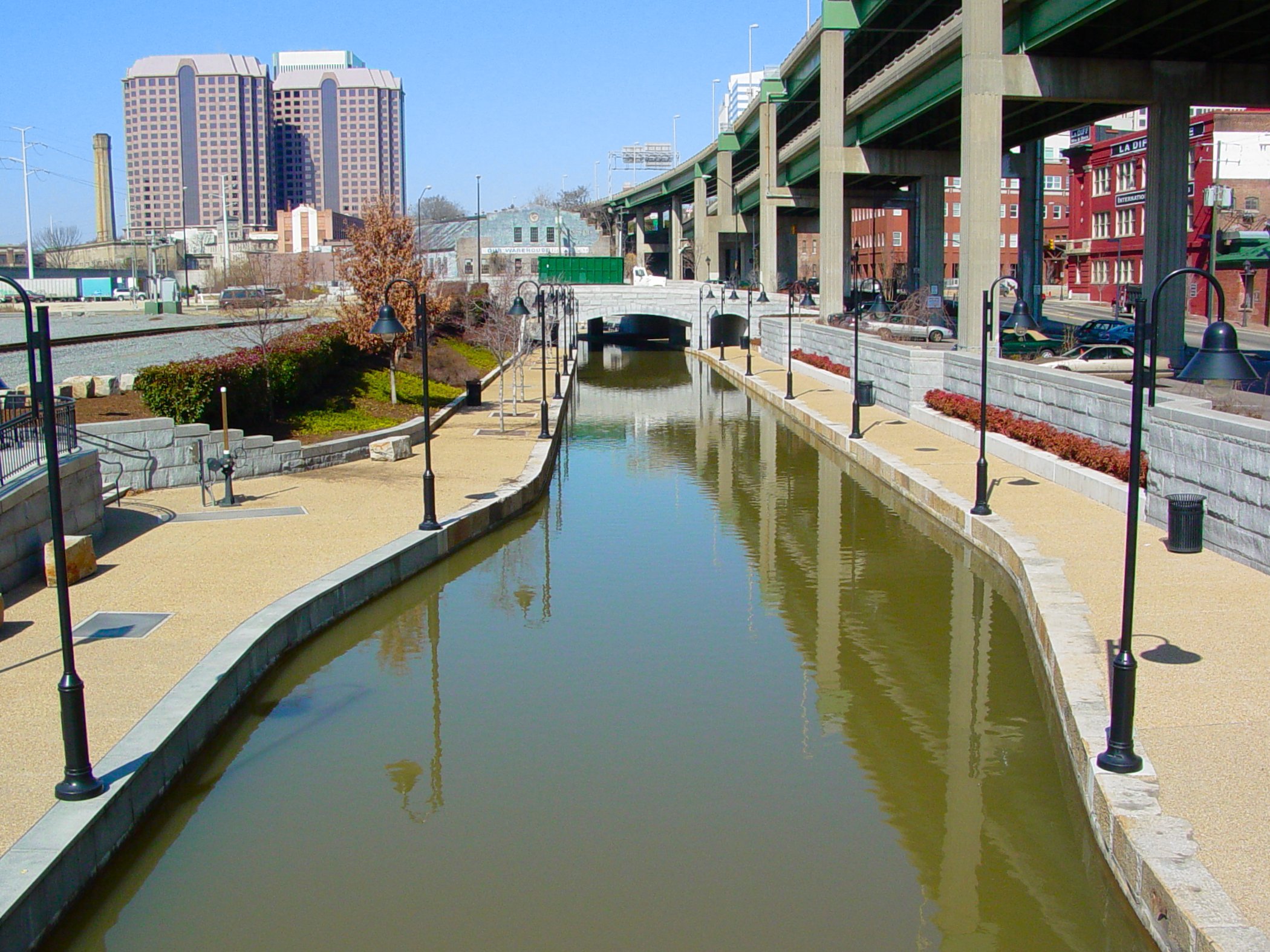
In Richmond, portions of the old canal have been restored as the Canal Walk, a pedestrian promenade through the revitalized waterfront that traces the route where bateaux once carried tobacco to market. The James River and Kanawha Canal Historic District was listed on the National Register of Historic Places in 1971. Visitors can walk to the Three-Mile Locks in Pump House Park behind the Carillon in William Byrd Park, where the remnants of the original canal entrance and the Gothic Revival New Pump House still stand. The western entrance of the Richmond section lies near the village of Sabot in Goochland County, while the eastern end sits near the Richmond Deepwater Terminal. Much of the former turnpike portage route through West Virginia is now the Midland Trail, a National Scenic Byway. The canal that Washington dreamed never reached the Ohio, but its path through the mountains shaped the corridors that commerce still follows.
From the Air
The canal route follows the James River westward from Richmond at 37.53N, 77.43W through the Virginia Piedmont toward the Blue Ridge. From the air, the CSX rail corridor closely tracks the former canal and towpath alignment along the James River valley. The Richmond Canal Walk is visible in the downtown waterfront area near the Tredegar Iron Works site. Bosher Dam, an 1835 structure, is visible on the western side of Richmond. The canal reached as far west as Buchanan in Botetourt County, roughly 150 miles from Richmond. Nearest airport is Richmond International (KRIC), approximately 7 miles southeast of the eastern terminus. Best viewed at 3,000-5,000 feet AGL to follow the river corridor and appreciate how the canal, railroad, and river share the same valley.