Jay Cooke State Park
Nineteen pauses. That is how the voyageurs divided the Grand Portage of the St. Louis River, spacing their rest stops a third to half a mile apart through some of the most punishing terrain in the Upper Midwest. Each man hauled two or three packs weighing up to 90 pounds, supported by a leather strap pressed against his forehead. Three to five days of backbreaking labor, plastered in mud and covered in mosquito bites, just to bypass a gorge too violent for any canoe. That gorge, carved into rock nearly two billion years old, is the centerpiece of Jay Cooke State Park, one of Minnesota's ten most visited state parks and a place where deep geological time and human perseverance collide at every turn of the trail.
The Highway Before Highways
Long before Minnesota had roads, its rivers were its interstate system. Three great watersheds carried water north to Hudson Bay, east to the Great Lakes, and south into the Mississippi. Native Americans navigated this network for centuries, followed by French missionaries, explorers, and the coureurs des bois who pushed ever deeper into the wilderness in pursuit of fur. The St. Louis River was a critical link in the chain connecting the Mississippi waterways to Lake Superior. But the rocky gorge that now defines Jay Cooke State Park was impassable by canoe. So Native Americans blazed a portage trail around it, and the voyageurs later adopted the route, dubbing it the Grand Portage of the St. Louis. Above the town of Carlton, travelers could continue upstream to Lake Vermilion and the Rainy River, or head southwest via the East Savanna River toward the Mississippi. The Grand Portage remained in active use until 1870, when railroads rendered it obsolete.
Stone From Before Life
The bedrock exposed in the park's gorge is the Thomson Formation, dating to the Paleoproterozoic era 1.9 billion years ago. It began as mud, silt, and clayey sand deposited by turbidity currents at the bottom of a deep sea, then compacted into horizontal layers of shale and greywacke. Ripple marks from that ancient ocean floor are still visible in the rock, but there are no fossils: complex organisms had not yet appeared on Earth. Around 1.85 billion years ago, the Penokean orogeny subjected these sediments to enormous pressure and heat, folding and tilting them into the formations visible today. Ice sheets covered Minnesota as many as twenty times over two million years, but nearly all the glacial features in the park date from the Wisconsin glaciation. The Thomson Moraine, a ridge along the park's northwest boundary, marks the farthest reach of the Laurentide Ice Sheet's Superior Lobe. As the ice retreated roughly 12,000 years ago, meltwater filled the basin to form Lake Duluth, a body of water significantly higher than modern Lake Superior.
The CCC's Masterwork
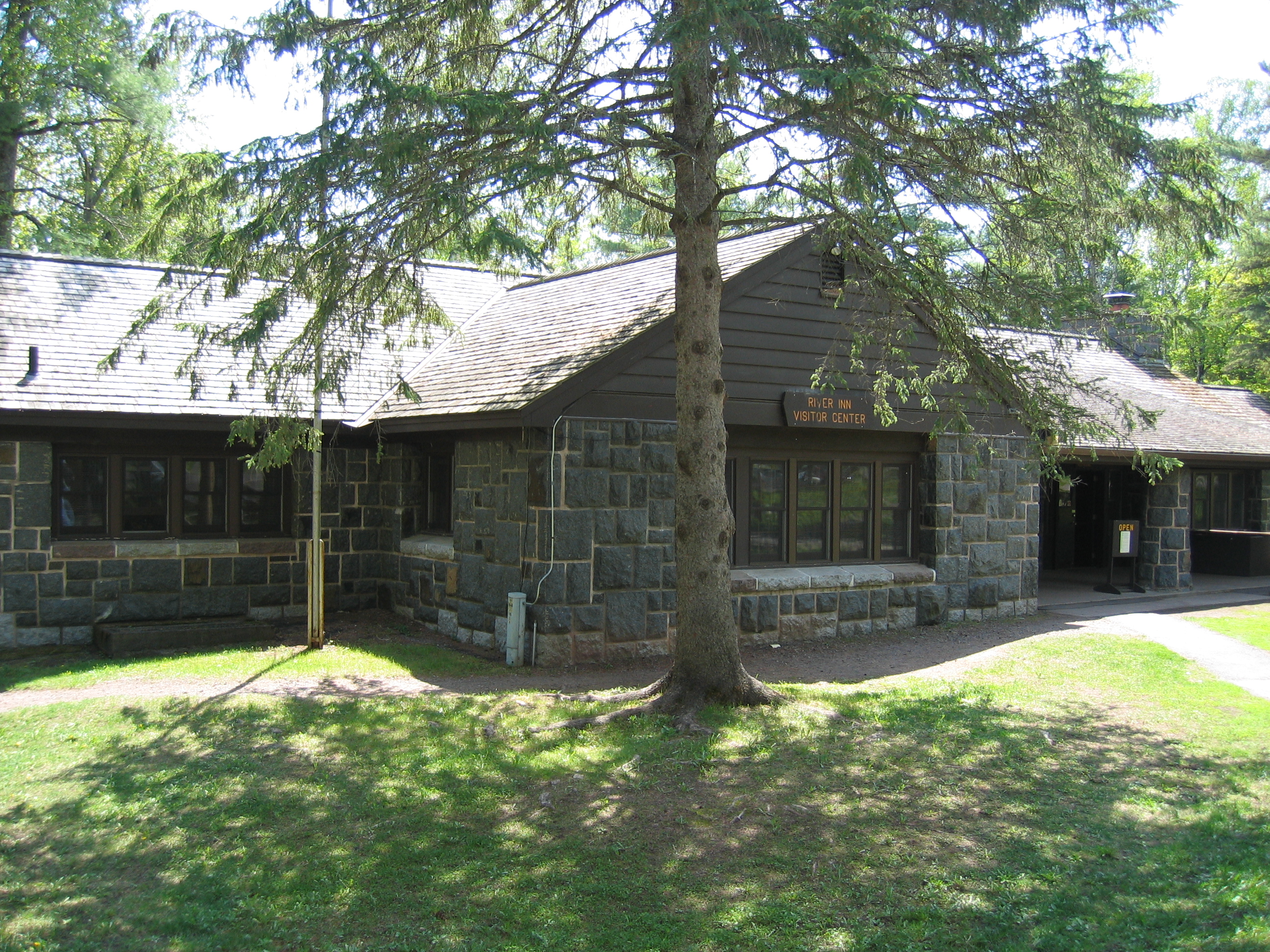
The Saint Louis Power Company donated the park's first tract of land to the state in 1915, and the park is named for Pennsylvania financier Jay Cooke, who developed a nearby power plant still in operation today. But the park remained largely undeveloped until 1933, when the Civilian Conservation Corps established a camp on site. The CCC workers built the park's most iconic structure: a rustic swinging bridge spanning the St. Louis River just downstream from torrential rapids and waterfalls. Designed by Oscar Newstrom, it is one of only two suspension bridges in any Minnesota state park, supported by massive concrete pylons faced with locally quarried gabbro stone. A second CCC camp in 1939 rebuilt the bridge and constructed the River Inn, which now serves as the visitor center. All major structures are built in Rustic Style using local basalt, gabbro, dark planks, and logs. Three historic districts of these CCC structures are listed on the National Register of Historic Places.
Flood, Ruin, and Renewal
On June 20, 2012, a record-setting rainstorm struck the Duluth area and turned Jay Cooke's gorge into a churning torrent. Floodwaters filled the gorge with debris, devastated the park's roads and trails, and destroyed the historic swinging bridge. The Pine Journal reported that at least one stone pillar and half of another were washed away, and the bridge decking was twisted and mangled. It was a catastrophic blow to a park that drew hundreds of thousands of visitors annually. But by 2014, extensive repair work had restored most trails and replaced the bridge. In June 2015, the park celebrated its 100th anniversary. That year, 378,000 visitors walked the rebuilt trails and crossed the new bridge, a testament to the same kind of stubborn recovery that has defined this stretch of river since the voyageurs first portaged around it.
Fifty Miles of Trail
Today Jay Cooke offers over 50 miles of hiking trails with scenic overlooks above the St. Louis River. The Willard Munger State Trail passes through the park, connecting it to Duluth by a paved route popular with cyclists and skaters. The North Country National Scenic Trail, stretching 4,800 miles from Vermont to North Dakota, also threads through the park. Mountain biking is permitted on the Greely Creek, Triangle, and Gill Creek trails. The park shelters 46 species of mammals, including black bears, wolf packs, and white-tailed deer, along with 173 bird species. Brown trout run in the St. Louis River, and brook trout populate Silver and Otter creeks. Park rangers deliver over 400 naturalist events each year, from evening campfire talks to snowshoe-building lessons. The Grand Portage trail itself has been partially renovated for hiking, letting modern visitors trace the same path once worn smooth by moccasins and muddy boots.
From the Air
Located at 46.65N, 92.33W, approximately 10 miles southwest of Duluth, Minnesota. The St. Louis River gorge is the park's dominant visual feature from the air, with the rocky canyon clearly visible at lower altitudes. Minnesota State Highway 210 runs through the park along the Rushing Rapids Parkway scenic byway. Two dams flank the park: the Thomson Dam to the northwest and the Fond du Lac Dam to the northeast. Nearest airports include Duluth International Airport (KDLH) approximately 15 miles northeast and Duluth Sky Harbor Airport (KDYT). Best viewed at 2,000-4,000 feet AGL, where the river gorge, surrounding glacial terrain, and the CCC-era structures along the riverbank are all visible.