Jean Lafitte National Historical Park and Preserve
Most national parks occupy a single piece of land. Jean Lafitte National Historical Park and Preserve exists in six pieces scattered across southern Louisiana, connected not by geography but by the cultural currents of the Mississippi River Delta. Named for the French pirate and privateer Jean Lafitte, whose smuggling operations once ran through these bayous, the park binds together a battlefield where America won a famous victory, a cypress swamp where alligators glide through black water, three Cajun cultural centers preserving the heritage of exiled Acadians, and a visitor center in the heart of New Orleans' French Quarter. It is less a park than a constellation of stories.
The Battle That Made a Nation
The Chalmette Battlefield unit sits six miles southeast of downtown New Orleans, on the ground where Andrew Jackson's forces defeated a British army on January 8, 1815. The battle technically occurred after the Treaty of Ghent had been signed to end the War of 1812, though neither side knew it yet. The victory transformed Jackson into a national hero and cemented American control of the Mississippi River. Today, a 100-foot obelisk marks the site. Construction began in 1855 but stalled during the Civil War, and the monument was not completed until 1908, when President Theodore Roosevelt's administration finally pushed it through. Hurricane Katrina damaged the monument in 2005; it reopened during a rededication ceremony on National Public Lands Day, September 28, 2013. The adjacent Chalmette National Cemetery, established in 1864, holds the remains of soldiers from the Civil War through the Vietnam War.
Where the Bayou Breathes
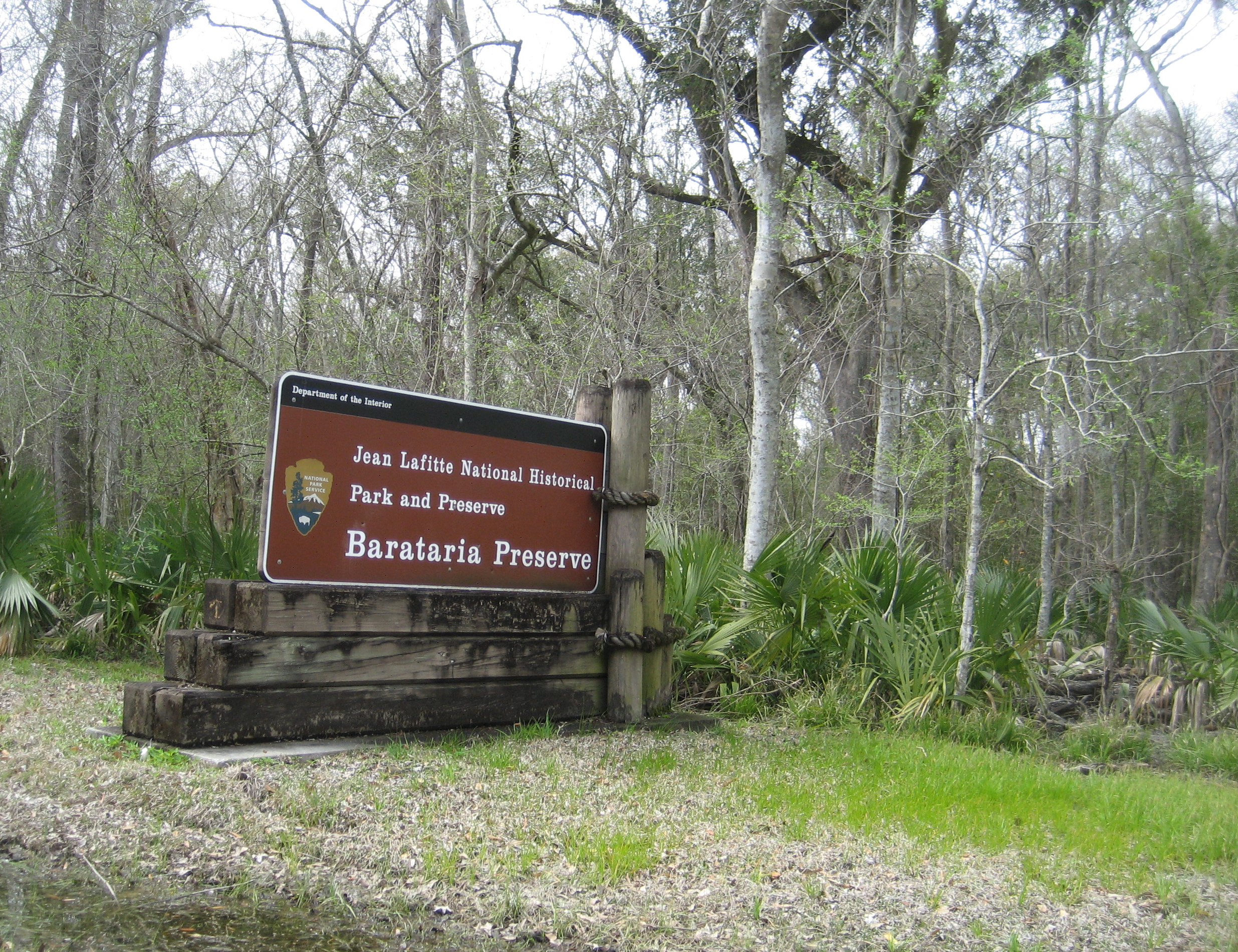
The Barataria Preserve in Marrero offers something entirely different: 23,000 acres of bottomland hardwood forests, swamps, and marshland where the Delta reveals its wild heart. Trails wind through bald cypress draped in Spanish moss, past water tupelo knees rising from mirror-still water. Canoe tours push through channels where great blue herons stand motionless and alligators drift like logs. The preserve interprets both the natural and cultural history of the region, a landscape shaped by water that rises and falls with the seasons. The Barataria area was listed as a historic district on the National Register of Historic Places on October 15, 1966, recognizing 63 contributing properties within 1,855 acres of wetland landscape. An education center provides programming for school groups, introducing Louisiana children to the ecosystem that defines their home.
The Exiles Who Built a Culture
Three sites in the park's Acadiana unit preserve the culture of the Cajuns, descendants of French-speaking Acadians expelled from Canada by the British between 1755 and 1764. Forced from their homes in what is now Nova Scotia, New Brunswick, and Prince Edward Island, these families eventually settled in the bayou country of southern Louisiana, where they built a culture distinct from anything else in America. The Acadian Cultural Center in Lafayette, the Prairie Acadian Cultural Center in Eunice, and the Wetlands Acadian Cultural Center in Thibodaux each interpret different aspects of Cajun life. From the fiddle-driven music of the prairie to the fishing traditions of the wetlands, the Acadiana sites capture a people who turned exile into identity, transforming the hardship of displacement into a cultural tradition that continues to define southern Louisiana.
Ghosts and Erasures
The park's history carries difficult truths. Adjacent to the Chalmette National Cemetery lies the site of the Freedmen's Cemetery, a four-acre African American burial ground established by the federal government in 1867 for formerly enslaved men, women, and children receiving aid from the Freedmen's Bureau. The cemetery was initially well maintained but fell into disrepair during the 1870s as Reconstruction-era services were curtailed and then eliminated. Today a historical marker near the Chalmette entrance is all that remains. In the early 1960s, the historic community of Fazendeville, founded around 1870 by Jean-Pierre Fazende as a home for newly freed enslaved people, was demolished to expand the battlefield grounds for the 150th anniversary of the Battle of New Orleans. The park preserves victories and honors the dead, but it also stands on ground where entire communities were erased.
Six Sites, One Story
Congress formally established Jean Lafitte National Historical Park and Preserve in 1978, weaving together sites that had been managed separately for decades. The Chalmette unit had been a federal site since 1907, transferred to the National Park Service in 1933. The enabling legislation incorporated Chalmette, the Barataria Preserve, and interpretive facilities in the French Quarter. In 1988, Congress added the Acadiana unit, completing the six-site configuration that exists today. The French Quarter Visitor Center at 419 Decatur Street in New Orleans serves as the park's public face, interpreting the broader history and cultures of the Delta region. The park's headquarters are also in New Orleans, overseeing a network that stretches from the heart of the city into the wild marshes and quiet prairies of Cajun country.
From the Air
The Chalmette unit is located at 29.94N, 89.99W, about 6 miles southeast of downtown New Orleans on the east bank of the Mississippi River. The Chalmette Monument obelisk (100 feet tall) is visible from moderate altitude. The Barataria Preserve lies across the river to the southwest near Marrero, a large expanse of wetlands and dark water visible from the air. The park's six sites are spread across southern Louisiana from New Orleans to Lafayette. Nearest airports: Louis Armstrong New Orleans International Airport (KMSY) about 20 miles west, New Orleans Lakefront Airport (KNEW) about 8 miles northwest. Best viewed at 2,000-4,000 feet AGL for the Chalmette and Barataria units.