Jeannette Kawas National Park
This park carries the name of a woman who was killed for defending it. On February 6, 1995, Blanca Jeannette Kawas Fernandez was shot at her home in Tela by two unidentified gunmen. She had been president of PROLANSATE, the foundation working to protect the wetlands and forests of what was then called Punta Sal National Park, and she had made enemies among those who wanted to clear the land for oil palm plantations. The Honduran government renamed the park in her honor. Years later, the Inter-American Court of Human Rights found that the crime was facilitated by the intervention of state agents and was motivated by her environmental defense work. The park she died to protect covers more than 780 square kilometers of Caribbean coastline, mangrove swamps, lagoons, and tropical forest.
The Woman Behind the Name
Jeannette Kawas was of Honduran-Palestinian descent, and she dedicated herself to conservation at a time when environmental activism in Honduras could be -- and was -- a death sentence. As president of PROLANSATE (the Foundation for the Protection of Natural Resources of the regions of Lancetilla, Punta Sal, and Texiguat), she led the effort that convinced the Honduran government to create Punta Sal National Park in 1994. She opposed the encroachment of the palm oil industry into protected lands and fought against illegal logging. Her work made the park possible, but it also put her directly in the crosshairs of powerful economic interests. She was 48 years old when she was murdered. Honduras has since recognized her as the country's first environmental martyr, though that recognition came after her death rather than before it, a pattern all too familiar in the history of conservation in Central America.
Where the Jungle Meets the Sea
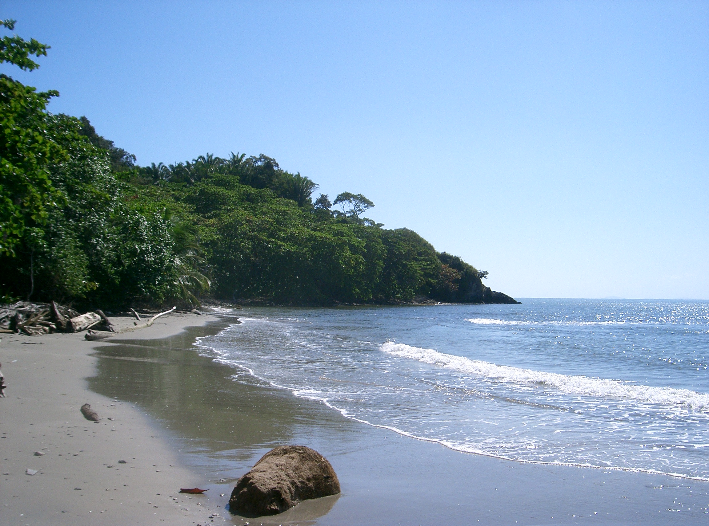
The park stretches along 35 kilometers of Caribbean coastline west of Tela, encompassing a landscape that shifts from white-sand beaches backed by dense jungle to mangrove swamps, freshwater lagoons, and patches of tropical forest. One large lagoon and several smaller ones sit within the park's boundaries, their banks frequented by crocodiles and caimans. The beaches are striking -- crystal-clear light blue water, strips of white sand, and verdant forest pressing right up to the shore. Most visitors stay near the coast, but the interior holds an ecosystem of remarkable density. The park is remote and difficult to reach; the best access from Tela involves rough dirt roads passable mainly in the dry season, or boats hired from the coastal village of Rio Tinto. That isolation has helped preserve what Kawas fought to protect.
A Census of Wings and Whiskers
More than 400 bird species have been identified within the park's boundaries, making it one of the richest birding sites in Honduras. The roll call includes the keel-billed motmot, turquoise-browed motmot, green-breasted mountain-gem, lovely cotinga, resplendent quetzal, bushy-crested jay, blue-crowned chlorophonia, and the lesser ground-cuckoo. Marine mammals patrol the waters offshore: Indian manatees move slowly through the shallows, while common dolphins surface beyond the reef. On land, monkeys swing through the canopy, tapirs push through the undergrowth, coatis forage along streambeds, and jungle cats prowl at dusk. The swamps and wetlands teem with reptiles -- green iguanas are common, and a patient observer might spot a red-tailed boa constrictor draped across a branch. The park holds a designated Ramsar wetland status, recognizing its international significance as a habitat for waterbirds and aquatic species.
Tropical Heat and Distant Roads
The climate is unambiguously tropical. Average temperatures hover between 34 and 36 degrees Celsius, with summer highs occasionally reaching 39 degrees. Rain falls throughout the year, and flooding can occur, particularly during the wet season when the dirt roads that serve as the primary overland access become impassable. During those months, the only reliable way to reach the park is by boat from Rio Tinto. Tropical storms occasionally sweep through in summer or fall, though they remain rare. The remoteness that makes the park difficult to visit is also what gives it its character. There is a small beach restaurant that serves light food and cold drinks, and hammocks are available for visitors who want to rest in the shade. The infrastructure is minimal. The wildness is the point.
A Legacy Measured in Mangroves
Parks are often named for geographic features -- rivers, mountains, peninsulas. This one is named for a person who was murdered for caring about it. That fact changes how you experience the place. The mangroves, the lagoons, the 400-plus bird species -- all of it exists in its current protected state because Kawas and her colleagues at PROLANSATE insisted it should, even when powerful interests wanted it converted to palm plantations. Her death did not end the threats; land conflicts and environmental pressures in Honduras have continued. But the park endures, and her name endures with it. Walking along the beach or watching a motmot flash its turquoise feathers from a low branch, it is worth remembering that this particular stretch of Caribbean coast almost became something else entirely.
From the Air
Located at 15.85N, 87.67W on the Caribbean coast of northern Honduras, west of the town of Tela. The park is visible as a long stretch of undeveloped coastline with lagoons, mangrove systems, and dense tropical forest meeting white-sand beaches. Nearest airports include La Ceiba Goloson International (MHLC) to the east and San Pedro Sula Ramon Villeda Morales International (MHLM) to the southwest. The park's 35 km of coastline is best seen from a low coastal approach heading west from Tela. Look for the contrast between developed coastline near Tela and the unbroken green of the park to the west.