Thirty-Two Miles Along the River
In the 1890s, a group called the Capital City Wheelmen marked out a route along the American River east of Sacramento. They were part of the cycling craze that swept American cities before the automobile rendered their sport a curiosity, and the path they blazed -- from the confluence where the American meets the Sacramento River to the foothills near Folsom -- followed terrain that fur trapper Jedediah Smith had explored decades earlier. The cars came, the Wheelmen disbanded, and the route disappeared into scrub and riverbank. Eighty years later, cyclists rediscovered it. Today the Jedediah Smith Memorial Trail stretches thirty-two paved miles from Discovery Park to Beal's Point at Folsom Lake, and roughly five million people use it every year.
The Man, the River, the Route
Jedediah Strong Smith was among the most remarkable explorers of the American West, a fur trapper who led the first overland expedition from the Rocky Mountains to California in 1826. He explored the territory east of Sacramento in the early nineteenth century, moving through country that was still unmapped by Americans, following the course of the river that would later bear the name American -- the same river where, in 1848, James Marshall's discovery of gold would transform California and the nation. The trail named for Smith traces the American River's path from the flat Central Valley floor into the Sierra Nevada foothills, climbing gently from sea level at Discovery Park to Folsom Lake's elevation of about 466 feet. It is a journey through geology as much as geography: the valley's cottonwoods and valley oaks give way to foothill pines and exposed granite as the trail moves east.
A Bridge That Looks Familiar
Roughly nine miles from the western trailhead, a suspension bridge spans the American River with cables and towers that look like they belong in San Francisco. The Guy West Bridge, completed in 1967, is a scaled-down reproduction of the Golden Gate -- painted in the same international orange, strung with the same graceful catenary cables, connecting the California State University, Sacramento campus to the south bank of the river. It is one of the trail's most photographed landmarks, and it captures something essential about Sacramento's relationship with its larger coastal neighbor: affectionate imitation without apology. The bridge serves as a gateway to the university campus and a natural pause point for cyclists and joggers who have ridden east from Discovery Park through the leafy corridor of the American River Parkway.
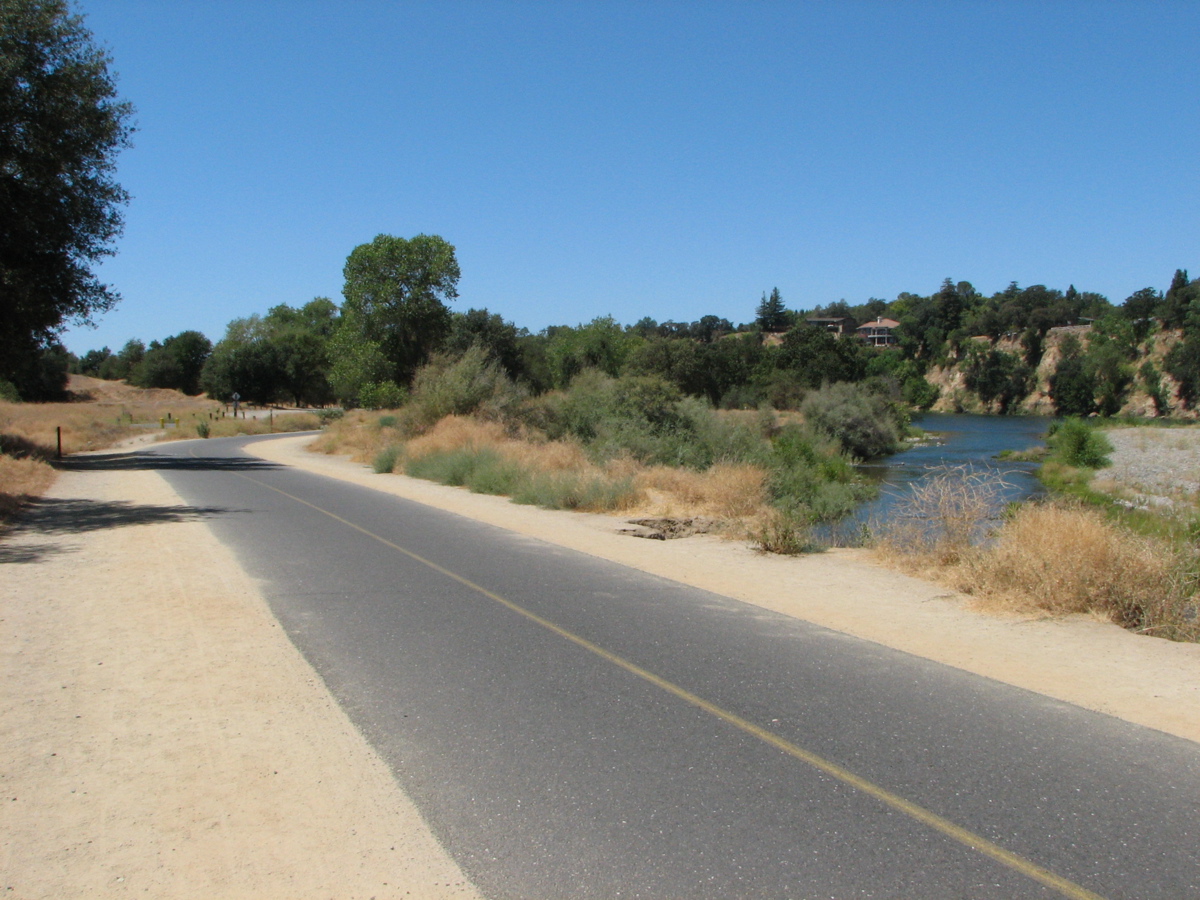
Wildlife Between the Subdivisions
The trail runs through one of the most urbanized regions of Northern California, but the American River Parkway that surrounds it preserves a surprising corridor of wildness. Deer browse in the river bottoms at dawn, their tracks crossing the pavement before commuters arrive. Western rattlesnakes sun themselves on the trail's warm asphalt in spring and summer -- a hazard that the county's half-mile markers do not warn about. Woodpeckers drill the oaks that line the riverbank, and red-tailed hawks circle above the open stretches near William B. Pond Recreation Area. In recent years, coyotes have become increasingly common along the trail, growing bold enough to watch passing cyclists with little more than casual interest. The parkway functions as a green artery through a metropolitan area of more than two million people, proof that a river corridor, if left mostly intact, can sustain biological diversity even as suburbs press against its edges.
From Discovery to Folsom
The trail's western terminus at Discovery Park sits at the confluence of the American and Sacramento Rivers -- the point where John Sutter, the Swiss-born founder of Sacramento, first landed in 1839. From there, the path winds east through a chain of parks and landmarks: Sutter's Landing, the Howe Avenue bridge, the Fair Oaks walking bridge, and the Nimbus Fish Hatchery, where Chinook salmon are spawned to replenish the American River's runs. Past Nimbus Dam, the trail splits to loop both shores of Lake Natoma, a calm reservoir popular with kayakers and rowers, before climbing to its eastern endpoint at Beal's Point on Folsom Lake. The entire route is painted with mile markers at every half-mile increment, maintained by Sacramento County, and connected to a larger network of bike trails that branch north toward Natomas and south past the Capitol into the Pocket neighborhood. For commuters, it is a freeway without exhaust. For everyone else, it is thirty-two miles of river, oak, and sky.
From the Air
The trail follows the American River corridor from 38.607N, 121.502W (Discovery Park at the Sacramento-American River confluence) east to 38.691N, 121.171W (Beal's Point at Folsom Lake). The river and its parkway form a clearly visible green corridor through the Sacramento metro area from altitude. Sacramento Executive Airport (KSAC) is approximately 3nm south of the western trailhead; Sacramento International (KSMF) is 10nm northwest. Mather Airport (KMHR) lies about 3nm south of the trail's midpoint near Rancho Cordova. The Guy West Bridge and Nimbus Dam are identifiable landmarks from 2,000-3,000 feet AGL.