Jerpoint Abbey
Between the columns of Jerpoint Abbey's cloister arcade, stone figures peer out at visitors with expressions that have survived eight centuries of Irish weather. Knights in armor, saints with haloes, ordinary men and women with medieval haircuts -- they are carved directly into the structural stonework, making the cloister itself a portrait gallery of 15th-century Ireland. There is nothing quite like them anywhere else in the country. Jerpoint was once a powerhouse of the Cistercian order, commanding 14,000 acres of County Kilkenny farmland. Today it is a ruin, but those faces in the stone remain.
The Bridge at the River
Several theories attempt to explain the name "Jerpoint." The most compelling links it to the Irish name for the River Nore -- An Fheoir -- Latinized as Jeri, combined with the Latin pons for bridge. A bridge across the river, then, gave its name to the monastery. Scholars believe the abbey may have existed since the 1160s, though it was only formally affiliated with the Cistercian order in 1180. Its likely founder was Domnall Mac Gilla Patraic, who died in 1176. Dedicated to the Blessed Virgin, Jerpoint stood near the anciently corporate town of Newtown Jerpoint, 2.5 km southwest of Thomastown. Until around 1310, the abbey housed monks of Irish descent, while the Cistercian house at Graiguenamanagh, not far away, served monks of Norman descent -- an arrangement that reveals how even monastic life in medieval Ireland was divided along ethnic lines.
Bishops in Stone
Jerpoint's most important burial is that of Felix Ua Duib Slain, Bishop of the Diocese of Ossory and the Cistercian founder of the abbey, who was interred here in 1202. His effigy tomb is among the finest medieval stone carvings in Ireland. Beside him lies William, Bishop of Cork, also known as William of Jerpoint, whose own well-preserved effigy features a crozier that is, according to historian William Carrigan, an exact copy of Bishop Ledrede's crozier at Saint Canice's Cathedral in Kilkenny. These two were the only monks from Jerpoint "ever elevated to the Episcopal dignity." The abbey became a favored burial place for the great families of the surrounding countryside, their tombs accumulating in the transept chapels across the 13th through 16th centuries.
From 14,000 Acres to Ruin
The abbey flourished for centuries, its wealth measured in the vast acreage it controlled. That wealth ended abruptly when Henry VIII dissolved the monasteries. Oliver Grace, the last abbot, surrendered Jerpoint to the crown. In 1541, Philip and Mary leased it to James Butler, the 9th Earl of Ormond, continuing the Butler dynasty's long association with Cistercian properties across Munster and Leinster. Local tradition, recorded in the Schools' Collection of Irish folklore, tells of Cromwellian soldiers killing all the monks -- a story that, even if embellished, captures the violence that defined the abbey's end. Another account from the same collection describes two local boys who served mass with a ghostly, otherworldly priest at the abbey during the Penal Times, when Catholic worship was suppressed.
The Faces Between the Columns
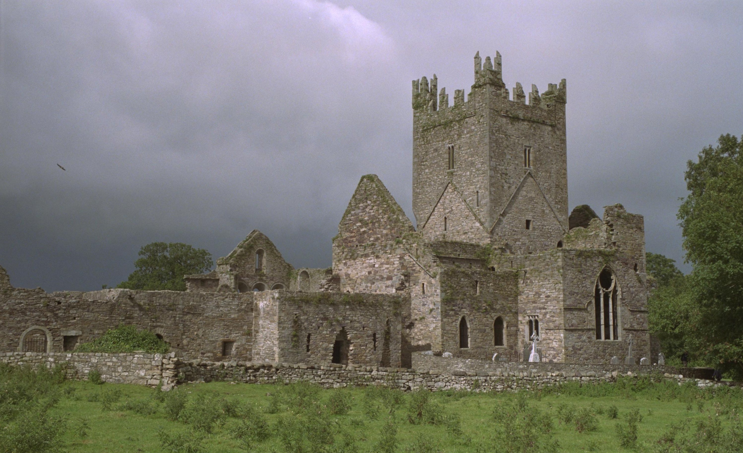
What draws visitors today is the cloister arcade, restored and displayed with its unique figure carvings visible between the columns. The church itself, with its Romanesque details, dates from the 12th century; the well-proportioned square tower and the cloister were added in the 15th century. The architectural style blends late Norman and early English Gothic -- a transition visible in the stonework. Jerpoint has been a national monument since 1880, managed by the Office of Public Works, which operates a visitor centre with an exhibition on the site. From the air, the abbey appears as an extensive footprint of grey walls in the green Nore valley, the tower rising above the surrounding farmland. Those carved faces in the cloister -- knights and bishops, ladies and monks -- remain the most intimate connection to the people who built this place and prayed within it.
From the Air
Located at 52.51N, 7.16W in County Kilkenny, 2.5 km southwest of Thomastown along the River Nore valley. The extensive ruins and square tower are visible against green farmland. Nearest airports: Waterford (EIWF) approximately 35 km south, Kilkenny area. Best viewed below 2,500 ft AGL. The River Nore provides a navigation reference.