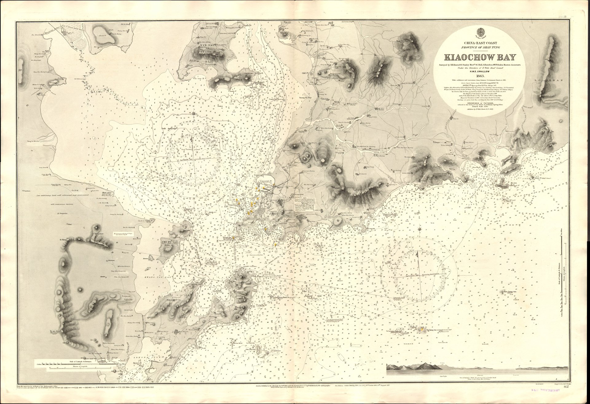
Jiaozhou Bay
In 1928, Jiaozhou Bay covered 560 square kilometers of the Yellow Sea, a broad natural harbor on the southern coast of the Shandong Peninsula. By 2003, sustained land reclamation had shrunk it to 362 square kilometers, roughly two-thirds of its former self. The bay that Kaiser Wilhelm II coveted, that Japan seized, that ignited student protests across China, and that now sustains one of the world's busiest ports has been physically diminishing even as its significance has grown. Out of 170 marine species found in its northwestern basin during the 1970s, only 17 remained by 1989. False killer whales, once regular visitors, now appear only occasionally. Jiaozhou Bay is a place where grand history meets ecological reckoning.
The Bay That Launched an Empire
During the Qing dynasty, Jiaozhou Bay supported a thriving junk trade, its natural harbor sheltering vessels that carried goods along the Shandong coast. The bay first drew European attention when geographer Ferdinand von Richthofen recommended it as a potential German naval base in the 1870s. In March 1898, the German Empire concluded a 99-year lease with the Qing government, mirroring the terms the British would soon negotiate for Hong Kong's New Territories and the French for Guangzhouwan. The fishing village of Tsingtau became a German colonial city practically overnight, and the bay became home to the Imperial German Navy's East Asia Squadron. Germany introduced a land value tax as the colony's sole source of revenue, an experiment in Georgist economics that eliminated land speculation and brought rapid prosperity. It remains the only government in history to rely exclusively on a single tax on land value.
From Versailles to May Fourth
World War I shattered the German colony. Japan issued an ultimatum on August 15, 1914, and after a two-month siege, the territory fell. China entered the war in 1917, expecting the victorious Allies to return Qingdao. Instead, the Treaty of Versailles awarded all former German Pacific territories north of the equator to Japan, Jiaozhou Bay included. The betrayal was shattering. On May 4, 1919, students in Beijing poured into the streets in protest, launching what became the May Fourth Movement, one of the defining events of modern Chinese history. The Beiyang government refused to sign the treaty. The crisis, known as the Shandong Problem, was eventually resolved through American mediation, and the territory returned to Chinese sovereignty in February 1922. A bay that had been a pawn of European imperialism had become the catalyst for Chinese nationalism.
Bridging the Gap
In 1993, Qingdao decided to build a transportation corridor across its defining body of water. Construction began in 2006, and in 2011 both the Jiaozhou Bay Bridge and the Jiaozhou Bay Tunnel opened simultaneously. At the time of its completion, the bridge stretched 42.5 kilometers, making it the world's longest bridge over water. It cut travel time from central Qingdao to outlying districts by more than half. The tunnel, running beneath the bay's entrance, connected central Qingdao to Huangdao District with an automobile travel time of approximately ten minutes. Together, the two structures transformed the bay from a barrier into a connector, stitching the city's scattered districts into a coherent metropolitan area. The bay that once separated empires now unites neighborhoods.
An Ecosystem in Recovery
Jiaozhou Bay's ecological decline has been as dramatic as its political history. Land reclamation consumed nearly 200 square kilometers of water surface over the course of the twentieth century. Industrial development along its shores decimated marine life, collapsing biodiversity by two-thirds in fifty years. Yet the bay's story is not entirely one of loss. Scientists have identified it as a potential laboratory for studying the recovery of coastal marine ecosystems. The ice-free harbor, with its dredged channels serving three major ports, remains ecologically productive enough to support the occasional appearance of false killer whales, a species that frequented these waters regularly until the 1980s. Whether the bay can recover what it has lost is an open question, one that will shape Qingdao's future as much as any bridge or treaty.
From the Air
Located at 36.123N, 120.246E on the southern coast of the Shandong Peninsula. The bay is 32 km long and 27 km wide, with a 6.17 km entrance visible from altitude. The Jiaozhou Bay Bridge (42.5 km) is a prominent landmark stretching across the bay. Nearest airport is Qingdao Jiaodong International Airport (ZSQD). The bay's outline, bridge, and surrounding urban development are clearly visible from 10,000-15,000 feet.