Jicarilla Apache
The name gives them away: Jicarilla, from the Spanish for "little basket," a nod to the finely sealed drinking vessels these Apache people crafted with such skill that the Spanish could not help naming them for it. The Jicarilla called themselves Haisndayin, "people who came from below," believing they were the sole descendants of the first humans to emerge from the underworld. For centuries they moved between the Sangre de Cristo Mountains and the Great Plains, learning pottery from the Pueblo peoples and buffalo hunting from the Plains peoples, becoming something rare among Apache bands: a people equally at home in the mountains and on the open grasslands.
Two Peoples in One Nation
The Jicarilla's dual identity crystallized into two distinct bands shaped by the geography of their territory. The Olleros, whose name means "potters" in Spanish, settled in the mountain valleys west of the Rio Grande along the Chama River, farming, making micaceous clay pottery, and living in Pueblo-style villages. They called themselves Saidinde, the Sand People. The Llaneros, the Plains People or Gulgahen, lived as nomadic buffalo hunters east of the Rio Grande, sleeping in tipis they called kozhan and trading at Picuris Pueblo, Pecos, and Taos. The two bands represented a complete cultural spectrum, from settled agriculturalists to roaming hunters, yet they shared sacred stories, ceremonies, and a homeland bounded by four sacred rivers: the Rio Grande, the Pecos, the Arkansas, and the Canadian.
Squeezed from Every Direction
Peace did not last. Starting in the 1700s, the Comanche, armed with French guns, and their Ute allies began pillaging the eastern Apache peoples for control of the southern plains. Pushed off their hunting grounds, the Jicarilla retreated to the mountains and sought alliances with Pueblo communities and Spanish settlers. In 1779, a combined force of Jicarilla, Ute, Pueblo, and Spanish soldiers defeated the Comanche, who after seven more years of fighting finally sued for peace. But the Americans arrived next, bringing Manifest Destiny and the Indian Wars. The Battle of Cieneguilla on March 30, 1854, saw 250 Jicarilla and Ute fighters ambush 60 U.S. Dragoons near Pilar, New Mexico, killing 22 and wounding 36. The Army's pursuit through winter mountains was led by Kit Carson himself, and though the Jicarilla scattered to survive, the cost was devastating.
The Darkest Decades
The mid-1800s through the mid-1900s brought the Jicarilla to the edge of extinction. Treaties were made and broken. Bands were displaced from their sacred lands. When the reservation finally came in 1887, the land was largely unsuitable for agriculture. The tribe sold timber to survive. By 1914, up to 90 percent of tribal members had tuberculosis. Trachoma ravaged the community alongside malnutrition and poverty. In the 1920s, it seemed plausible that the Jicarilla Apache nation might simply cease to exist. Additional land secured in 1907 proved better suited to sheep ranching, which became profitable by the 1920s, offering the first genuine economic foothold in decades. But ranching fluctuated, and many herders eventually relocated to the tribal headquarters in Dulce, New Mexico.
Black Gold Beneath Sacred Ground
The Jicarilla reservation sits atop the San Juan Basin, the largest oil producer along the Rocky Mountains and the second largest natural gas producer in the United States. Oil and gas development began after World War II, generating up to one million dollars annually and funding a tribal scholarship program and the Stone Lake Lodge facility. In 1971, the tribe received a $9.15 million settlement for lost lands. Today the Jicarilla Apache Nation, which formally adopted that name in 2000, governs itself under a constitution adopted in 1937 with executive, legislative, and judicial branches. The reservation spans 1,316 square miles across Rio Arriba and Sandoval Counties, from the Colorado border south to Cuba, New Mexico, with over 95 percent of the population living in the capital of Dulce.
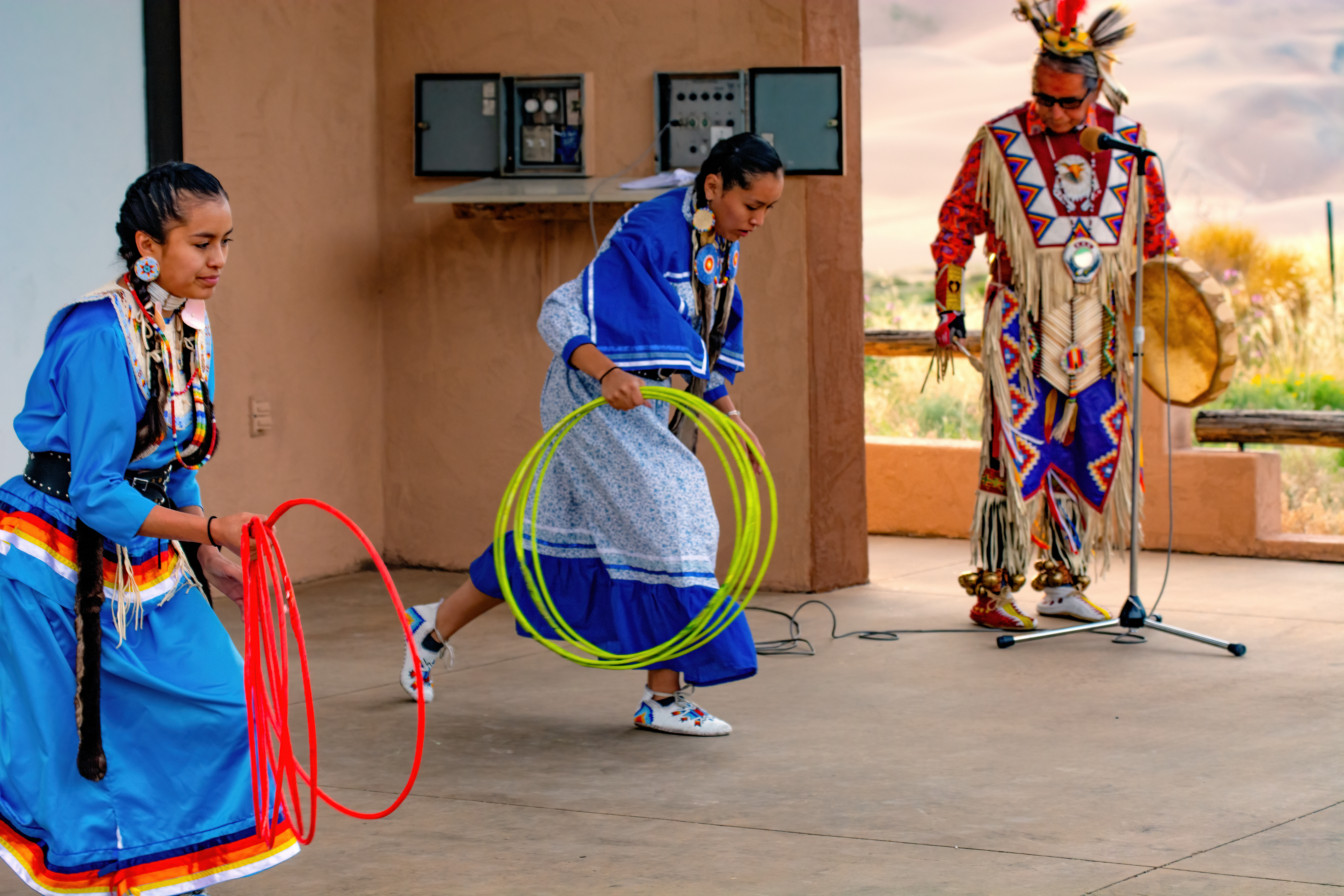
Baskets, Fiddles, and Living Culture
The Jicarilla remain renowned for the craft that gave them their name. Their baskets feature distinctive diamond, cross, and zigzag designs, sometimes depicting deer, horses, or other animals. They are equally known for their micaceous clay pottery, a tradition stretching back centuries to the clay deposits near Taos and Picuris Pueblos. The Jicarilla are among the few peoples keeping the Apache fiddle-making tradition alive. The tribe is traditionally matrilocal and organized into matrilineal clans. About half of tribal members still speak the Jicarilla language, mostly among older generations. The reservation supports industries from oil and gas to casino gaming, forestry, ranching, tourism, and solar energy, and the tribe operates its own radio station, KCIE at 90.5 FM, broadcasting from Dulce.
From the Air
The Jicarilla Apache Indian Reservation is centered near 36.55N, 107.07W in northern New Mexico. The reservation spans 1,316 square miles from the Rocky Mountain foothills to open plains. From altitude, the northern portion shows forested mountain terrain while the southern half opens into rolling plains. The tribal capital of Dulce sits near the Colorado border along US Route 64. Nearest airports include Jicarilla Apache Nation Airport (24N) and Farmington Four Corners Regional (FMN) approximately 70 nm to the west.