Jirisan
Somewhere in the mist-wrapped valleys of Baemsagol, a thousand years ago, monks were disappearing. Each year, the most pious among them was selected for a ritual on the full moon of July, sent to pray on a terrace above a roaring stream. None ever returned. It took a visiting elder named Seosandaesa to uncover the secret: an imugi, a great serpent that had failed to become a dragon, was devouring the chosen monks. The valley's name still remembers that creature's death. This is Jirisan, where Buddhist devotion and ancient myth intertwine along the ridgelines of South Korea's tallest mainland mountain.
The Spine of the Peninsula
At 1,915 meters, Jirisan stands as the highest point on mainland South Korea, surpassed only by Hallasan on the volcanic island of Jeju. But height alone does not explain its stature. The mountain marks the southern terminus of the Baekdu-daegan, the great mountain chain Koreans call the "spine" of their peninsula, stretching from the sacred peak of Baekdu on the Chinese-North Korean border all the way south to this massif. Three provinces converge on its slopes: North Jeolla, South Jeolla, and South Gyeongsang, making Jirisan a geographic and cultural crossroads. The national park that protects it is the largest in South Korea, and its highest summit, Cheonwangbong, sits in South Gyeongsang Province alongside Samsinbong, the "Three Spirits Peak" that draws hikers willing to endure an 18-kilometer round trip from the temple trailhead below.
Temples in the Clouds
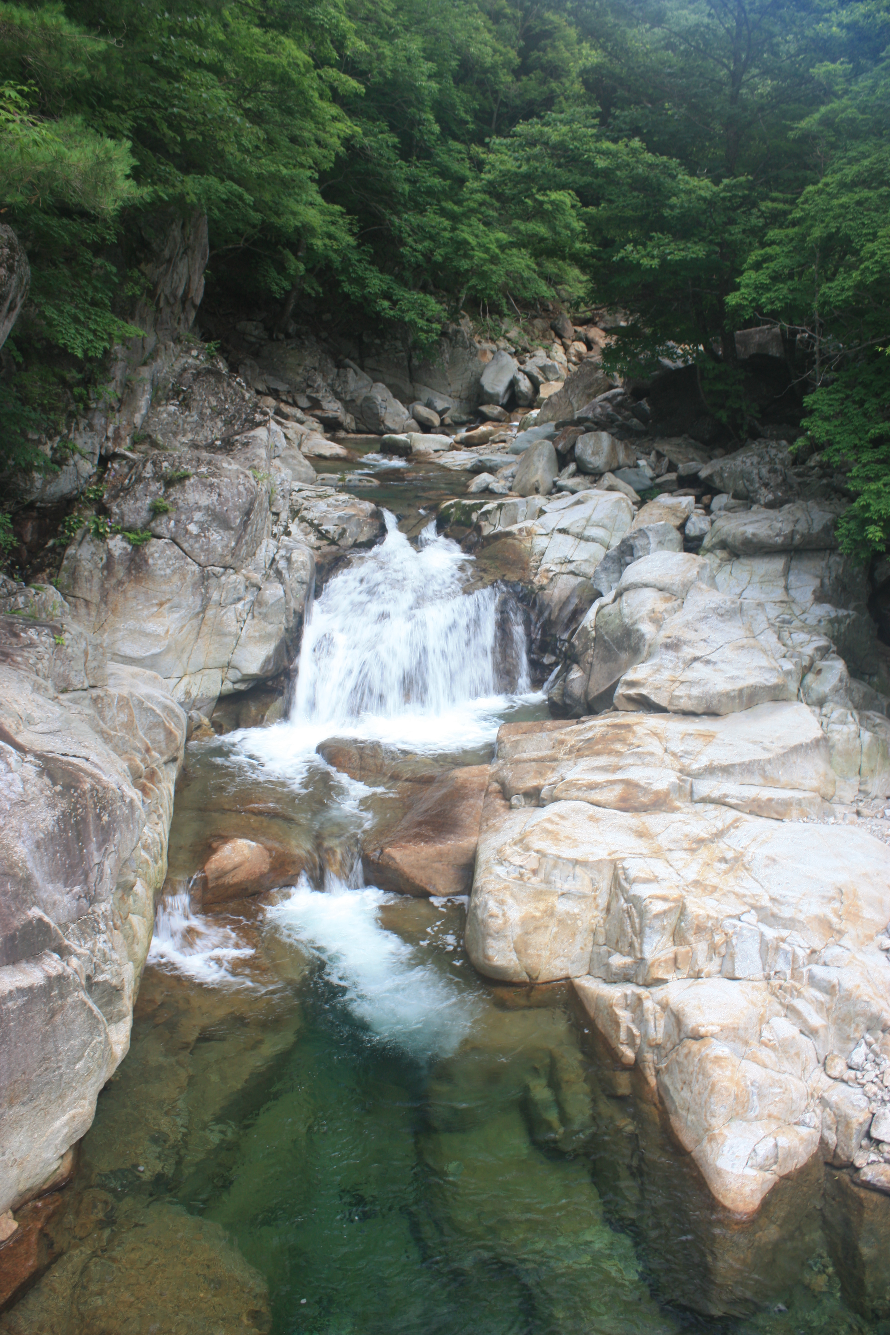
Seven major Buddhist temples occupy Jirisan's forests and ridges, but Hwaeomsa commands the most attention. Founded during the Silla dynasty, it houses several national treasures, primarily stone artworks dating from the 7th through 9th centuries. Higher up, in the alpine valley called Cheonghak-dong, or Azure Crane Village, the Samseonggung palace celebrates one of Korea's most cherished foundation myths. The mountain's trails pass through these sacred spaces casually, as though wandering between worlds. Hikers ascending from Ssanggyesa follow a path that winds 2.3 kilometers to Bul-il Falls before climbing another 6.9 kilometers to the peak, and the Buddhist temple suffix "sa" in the trailhead's name serves as a reminder that every route on Jirisan begins at an altar.
A Mountain at War
The dense forests that shelter temples also sheltered soldiers. During the Korean War, North Korean troops occupied Jirisan's slopes in 1950. After United Nations forces retook the area in 1951, hundreds of North Korean fighters refused to leave, waging a guerrilla campaign from the mountain's ravines and caves for four more years, until 1955, two full years after the armistice was signed. South Korea eventually issued an Anti-Guerrilla Warfare Service Medal to troops who fought in this forgotten theater. The conflict inspired at least two films, including Piagol, released in 1955, which followed a group of North Korean holdouts struggling to survive. The valley that gave the film its name, Piagol, is today celebrated for an entirely different spectacle: its autumn leaves rank among Jirisan's ten official scenic views.
Ten Views and 1,500 Species
More than 280,000 visitors climb Jirisan each year, drawn by a list of ten scenic views the park advertises with the pride of a poet naming chapters. Sunrise from Cheonwangbong peak comes first. Then the sea of clouds rolling over Nogodan, the autumn foliage blazing through Piagol Valley, royal azaleas bursting into bloom across alpine meadows, and the full moon seen from the Byukso-ryung ridge. Each season offers a different mountain. Below the spectacle, some 1,500 plant species grow on these slopes, the greatest botanical diversity on the Korean mainland outside of Hallasan. Many species were first documented here and carry the mountain's name in their scientific descriptions, tying Jirisan's identity to the living world as firmly as any temple or legend.
From the Air
Jirisan sits at 35.34N, 127.73E in southern South Korea, rising to 1,915 meters. It is a prominent terrain feature visible from considerable distance in clear weather. The nearest significant airports are Sacheon Airport (RKPS) approximately 60 km to the southeast and Gwangju Airport (RKJJ) roughly 100 km to the west. Pilots should be aware of mountain weather, including rapid cloud formation and updrafts along the ridgeline. Recommended viewing altitude is 8,000-10,000 feet AGL for the full scope of the massif.