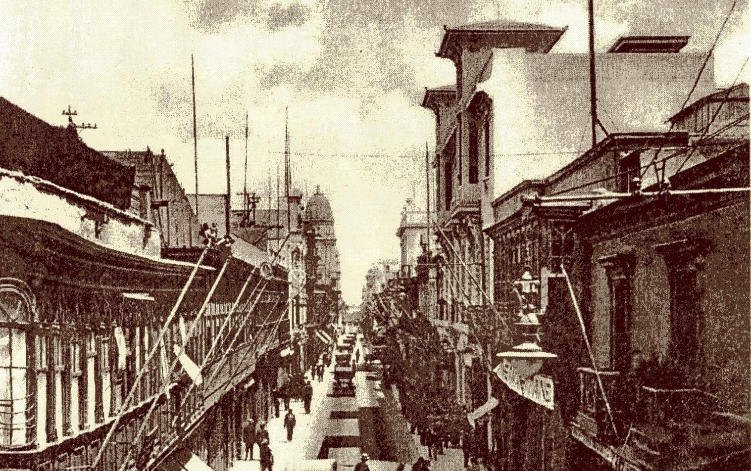
Jiron de la Union
Francisco Pizarro laid out this street the same year he founded Lima -- 1535 -- and nearly five centuries later, it remains the spine of the city's historic center. Jiron de la Union runs eleven blocks through the Damero de Pizarro, from the Puente de Piedra bridge over the Rimac River to the Paseo de la Republica. Each block still carries the ghost of its colonial-era name: the Street of Sword Makers, the Street of Merchants, the Street of the Scribes. Walk it today and you walk through layers of conquest, independence, aristocratic promenade, political upheaval, and commercial reinvention -- all compressed into a single pedestrian corridor.
Eleven Blocks, Eleven Names
Before 1862, every block had its own identity. Calle de Palacio took its name from the Government Palace nearby. Calle de Mercaderes honored the textile merchants who clustered there, alongside a pharmacy that opened in 1613 and a trade tribunal that operated until 1877. Calle de Espaderos -- the Street of Sword Makers -- was named for the shops selling edged weapons. When the city modernized its street names in 1862, this thoroughfare became the unifying axis, the street that tied Lima's old colonial grid together. The name Jiron de la Union literally reflects that purpose: the street of union, the seam running through the city's political geography. Across the Rimac River, Trujillo Street performed the same function in the Rimac District.
The Architecture of Power
The street's second block flanks the Government Palace itself, with the Casa de Aliaga -- continuously inhabited since the 1530s -- standing on the opposite side. Block three passes the City Hall and the Union Club, facing the western edge of the Plaza Mayor. Further along, the Casa Courret preserves the studio of French photographer Eugene Courret, whose images from the late nineteenth and early twentieth centuries became a visual encyclopedia of Lima. The Casa Welsch, an Art Nouveau building on the corner of Ica Street, was inaugurated in 1909 as a German retail store. During World War II, anti-German sentiment led to an attack on the building, and its Longines clock was replaced with an IBM one. The store relocated to San Isidro in 1991; as of 2025, a Starbucks occupies the ground floor beneath the original facade.
Blood and Independence
History has bled into these blocks repeatedly. The Arco del Puente, at the street's northern end, was burned down on April 10, 1879, by a Chilean baker named Cornelio Granados, five days after the War of the Pacific began. On the sixth block, the square beside the Basilica of Our Lady of Mercy was where Jose de San Martin proclaimed Peruvian independence in 1821 -- one of several locations where he made the declaration, having first done so in Huaura and at the Plaza Mayor. The ninth block's Plaza San Martin sits on the site of the former San Juan de Dios train station, where revolutionary politician Bernardo de Monteagudo was assassinated in 1825 and where Silvestre Gutierrez died in a shootout during the 1872 coup attempt. The station was razed in 1921 for Peru's independence centennial, and the grand plaza that replaced it now anchors the street's southern end.
Decline and Revival
For centuries, the street's aristocratic families cultivated the art of jironear -- strolling the avenue to see and be seen. That custom survived independence, revolution, and economic booms, but it did not survive the late twentieth century. During the 1980s, Lima's historic center fell into steep decline. The economic recession and rising crime that accompanied Peru's internal conflict drove away the wealthy. Jiron de la Union filled with abandoned storefronts and street vendors. It had been pedestrianized in stages -- vehicles were first banned in 1976, the ban briefly annulled, then restored permanently when the newly paved street was inaugurated on November 20, 1982. But pedestrianization alone could not hold back the larger forces reshaping the city. Recovery came in the 1990s under Mayor Alberto Andrade Carmona, whose reorganization of the historic center brought commerce back to the street.
Walking the Union Today
Today Jiron de la Union is again a commercial center, though its aristocratic character is gone for good. The concrete benches installed during the 1970s pedestrianization have been replaced with new ones inscribed with the coat of arms of each of Peru's departments. The Gran Hotel Bolivar anchors the ninth block at San Martin Square, and nearby stands a replica of Germain Pilon's monument containing the heart of Henry II of France, known locally as the Lamp of the Three Graces. A Metropolitano bus station operates between the sixth and seventh blocks, and since 2025, the AeroDirecto bus runs from in front of the Gran Hotel Bolivar directly to Jorge Chavez International Airport. Five centuries after Pizarro drew it on a map, the street remains what it has always been: the place where Lima's many eras meet.
From the Air
Located at 12.05S, 77.03W in the historic center of Lima, Peru. The street runs north-south through the Damero de Pizarro, the original colonial grid laid out by Pizarro in 1535. Visible from low altitude as part of the dense urban fabric between the Rimac River and the Plaza San Martin. Nearest major airport: Jorge Chavez International (SPJC), approximately 10 km northwest. The Puente de Piedra bridge at the street's northern end is a useful visual landmark.