Johnstone Strait
In 1792, a survey party led by James Johnstone, master of the armed tender HMS Chatham, established something that seems obvious in hindsight but was genuinely uncertain at the time: Vancouver Island was, in fact, an island. The 110-kilometer channel he surveyed along its northeast coast was later named in his honor by Captain George Vancouver. Two centuries later, Johnstone Strait is still defining relationships -- between the island and the mainland, between commercial shipping and marine ecology, and between approximately 150 orcas and the scientists who have been studying them for more than fifty years.
The Passage North
Johnstone Strait runs between 2.5 and 5 kilometers wide, threading between Vancouver Island's northeast coast and a chain of islands: Hanson Island, West Cracroft Island, Hardwicke Island, and the Thurlow Islands. Where the strait meets Discovery Passage to the southeast, it connects to the Strait of Georgia and the ports of Vancouver, Seattle, and Tacoma. To the northwest, it opens into Queen Charlotte Strait and the routes to Prince Rupert, Haida Gwaii, Alaska, and the North Pacific. This makes Johnstone Strait one of the most important navigation channels on the west coast of North America -- the preferred route for vessels heading north from the Strait of Georgia or south from Alaska. Despite this heavy traffic, there are no cities or towns along its entire 110-kilometer length. Telegraph Cove and Robson Bight mark the north end; the village of Sayward on Kelsey Bay sits near the midpoint. The strait is a highway with no exits.
The Orcas of Robson Bight
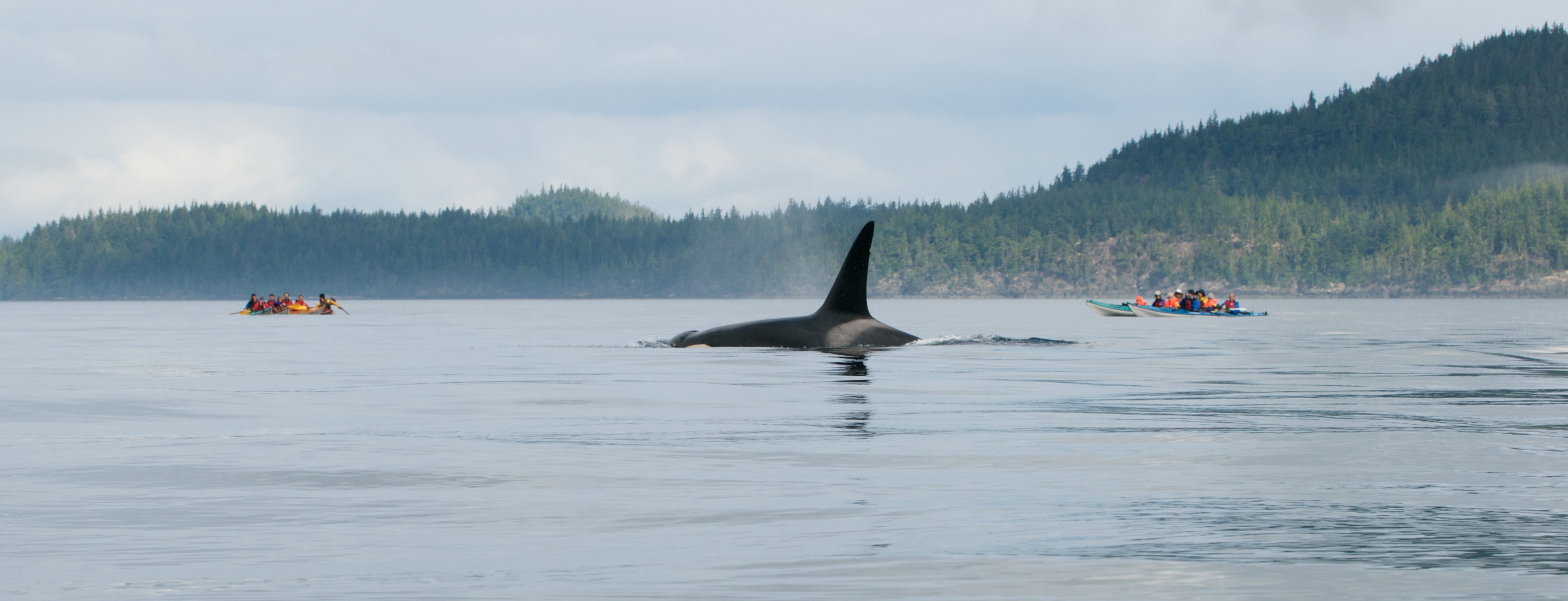
Every summer, approximately 150 orcas gather in Johnstone Strait, drawn by the rich salmon runs that funnel through the channel. Kayakers and tourist boats crowd the waters for a chance to see black dorsal fins cutting the surface, and on calm days the sound of an orca's exhalation carries across the water like a gunshot. The strait includes the Robson Bight (Michael Bigg) Ecological Reserve, named for the marine biologist who pioneered the photo-identification of individual orcas in the early 1970s. Bigg's method -- cataloging each whale by the unique shape and scars of its dorsal fin -- revolutionized cetacean research worldwide. His colleague Paul Spong established OrcaLab, a research station dedicated to studying the orcas in their natural habitat without interfering with their lives. The work that began here in 1970 continues today, making this one of the longest-running orca research programs in the world.
Where the Wild Coast Meets Commerce
The tension in Johnstone Strait is quiet but persistent. Container ships and cruise liners share the water with orca pods and salmon runs. The channel is narrow enough that whale-watching boats and cargo vessels sometimes navigate the same stretch simultaneously. There are no bridges, no tunnels, no settlements to mediate between the human and natural uses of this waterway. The forested islands that line the strait remain largely undeveloped, their dark green slopes dropping steeply into cold, deep water. Tidal currents run strong through the narrower sections, and weather can change rapidly as Pacific systems push through the gap between the island and the mainland. For mariners, Johnstone Strait demands attention. For the orcas, it remains what it has been for millennia: a corridor of abundance where the salmon come through on schedule every summer.
From the Air
Johnstone Strait runs from approximately 50.47N, 126.22W at its northwest end to approximately 50.25N, 125.50W at its southeast junction with Discovery Passage. The channel is 2.5-5 km wide and 110 km long, clearly visible from cruising altitude as a dark waterway between forested Vancouver Island to the southwest and the chain of islands to the northeast. Telegraph Cove and Robson Bight are at the northwest end. Shipping traffic is usually visible in the strait. Nearest airports: Campbell River (CYBL) near the southeast end, Port Hardy (CYZT) to the northwest. Watch for float plane traffic -- this is an active bush flying area.