Juan de Fuca Marine Trail
Mystic Beach, Sombrio Beach, Bear Beach, Chin Beach -- the names along the Juan de Fuca Marine Trail read like chapters in a West Coast daydream. The reality is rougher than the names suggest. This 47-kilometer wilderness trail along the southwestern coast of Vancouver Island is a gauntlet of mud, roots, suspension bridges, and surge channels that rewards endurance with some of the most dramatic coastal scenery in British Columbia. Stretching from China Beach, 35 kilometers west of Sooke, to Botanical Beach just outside Port Renfrew, the trail runs through Juan de Fuca Provincial Park along a shore where old-growth forest meets the open Pacific. It is often described as the younger, wilder sibling of the more famous West Coast Trail to the north.
Cut Through the Clearcut
The trail's origins are more pragmatic than poetic. Parks Canada funded its construction, originally intending it as a segment of the Trans Canada Trail. The actual labor was contracted to Island Green Forestry, and the path was cut and built through the coastal forest in 1995 and 1996. In some sections, particularly between Minute Creek and Sombrio Beach, that forest had already been clearcut in 1994, and the trail passed through the raw aftermath of industrial logging. Control of the trail eventually passed from Parks Canada to BC Parks. The B.C. government later claimed the trail was built to honor the 1994 Commonwealth Games, a characterization that remains debatable. What is not debatable is that the trail stitched together a coastline that had been fragmented by logging, giving the public access to beaches and headlands that might otherwise have disappeared behind private fences.
Beaches and Trailheads
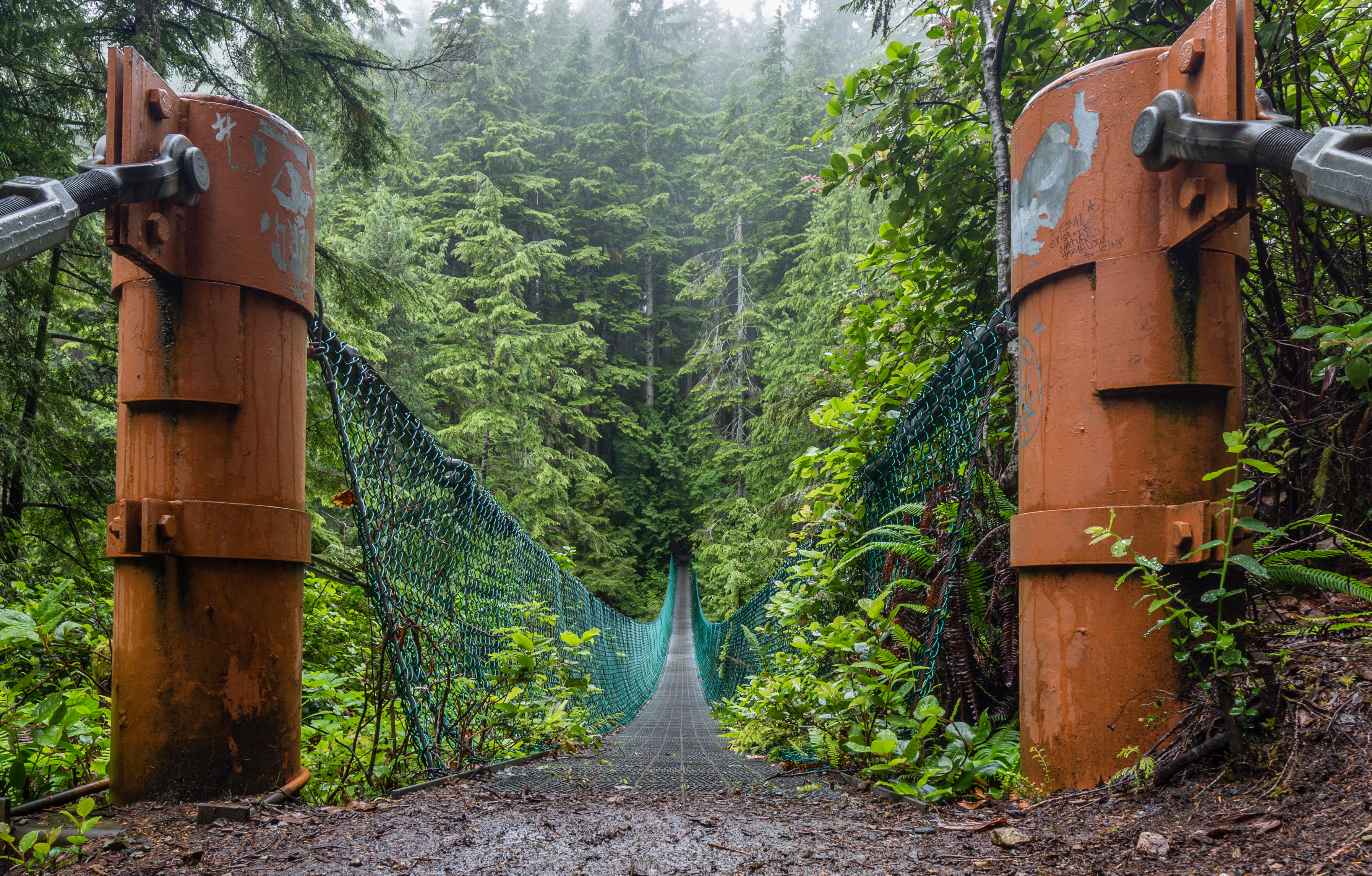
Four main trailheads -- China Beach, Sombrio Beach, Parkinson Creek, and Botanical Beach -- are car-accessible with parking lots, letting hikers choose their section rather than committing to the full multi-day traverse. Between these anchor points lie intermediate access trails to Mystic Beach, Bear Beach, Magdalena Point, and Chin Beach, each reached by parking along Highway 14 and descending unmarked side paths through the forest. The flexibility matters: the trail's condition varies dramatically with the season and the tides. Storm-tossed logs block some beach crossings at high water. Mud can swallow boots to the ankle in winter. Campsites along the route are small and fill quickly, making an early start essential for groups. For those who commit to the full traverse, the reward is a continuous immersion in the collision zone between temperate rainforest and open ocean.
The Resort That Never Was
In January 2007, the provincial government removed 500 hectares of land from tree farm licenses on the southwestern coast of Vancouver Island, allowing Western Forest Products to sell the property for residential development. The provincial auditor general subsequently condemned the decision as having been made "without sufficient regard for the public interest." A Vancouver-based businessman purchased 236 hectares of the freed land and proposed a 257-cabin resort bordering twelve kilometers of the Juan de Fuca Trail. The project drew broad opposition from citizens, community groups, environmentalists, and First Nations. In September 2011, the Capital Regional District voted to deny the developer's rezoning application, effectively killing the proposal. The fight underscored how vulnerable the trail remained despite its provincial park status -- the park boundaries protected the land within them, but the surrounding landscape was still subject to the pressures of development and resource extraction.
Where the Forest Meets the Surge
What makes the Juan de Fuca Marine Trail distinctive is the raw immediacy of its setting. This is not a groomed coastal path with interpretive signs and guardrails. The trail drops from dense stands of Sitka spruce and western red cedar onto wave-sculpted sandstone shelves, crosses surge channels on slippery rock, and climbs back into the forest through tangles of salal and sword fern. At low tide, Botanical Beach reveals a world of tidepools -- red and purple starfish, green sea anemones, white gooseneck barnacles, blue mussels, and sea cucumbers in a kaleidoscope of intertidal life. Cougars, black bears, and wolves move through the park's forested corridor, and seals and sea lions haul out on the offshore rocks. The trail exists because people fought to keep this coastline public. Walking it, you understand why they bothered.
From the Air
Located at 48.47N, 124.24W along the southwestern coast of Vancouver Island. The 47-kilometer trail is visible as a strip of coastline running between China Beach (near Sooke) and Botanical Beach (near Port Renfrew). Nearest major airport: Victoria International (CYYJ), about 90 km east. Look for the narrow band of forest between Highway 14 and the Pacific shore, with small beaches punctuating rocky headlands.