Juchitan de Zaragoza
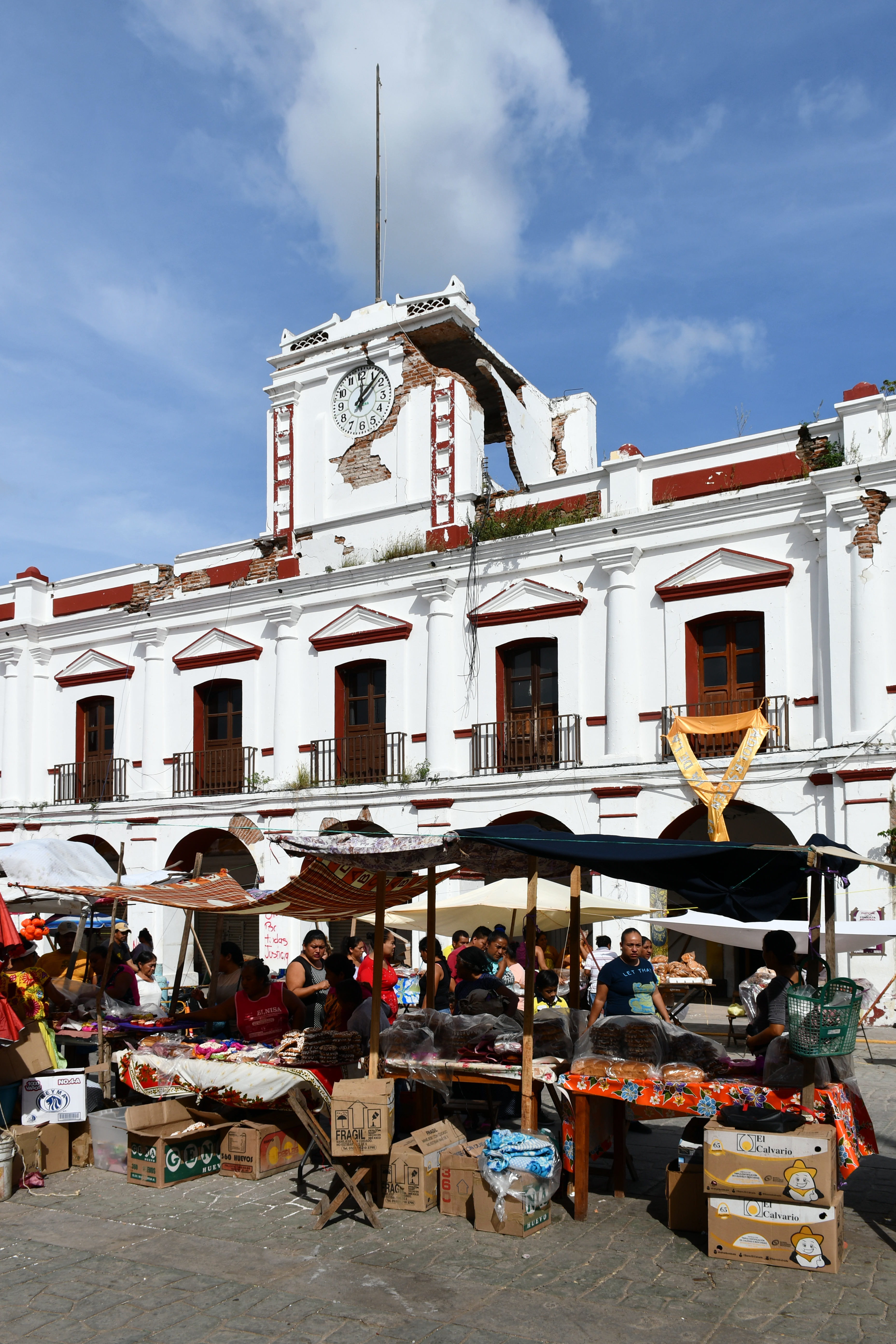
On the night of September 7, 2017, an earthquake measuring 8.2 struck off the coast of Chiapas -- the strongest to hit Mexico in a century. In Juchitan de Zaragoza, entire streets collapsed. The nineteenth-century municipal palace, with its famous thirty-one arches, crumbled. But from the rubble, a resident retrieved the Mexican national flag and planted it atop the ruins. The photograph went viral and became a symbol of resilience across the disaster-stricken country. It was, in many ways, a fitting image for Juchitan. This is a city that has been fighting -- and rebuilding -- for nearly two hundred years.
Rebels by Tradition
Juchitan's history reads like a catalog of revolts. In 1834, a local leader known as Che Gorio Melendre led an uprising against the government of Oaxaca, demanding control of coastal salt mines and local autonomy. The revolt paused during the Mexican-American War, when Melendre's irregular troops joined the national resistance. It did not end well: in 1850, the governor of Oaxaca -- Benito Juarez, the future president who would become a hero of Mexican democracy -- sent troops to burn Juchitan and assassinate Melendre. On September 5, 1866, during the French intervention, indigenous fighters from Juchitan and surrounding towns defeated the French army stationed in Tehuantepec. Many of the soldiers who later served under Porfirio Diaz, the future president turned dictator, were Juchitan natives. In 1910, Jose Fructuoso Gomez, known as Che Gomez, led a local revolt in support of the Mexican Revolution, allied with Zapata and Villa. By the 1970s, the pattern shifted: a coalition of students, workers, and farmers organized to take power through elections rather than arms. In 2006, the state congress formally renamed the city Heroica Ciudad de Juchitan de Zaragoza for its defense against the French invasion.
The Narrowest Crossing
Juchitan's rebellious streak is inseparable from its geography. The city sits on the Isthmus of Tehuantepec, the thinnest strip of land between the Pacific Ocean and the Gulf of Mexico. This chokepoint has been coveted by foreign powers since the McLane-Ocampo Treaty of 1859, under which President Benito Juarez granted the United States transit rights across the isthmus in exchange for a loan. In the 1970s, an attempt to revive the treaty as the Alfa-Omega project was abandoned. In 2000, it resurfaced as the Plan Puebla Panama. The wind that funnels through the isthmus has also drawn modern industry: wind farms developed by Gamesa and Iberdrola around Juchitan produce at least eighty-eight megawatts of power, making the area a center of renewable energy in Mexico. But the projects have been controversial, with critics questioning the ecological and cultural consequences for a region where land ownership is central to Zapotec identity.
Muxes, Candles, and the Third Gender
About seventy percent of Juchitan's population of 88,280 is Isthmus Zapotec, and the culture here runs deeper than politics. The Zapotec language fills the market west of the municipal palace, where local goods are traded beneath what may be the widest civic building in Mexico, its facade stretching thirty-one arches across the front portal. The seventeenth-century Parroquia de San Vicente Ferrer still anchors religious life, and each May the Fiesta de las Velas -- the Festival of the Candles -- fills the streets with processions honoring the patron saint. Zapotec spiritual practice blends Catholic and indigenous traditions: anthropologist Anya Peterson Royce has documented how the community uses flowers, processions, and prayer in rituals that guide spirits through the journey of dying, alongside Day of the Dead and Holy Week observances. Perhaps most distinctively, Juchitan is known throughout Mexico for the muxes -- people assigned male at birth who adopt feminine roles and identities within traditional Zapotec culture. This is not a recent development or a Western import; muxes have been part of Zapotec society for centuries, and Juchitan's acceptance of them has made the city a significant oasis of gender tolerance in a country where such openness remains rare.
A Flag in the Rubble
The 2017 earthquake devastated Juchitan more than perhaps any other city. The municipal palace, dating to 1860, lost entire sections of its structure. Streets in the center were reduced to debris. But Juchitan had rebuilt before -- after revolts, after wars, after having its city burned by its own state government. The image of the flag planted in the wreckage resonated because it distilled a truth about the place: Juchitan defines itself through what it endures. Between June and October 2020, the city reported 241 COVID-19 deaths, straining its cemeteries to capacity. In February 2021, an agreement between the National Institute of Indigenous Peoples and the federal electricity commission brought solar power to the Santa Maria del Mar community, delivering electricity for the first time in ten years. The cycles of disaster and recovery continue, as they have since Che Gorio Melendre first demanded that this city be allowed to determine its own fate.
From the Air
Located at 16.43N, 95.02W on the Isthmus of Tehuantepec, 26 km northeast of Tehuantepec. The city is visible as a large settlement on the low plains of the isthmus, with wind turbines of the La Venta wind farm visible from altitude to the south. Nearest airport is Ixtepec Airport (MMIT). The isthmus geography is dramatic from the air -- the narrowest point of Mexico between the Pacific and the Gulf of Mexico, with the wind gap clearly visible.