Judge C. R. Magney State Park
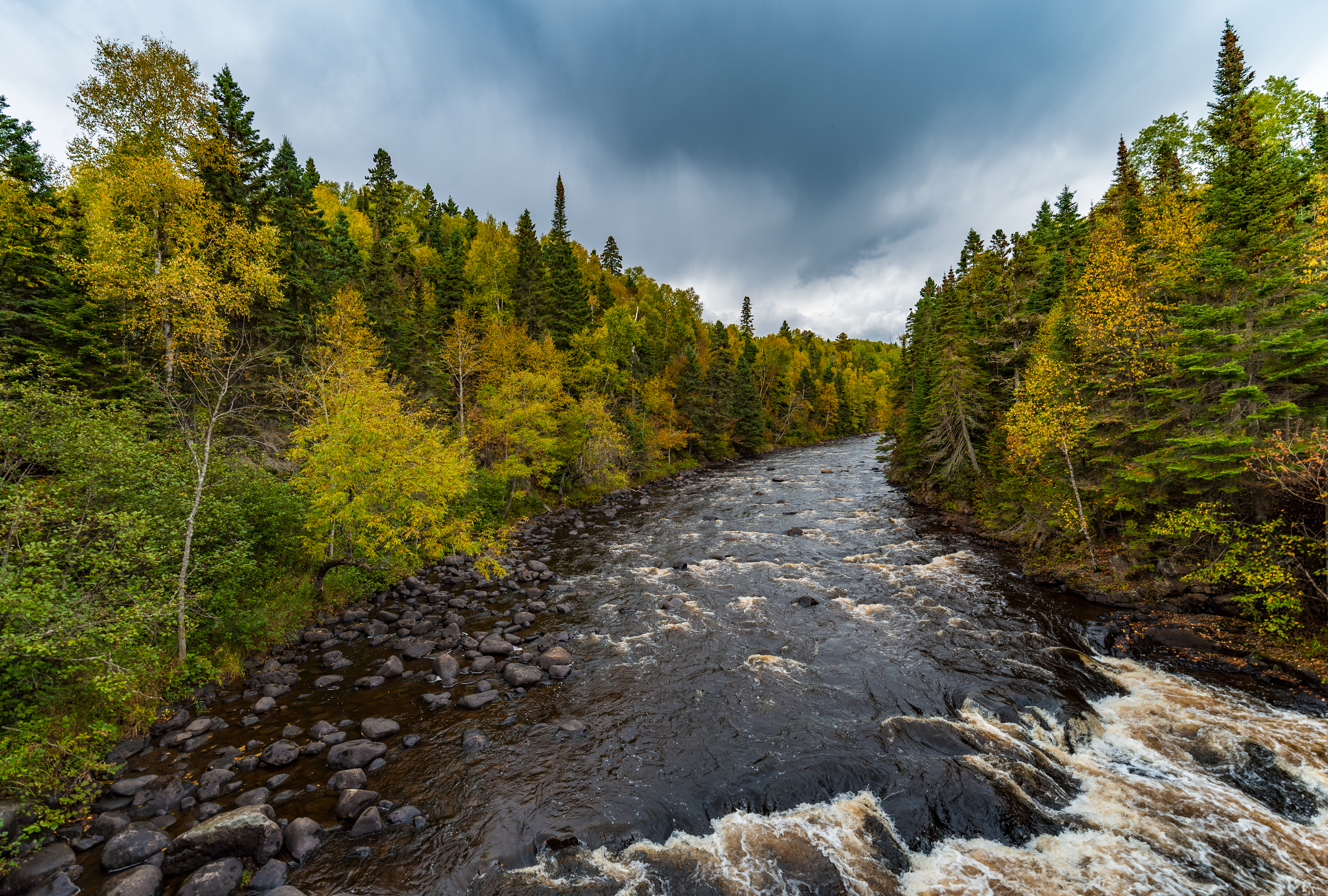
People have thrown ping pong balls into the Devil's Kettle. They have dropped sticks, dye, and GPS trackers. According to local legend, someone once pushed an entire car into the hole, though given that no road comes within miles of the spot, skeptics have reasonably dismissed that claim. For decades, every object that entered the Devil's Kettle vanished. Half the Brule River splits around a rock outcrop, and the eastern half tumbles over a conventional waterfall. The western half pours into a massive pothole in the volcanic rock and disappears. Where does it go? That question made Judge C. R. Magney State Park one of the most talked-about geological curiosities in the upper Midwest -- and the answer, when it finally came in 2017, was both satisfying and slightly anticlimactic.
The River That Eats Itself
The Brule River drops steeply through its final stretch inside the park, producing several waterfalls and cascades before reaching Lake Superior. At Devil's Kettle Falls, the river encounters a rhyolite rock formation that splits the flow. The eastern channel drops in a standard waterfall. The western channel plunges into a deep pothole -- a giant's kettle carved by millennia of water and grinding rock. For years, no one could satisfactorily explain where the swallowed water went. Theories ranged from underground rivers to lava tubes to a subterranean connection to Lake Superior. Hydrologists from the Minnesota Department of Natural Resources finally resolved the mystery in 2017 by measuring water flow above and below the falls. The volume below accounted for the entire river, meaning the pothole water reemerges through cracks in the rock and rejoins the main channel downstream. The powerful currents inside the kettle's plunge pool pulverize anything dropped in, which is why no objects ever resurfaced.
Eleven Parks for the North Shore
The park bears the name of Clarence R. Magney, a former mayor of Duluth and justice of the Minnesota Supreme Court who championed the creation of state parks along Lake Superior's North Shore. His advocacy led to the establishment of eleven parks and scenic waysides along this stretch of Minnesota Highway 61, preserving some of the most dramatic shoreline in the Great Lakes region. This particular park, located near the Canadian border, was established in 1957. The Brule River's last miles flow entirely through park land, and the surrounding Grand Portage State Forest extends the wilderness in every direction. Magney understood that the North Shore's combination of Superior's shoreline, boreal forest, and volcanic geology was irreplaceable, and he spent his public career ensuring it would remain accessible.
A Jazz-Age Lodge and the Crash
Just outside the park stands the Naniboujou Club Lodge, a remnant of ambitions that collapsed with the stock market. The exclusive club attracted nearly 600 members and completed its lodge in July 1929. The plans called for a sprawling complex along the Lake Superior shoreline, with additional buildings and inland property. Three months later, the Wall Street Crash of October 1929 ended those dreams. The rest of the complex was never built. The lodge passed through successive owners and periods of closure, surviving as a colorful artifact of the moment when roaring twenties optimism collided with economic catastrophe. During the Great Depression, the Civilian Conservation Corps established a transient camp nearby, where workers built the trail and stairs that still lead visitors to the Devil's Kettle today.
Wolves, Moose, and the Darkest Skies
The park's significant elevation change supports a rich variety of wildlife. Timber wolves and moose roam the remote northern sections, alongside black bears, red foxes, and martens. Broad-winged hawks and barred owls patrol the canopy, while migrating raptors pass through seasonally. White-tailed deer, not originally native to northern Minnesota, expanded into the region during the logging era to feed on regrowth. By the 1940s and 1950s, densities reached 300 deer per square mile. As the forest matured, deer numbers dropped, but they continue to alter forest composition through selective overgrazing of young trees. Beyond its wildlife, the park holds a distinction that draws visitors after dark: it is the only state park in Minnesota with minimal light pollution, earning a Bortle 1 rating. On clear nights, the Milky Way arches overhead with a clarity that makes the park a destination for amateur astronomers and night photographers.
Into the Kettle of Story
The Devil's Kettle has swallowed more than water and ping pong balls -- it has consumed the imagination of novelists, screenwriters, and storytellers. Chuck Logan set scenes of his crime novel The Big Law at the falls in 1998. The 2009 horror film Jennifer's Body invented an entire fictional town named after the Devil's Kettle. Minnesota author Peter Geye reimagined the formation as 'The Devil's Maw' in his acclaimed historical novels The Lighthouse Road and Wintering. Mystery writer Monica Ferris brought the Naniboujou Lodge and the falls together in her 2009 anthology. Something about the place -- a river that vanishes, a hole with no apparent bottom, a geological puzzle that resisted explanation for decades -- calls out to the narrative instinct. Even now that science has provided an answer, the Devil's Kettle retains its hold on the imagination. Some mysteries are more powerful than their solutions.
From the Air
Located at 47.851°N, 90.058°W on Minnesota's North Shore of Lake Superior, within Cook County. The park sits along scenic Minnesota Highway 61, close to the Canadian border. The Brule River cuts through dense boreal forest before reaching the lake. Grand Marais/Cook County Airport (KCKC) is approximately 15 nm to the southwest. Thunder Bay International (CYQT) lies roughly 70 nm to the northeast across the border. The North Shore's rugged coastline and river valleys are dramatic from the air at 2,000-4,000 feet AGL. Look for the Brule River gorge cutting inland from Superior's shoreline. The Naniboujou Lodge, with its distinctive colorful exterior, may be visible near the river mouth along Highway 61.