Judge John Sutter Regional Shoreline
Stand at the end of the observation pier at Judge John Sutter Regional Shoreline and you are standing on history twice over - first on the concrete foundations of the old eastern span of the Bay Bridge, and beneath that, on ground where Key System trains once carried commuters to ferry slips reaching nearly to Yerba Buena Island. The park did not open until October 21, 2020, making it one of the youngest in the East Bay Regional Park District. But the land beneath it has been in continuous, restless use since 1903, cycling through identities as a railway terminus, a military base, and finally, after decades of advocacy by one stubborn civic leader, a place where anyone can cast a fishing line into the bay.
Tracks Across the Water
The story begins with the Key System mole - a long causeway and pier that stretched from the Oakland shoreline nearly to Yerba Buena Island starting in 1903. Commuters rode Key System trains to the mole's end, then transferred to ferryboats for the crossing to San Francisco. It was the daily rhythm of East Bay life for four decades. When the Bay Bridge opened in the 1930s, the site transformed again. Engineers adapted it for bridge railway service, and beginning in January 1939, trains from the Key System, Southern Pacific, and Sacramento Northern ran across the bridge's lower deck. A substation on-site powered the Key System's entire electric fleet. The 1930s-era Interurban Electric Railway Bridge Yard Shop building served as a maintenance center for the trains. For a brief window, this stretch of Oakland shoreline was a nexus of electric rail transportation.
Sixty Years in Uniform
In 1941, the Army arrived. The Department of the Army established the Oakland Army Base on the site as a transportation port and distribution terminal, and for the next six decades, this waterfront served a very different purpose. Soldiers and supplies flowed through the base on their way to World War II, the Korean War, the Vietnam War, Operation Desert Shield, and Operation Desert Storm. Generations of service members saw this particular stretch of Oakland shoreline as either the last piece of American soil beneath their feet or the first upon return. The base closed in 1999, leaving behind a contaminated industrial site and the question of what should come next.
The Judge's Long Campaign
The answer had been proposed thirty-two years earlier. In 1967, a man named John Sutter - an East Bay civic leader who served as a superior court judge, Oakland's vice mayor, and a director of the East Bay Regional Park District - wrote a letter to the Association of Bay Area Governments suggesting that the Oakland Army Base site become a waterfront park. Sutter was the president and a founding member of Citizens for Regional Recreation and Parks, and he spent his career fighting for public access to the bay shoreline. The park that eventually bore his name took decades of cooperation between nine agencies, including the City of Oakland, the Association of Bay Area Governments, the East Bay Regional Park District, and the California Department of Transportation. It was the kind of civic project that outlasts the patience of most advocates. Sutter's did not run out.
Old Bridge, New Purpose
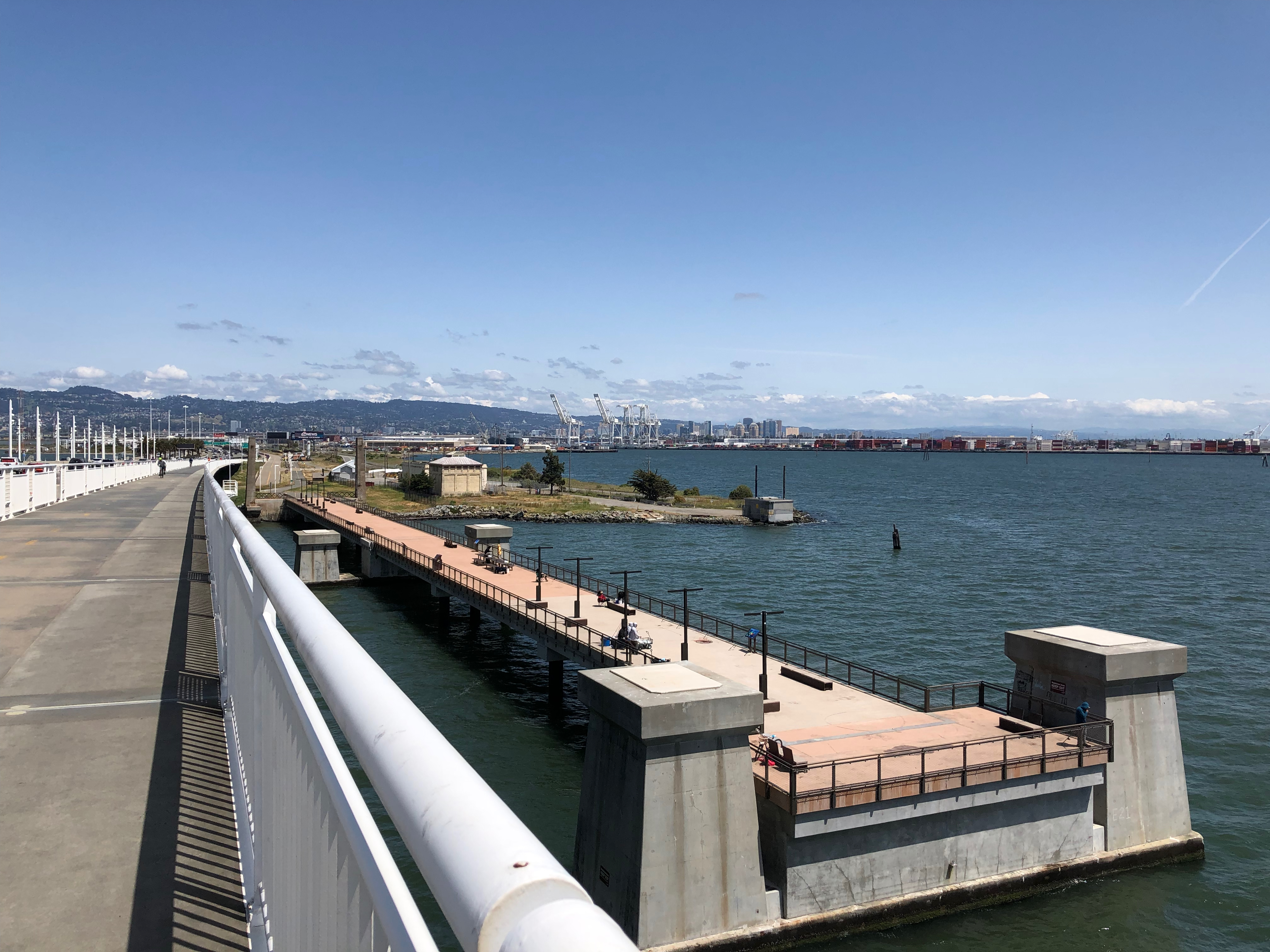
The park's most distinctive feature is its 600-foot observation pier, built on the existing foundations of the old eastern span of the Bay Bridge. Where massive steel trusses once carried automobiles, visitors now walk out over the water with unobstructed views of the bay, the bridge's newer eastern span, and the San Francisco skyline beyond. The pier provides public fishing access - a simple amenity that matters in a region where waterfront contact has historically been blocked by industry, military installations, and transportation infrastructure. The park also serves as an improved access point for the Alexander Zuckermann Bay Bridge Trail, a cyclist and pedestrian path that opened in 2016 as part of the San Francisco Bay Trail, extending across the bridge to Yerba Buena and Treasure Islands.
The Shoreline Reclaimed
What makes this park remarkable is not its size or its amenities but its layered identity. Every square foot of it has been something else - a railway terminus, an electric train yard, a military port processing soldiers for five wars. The transformation from army base to public parkland took twenty-one years after the base's closure and more than fifty years after a judge first imagined it. In a region where waterfront access is precious and contested, Judge John Sutter Regional Shoreline represents a rare outcome: land that served the military and the railroads finally serving everyone. The bay stretches wide from the end of the pier, the bridge soars overhead, and the fishing lines drop into water that has carried ferryboats, warships, and commuter trains in its time.
From the Air
Judge John Sutter Regional Shoreline sits at 37.8219N, 122.32W on the Oakland waterfront at the eastern foot of the San Francisco-Oakland Bay Bridge. From the air, the park's 600-foot observation pier extends visibly into the bay just south of where the bridge touches down. The Bay Bridge toll plaza is immediately adjacent, making the site easy to locate. Nearest airports: Oakland International (KOAK) approximately 7 nm south, and San Francisco International (KSFO) roughly 14 nm south-southwest across the bay. Look for the distinctive geometry of the bridge's eastern span transition from suspension to self-anchored suspension design nearby.