Junipero Serra County Park
Stanford University archaeologists keep coming back to dig. The shell mounds at Junipero Serra County Park, nestled in the hills above San Bruno and Millbrae, contain human remains and artifacts that testify to centuries of Native American habitation long before any Spanish missionary set foot on the peninsula. The park is named for Junipero Serra, the Franciscan priest who established the chain of California missions, but its oldest stories belong to the people who were here first.
Layers Beneath the Grass
The park's archaeological significance is not immediately obvious to weekend picnickers. Shell mounds -- accumulations of discarded shells, bone, and soil built up over centuries of occupation -- mark the presence of indigenous communities who harvested the coast's marine resources. Stanford University professor Patrick Hunt conducts regular excavations at the site, each season revealing more about the lifeways of the people who inhabited these hills. The shell mounds are fragile records, easily disturbed by foot traffic or construction, and their preservation within a public park represents an unusual intersection of recreation and research.
From Rancho to County Park
After the original indigenous inhabitants, the land passed through the familiar California sequence of Spanish mission, Mexican rancho, and American subdivision. Following the death of the rancho-era landholder, the property was broken into smaller parcels and a wagon trail was cut from San Bruno station to the San Andreas Valley, later paved into Crystal Springs Road. By the mid-twentieth century, San Mateo County recognized the hills' recreational value. Parks Director Ralph Shaw led the effort to establish the park, initially called North County Park, which was dedicated on May 22, 1960. A Master Plan published in 1981 formalized the park's dual role as a community recreation space and a site of historical importance.
A Green Crease in the Suburban Sprawl
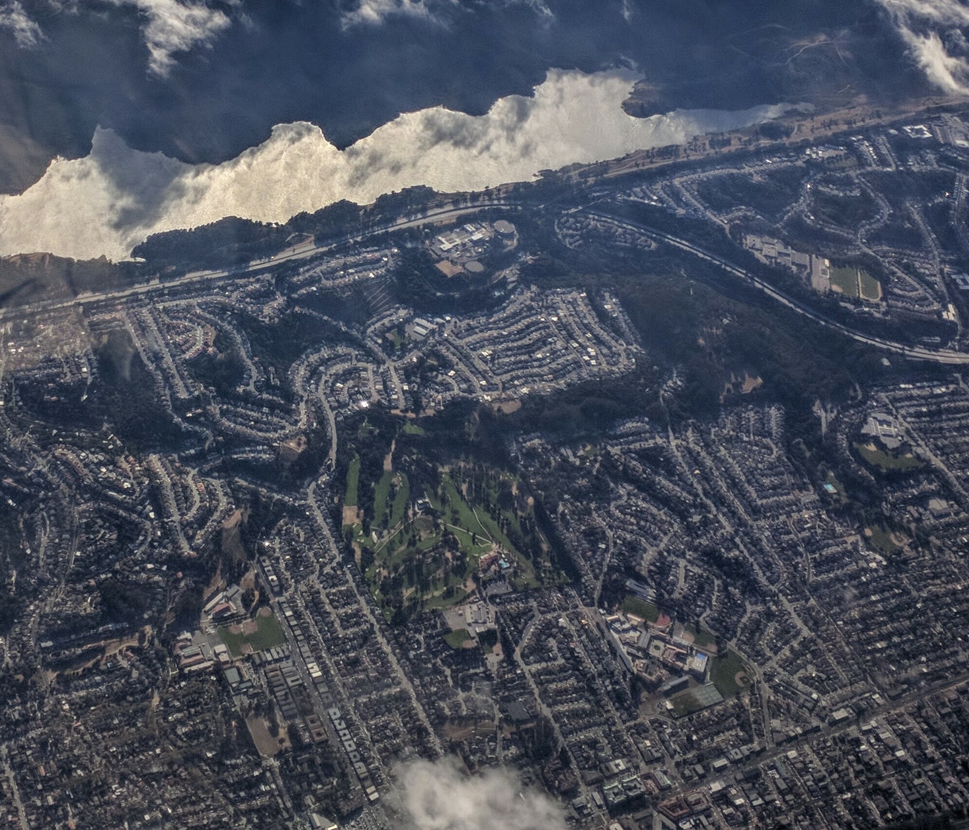
Junipero Serra County Park occupies a hilly tract between Interstate 280 and El Camino Real, east of the Crystal Springs watershed and west of the bayside suburbs. El Zanjon Creek flows along the park's north and west sides before joining San Bruno Creek. The terrain is steep enough to feel wild but accessible enough for families; paved roads lead to picnic areas and a youth camp, while City Park Trail connects eastward to San Bruno City Park and a southern entrance opens at the end of Helen Drive. From certain vantage points in the park, you can see both the bay and the wooded ridgeline of the Santa Cruz Mountains. The view is a reminder that the peninsula is narrow -- that ocean and bay are never far apart, and that this green space survives because someone in 1960 thought the hills were worth more than what could be built on them.
From the Air
Located at 37.61°N, 122.43°W in the hills between San Bruno and Millbrae. The park appears as a green patch between I-280 to the west and the suburban grid to the east. San Francisco International (KSFO) is approximately 3 nm east-southeast. Crystal Springs Reservoir is visible to the west-southwest. Best viewed at 2,000-3,000 ft AGL.