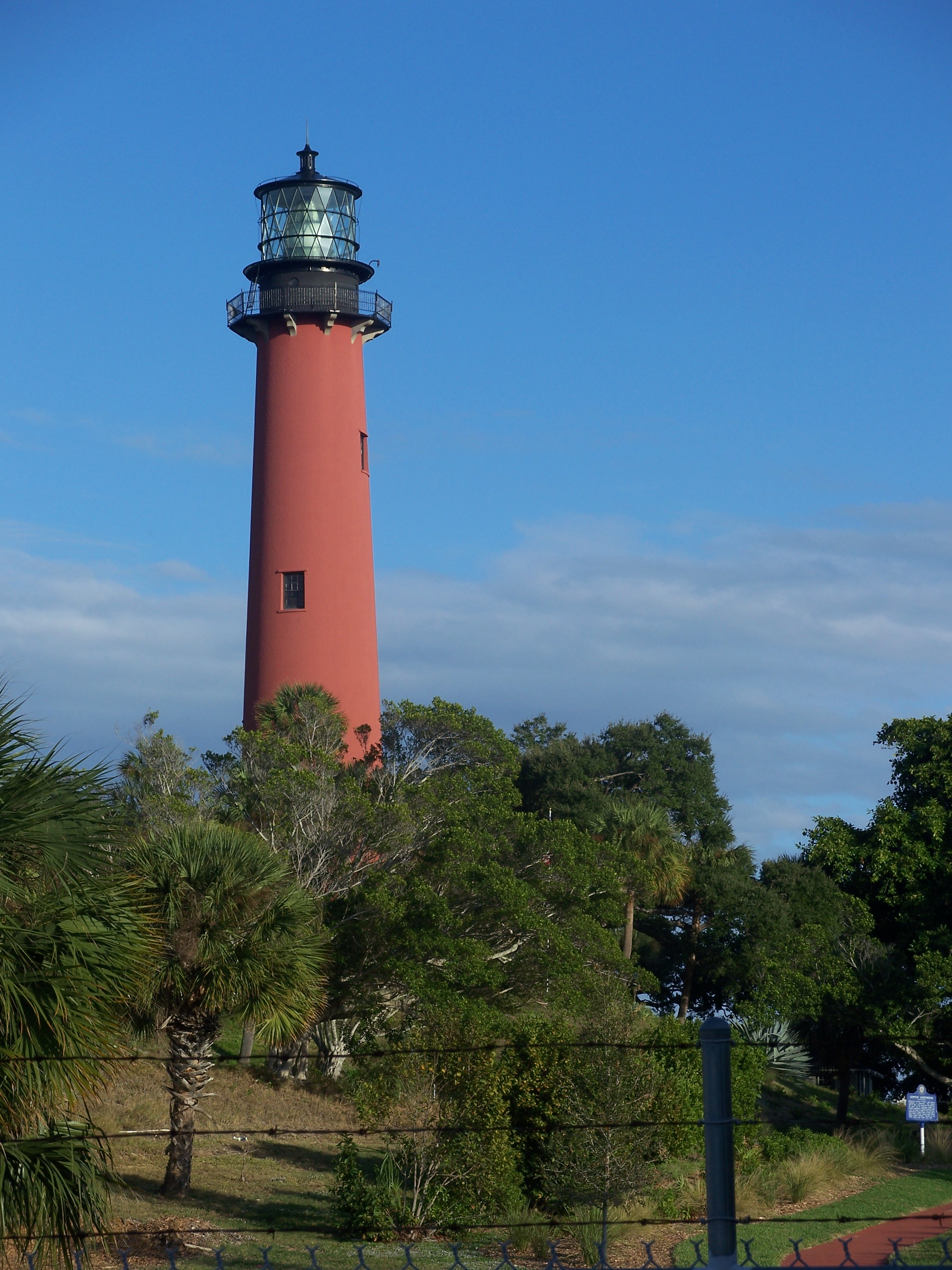
Jupiter Inlet Light
The man who designed the Jupiter Inlet Lighthouse would become far more famous for a different achievement thirteen years later -- defeating Robert E. Lee at the Battle of Gettysburg. In the 1850s, Lieutenant George Gordon Meade was simply a military engineer assigned to build lighthouses along the Florida coast, and the tower he sketched for the Jupiter Inlet would prove as sturdy as his generalship. Completed in 1860 after years of delays caused by a silted-shut inlet and the Third Seminole War, the 105-foot red brick tower still stands on a natural sand dune at the junction of the Indian River and Jupiter Inlet, its light visible 24 nautical miles out to sea. What Meade could not have predicted was that his lighthouse would become the center of a secret intelligence operation that helped turn the tide of the Battle of the Atlantic.
A Tower Built on Obstruction
The site for the lighthouse was selected in 1853, and President Franklin Pierce signed the order in 1854 to set aside a 61-and-a-half-acre reservation for its construction. Then everything went wrong. The Jupiter Inlet silted completely shut, making it impossible to bring heavy building materials by sea. Every brick, every beam had to be shipped in light boats down the Indian River -- a slow, punishing logistics chain through the Florida wilderness. In 1856, the Third Seminole War erupted, halting construction entirely for two years. Work finally resumed under Captain Edward A. Yorke, who arrived on the last day of 1859 and pushed the tower to completion by May 1860. The light was first lit on July 10, 1860, at a total cost exceeding $60,000. The structure Yorke built followed a double-wall design improved by Lieutenant William Raynolds: a conical outer wall of brick tapering from eight bricks thick at the base to three at the top, enclosing a cylindrical inner wall two bricks thick throughout. That engineering has held for more than 160 years.
Station J and the U-Boat War
By the late 1930s, the lighthouse reservation had acquired a new tenant. The U.S. Navy built a Radio Compass Station at Jupiter in 1936, broadcasting weather information and monitoring distress signals. When war came, the station's mission turned lethal. In 1939, the Navy established an Intelligence Listening Post, and by July 1940, the Radio Detection Finding Station code-named Station J came online. Its purpose was to intercept German U-boat radio transmissions, pinpoint submarine positions, and warn Allied convoys. The threat was immediate and close: in February 1942, two merchant ships -- the S.S. Republic and the S.S. W.D. Anderson -- were torpedoed and sunk just off Jupiter Inlet, killing at least 40 men. The men of Station J fought back with headphones and direction finders. Their work was devastatingly effective. In May 1943 alone, 30 German submarines were destroyed; in June, another 37. Most had been located by the intelligence gathered at this quiet outpost beside Meade's lighthouse.
Keepers of the Light
The Loxahatchee River Historical Society was founded on January 11, 1972, and quickly became the lighthouse's champion. The society opened the Oil House Museum in June 1973, the same year the lighthouse was placed on the National Register of Historic Places. In 1994, the society entered an agreement with the U.S. Coast Guard to conduct regular public tours to the top of the tower for the first time. A major restoration project began in 1999 to repair weather damage -- Hurricane Jeanne in 2004 would later sandblast the red paint from the upper tower, requiring a new coating of potassium silicate mineral paint. In 2006, the society moved into a renovated World War II building in Lighthouse Park, and the site became the Jupiter Inlet Lighthouse and Museum. The last remaining building from Station J, once used as military quarters, now houses part of the museum's exhibits. Visitors can climb the 105-foot tower and stand where Meade's original Fresnel lens once swept its beam across the dark Atlantic.
Protected Ground
In 2008, President George W. Bush signed the Jupiter Inlet Lighthouse Outstanding Natural Area Act, designating the lighthouse and 120 surrounding acres of sensitive habitat as a federally protected site within the Bureau of Land Management's National Landscape Conservation System. It was the first Outstanding Natural Area east of the Pacific Coast -- joining only two other lighthouse ONAs in the country, Yaquina Head in Oregon and Piedras Blancas in California. The site is managed cooperatively by the Bureau of Land Management, Palm Beach County, the Town of Jupiter, the Village of Tequesta, the Loxahatchee River Historical Society, the Coast Guard, and Jupiter High School's Environmental Research and Field Studies Academy. Together they have restored wetlands, stabilized riverbanks damaged by hurricanes, and improved habitat for endangered species. The partnership earned the Department of the Interior's Cooperative Conservation Award in April 2008 -- recognition that this point of land at the junction of river and sea, a meeting place for thousands of years, remains worth defending.
From the Air
Located at 26.95°N, 80.08°W on the north side of Jupiter Inlet where the Loxahatchee River meets the Intracoastal Waterway. The red-painted 105-foot tower on its elevated sand dune is visible from considerable distance and altitude. Best viewed at 1,500-3,000 feet AGL approaching from the east over the Atlantic. The lighthouse sits between Cape Canaveral Light to the north and Hillsboro Inlet Light to the south. Palm Beach International Airport (KPBI) is approximately 15 nm to the south. North Palm Beach County General Aviation Airport (F45) is closer at roughly 5 nm west. Jupiter Inlet, the Intracoastal Waterway, and the barrier island coastline provide clear visual reference points.