Ka Lae
The trees grow sideways here. At Ka Lae, the southernmost point in the fifty United States, the trade winds hit with such sustained force that vegetation bends permanently, branches stretching landward in a frozen lunge away from the sea. The Hawaiians named this place simply: Ka Lae means "the point" in their language. It is the tip of the Big Island, the end of the American road, a lava headland jutting into the convergence of ocean currents so powerful that a chief named Halaea was once swept to his death. Locals still fish from these cliffs, dangling lines over the edge of steep lava ledges into waters rich with red snapper and ulua.
Canoe Holes and First Arrivals
Ka Lae holds one of the longest archaeological records in the Hawaiian Islands. This was among the earliest places Polynesian voyagers settled, and the evidence of their ingenuity remains carved into the rock. Ancient Hawaiians drilled dozens of holes into the lava ledges at the point's edge -- not for building, but for mooring. They would tie long ropes to their canoes, thread them through these holes, and let the fierce current carry them out to fish over deep water without fear of being swept away. The system was elegant: the current itself became a tool rather than a threat. Ruins of a heiau -- a Hawaiian temple -- and a fishing shrine still stand nearby. Anthropologists from the Bishop Museum excavated the area in the 1960s, uncovering evidence of continuous habitation stretching back centuries. The site is now registered as the South Point Complex, a National Historic Landmark District.
The Light at Land's End
A small lighthouse opened at Ka Lae on March 5, 1906, its beam warning ships away from the treacherous currents that converge at the point. In 1908, roughly ten acres were set aside for the Coast Guard to build a keeper's house. At the request of William Tufts Brigham, then director of the Bishop Museum, construction was carefully planned to avoid disturbing the archaeological remains scattered across the headland. A steel tower replaced the original light in 1929, and the current structure -- a 32-foot concrete tower powered by solar cells -- went up in 1972. It stands there still, automated and solitary, the southernmost navigational aid in the United States.
Rockets, Radios, and the Space Race
Ka Lae's low latitude and remote position drew attention from a different kind of explorer in the twentieth century. During World War II, the Air Force built a landing strip called Morse Field on the point, which operated until 1953. In 1961, NASA added South Point to its shortlist of potential launch sites for crewed space missions, attracted by the rotational speed advantage that comes with proximity to the equator. The location was ultimately judged too remote, though sounding rockets were later launched from here to support instruments at the Air Force's Maui Space Surveillance Center. A space tracking station operated briefly in the mid-1960s. Today, two 13-meter parabolic antennas belonging to the Swedish Space Corporation's Universal Space Network stand on the east side of South Point Road, still tracking satellites overhead. Shortwave radio antennas once broadcast World Harvest Radio International from this same windswept headland, their signals reaching across the Pacific from the edge of America.
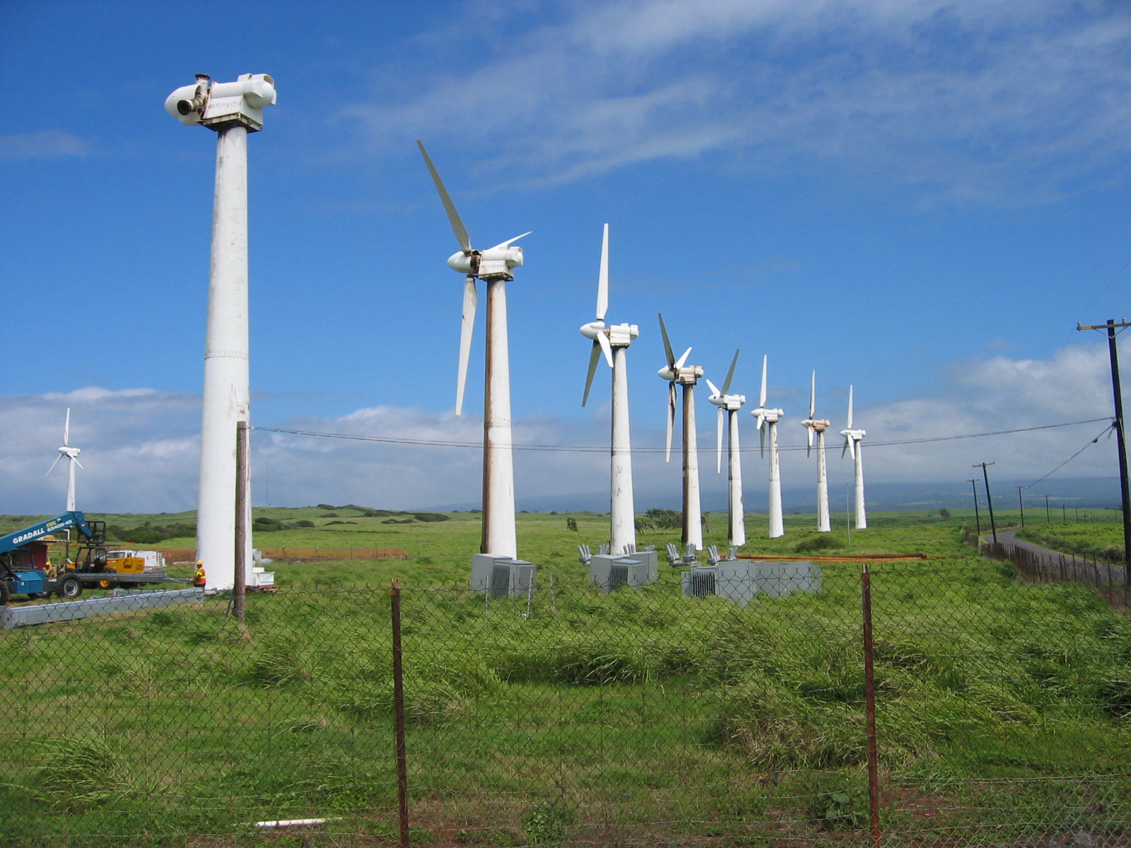
Harvesting the Wind
The same gusts that bend the trees have made Ka Lae a proving ground for wind energy. In 1987, the Kamaoa Wind Farm began generating power with thirty-seven Mitsubishi turbines capable of 7.5 megawatts at peak output. By 2006, the machines had deteriorated beyond repair and were shut down, their skeletal frames becoming a cautionary landmark visible from the road. But the wind did not stop blowing. Later that year, components for a replacement project arrived at South Point. The Pakini Nui Wind Farm, completed in April 2007 with fourteen General Electric turbines about 1.5 miles from the old site, now supplies up to 20.5 megawatts to the Big Island's electrical grid. It is the southernmost wind farm in the United States, spinning at the bottom of the country where ancient fishermen once let the current carry their canoes.
From the Air
Ka Lae (South Point) is at 18.911°N, 155.681°W, the southernmost point of the Big Island and the fifty United States. From the air, the headland is unmistakable: a stark lava promontory jutting south with wind turbines visible along the ridge and the old Morse Field airstrip remnants nearby. Papakōlea Green Sand Beach lies about 3 miles to the east. Best viewed below 2,500 feet AGL for detail. Winds are consistently strong from the northeast trades -- expect turbulence at low altitude. Nearest airports: Kona International (PHKO) roughly 60 nm northwest, Hilo International (PHTO) about 60 nm northeast.