Kaeng Krachan National Park
It took Thailand four attempts to get Kaeng Krachan listed as a UNESCO World Heritage Site. The first three bids failed, rejected over outdated boundary data and a damning absence: no consultation with the indigenous Karen people who had lived within the park's borders long before anyone drew them. On the fourth try, in July 2021, the World Heritage Committee voted 12 to 9 in favor - a margin narrow enough to suggest that nearly half the voting nations remained unconvinced. The UN's own Office of the High Commissioner for Human Rights had raised concerns about human rights violations against the park's indigenous inhabitants. Kaeng Krachan earned its designation, but the questions it raised about whose land a national park truly protects have not gone away.
Where the Mountains Meet the Rain
Kaeng Krachan occupies the eastern slope of the Tenasserim Mountain Range, the long spine of highlands that separates Thailand from Myanmar. At 2,915 square kilometers - enlarged from its original 2,478 square kilometers in December 1984 - it is Thailand's largest national park, sprawling across parts of Phetchaburi and Prachuap Khiri Khan provinces. The terrain climbs from lowland forest at the park's eastern edge to a peak of 1,513 meters along the Thai-Myanmar border, with Kao Panern Toong reaching 1,207 meters as the second highest summit.
Two rivers are born within the park. The Phetchaburi River flows east, impounded by the Kaeng Krachan Dam built in 1966, which created a reservoir covering 46.5 square kilometers - a vast sheet of water that serves as the park's visual anchor. The Pranburi River also originates here before flowing toward the Gulf of Thailand. The forests that feed these rivers are dense, layered, and ancient - tropical and subtropical broadleaf species interlocked with palms, the canopy broken only by streams and the occasional limestone outcrop.
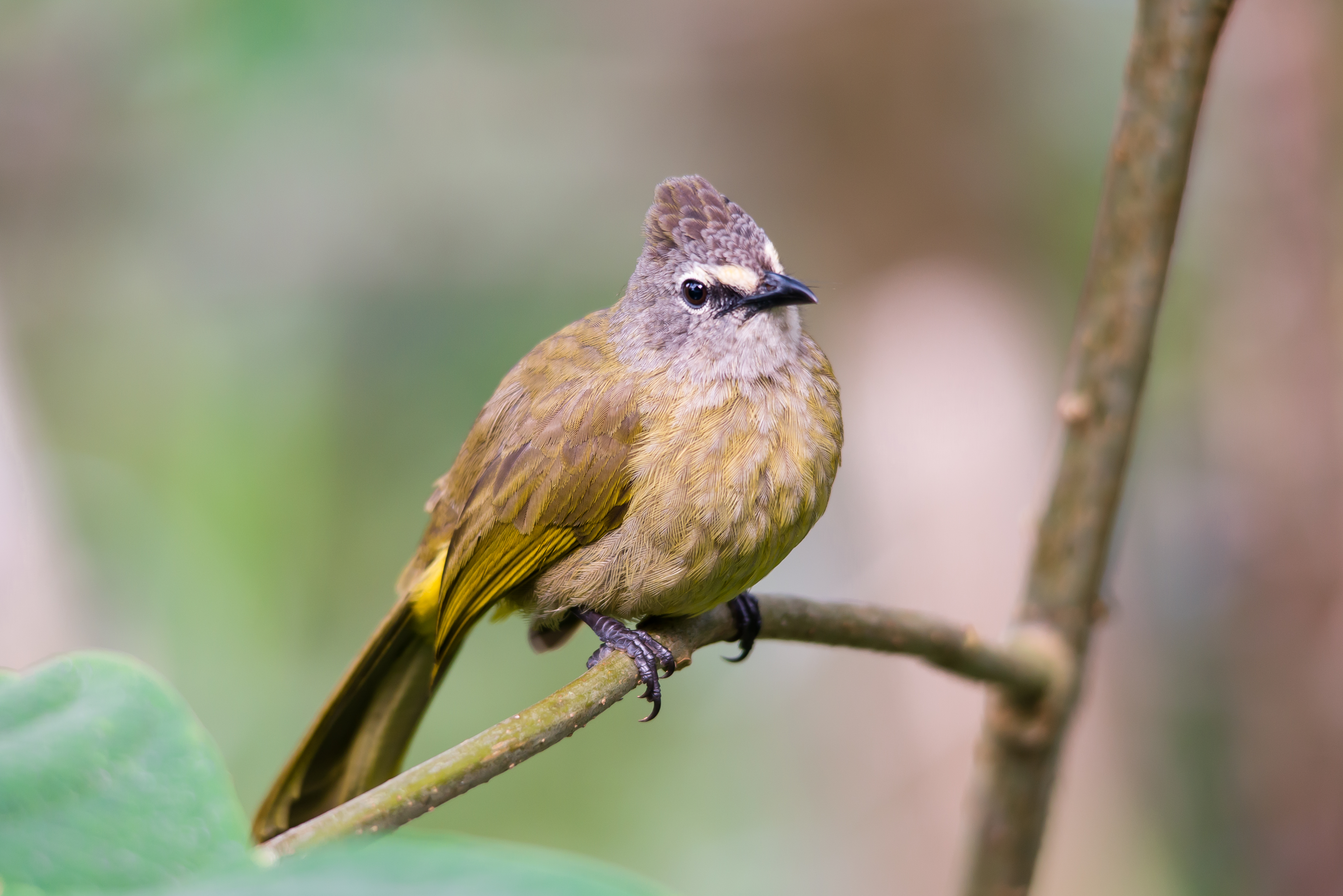
A Parliament of Birds
Birders know Kaeng Krachan the way surfers know Pipeline. The park's combination of altitude, latitude, and habitat diversity creates conditions that support 461 recorded bird species - one of the highest counts for any single protected area in mainland Southeast Asia. Ninety-one species of mammals share the forest, from yellow-throated martens to dusky leaf monkeys, but it is the birds that draw researchers and enthusiasts from around the world.
Streaked spiderhunters work the understory. Flavescent bulbuls call from mid-canopy. Ruddy kingfishers flash through the riverine corridors. Raptors ride thermals above the ridge. The park's altitudinal range creates distinct habitat bands - lowland tropical forest grades into hill evergreen and then montane forest near the peaks, each zone hosting its own avian community. Early mornings at the Kaeng Krachan reservoir or along the Bang Krang to Phanoen Thung road offer some of Thailand's most productive birding, with mixed feeding flocks moving through the canopy in waves that can produce a dozen species in minutes.
Elephants and Their Enemies
Kaeng Krachan's elephants face a grim irony: some of the people charged with protecting them have been accused of killing them instead. Despite the park's national status and UNESCO designation, poaching persists, and investigations have implicated park officials themselves in the trade of elephant parts. In June 2013, an elephant calf was electrocuted by a fence surrounding one of the private plantations that exist, improbably, within the national park's boundaries.
The plantations are a legacy of land claims that predate the park's establishment. When Kaeng Krachan was declared a reserve in 1964 and formally became Thailand's 28th national park on 12 June 1981, existing agricultural operations were not all removed. Some remain, fenced and operational, creating corridors of human activity that fragment elephant habitat and generate lethal encounters. The park's size - enormous by Thai standards - should provide ample range for its elephant population, but size means little when enforcement is compromised and economic incentives favor looking the other way.
Roads, Rights, and the Price of Access
In 2018, the park administration began taking bids on a project to pave 18.5 kilometers of the Bang Krang to Phanoen Thung road, budgeted at 87.62 million baht. The existing one-lane dirt track was, according to the park chief, "broken beyond repair." Environmentalists countered that easier access would funnel more tourists into a fragile ecosystem that was already struggling with poaching and encroachment. The National Parks Department halted the project in November 2018 to hear opposition arguments, but the tension it exposed runs deeper than any single road.
Kaeng Krachan sits at the intersection of competing claims. Conservation groups want the forest left alone. Tourism operators want access improved. The Thai government wants its World Heritage plaque. And the Karen communities who have lived in these mountains for generations want recognition that their presence is not a problem to be solved but a fact to be accommodated. The OHCHR's concerns about the treatment of indigenous inhabitants were not resolved by the UNESCO vote - they were simply overruled. The forest itself, indifferent to politics, continues to grow. Whether the people within it can coexist with the institutions claiming to protect it remains the park's central, unanswered question.
From the Air
Located at 12.80N, 99.45E on the eastern slope of the Tenasserim Mountain Range in western Thailand. The park spans 2,915 sq km across Phetchaburi and Prachuap Khiri Khan provinces. From cruising altitude, the Kaeng Krachan reservoir (46.5 sq km) is the most prominent visual landmark - a large body of water at the park's eastern edge created by the 1966 dam. The Tenasserim Range forms the western boundary, rising to 1,513 m along the Thai-Myanmar border. Dense forest canopy covers most of the park area. Nearest significant airports: Hua Hin (VTPH) to the southeast, approximately 60 km; U-Tapao (VTBU) to the east. The park lies roughly 200 km southwest of Bangkok. Expect tropical conditions with monsoon rains May-November reducing visibility significantly.