Kaghan Valley
Somewhere between the words 'valley' and 'corridor' lies the truth of Kaghan. It is not one wide, gentle basin but a 154-kilometer crack in the earth, threading north through the Lower Himalayas from the town of Balakot to the 13,691-foot Babusar Pass, where Khyber Pakhtunkhwa ends and the territories of Gilgit-Baltistan begin. The Kunhar River stitches the entire length together, born from the turquoise stillness of Lulusar Lake at 3,410 meters and gathering speed as it tumbles southwest through alpine meadows, deodar forests, and increasingly warm air until it merges with the Jhelum. In June 2024, more than 300,000 tourists arrived during the Eid al-Adha holidays alone, drawn by what the valley has always offered: a vertical escape from the plains below.
A Staircase of Lakes
What sets Kaghan apart from Pakistan's other Himalayan valleys is the density of its water. The lower reaches hold Saiful Muluk National Park, its namesake lake sitting at over 3,200 meters, framed by peaks that remain snow-capped well into July. Higher up, Lulusar-Dudipatsar National Park strings together at least nine lakes along the Naran-Chilas road, including Dudipatsar, the so-called 'Pearl of Pearls,' and Lulusar itself, whose glacial waters mark the headwaters of the Kunhar River. Smaller lakes appear at nearly every turn: Pyala Lake near the town of Jalkhand, Dharamsar and Sambaksar near the Gittidas meadows at 3,678 meters. The effect from above is of a green-and-grey landscape punctuated by implausibly blue mirrors, each one reflecting a slightly different altitude and angle of Himalayan sky.
Forests Built on Deep Roots
The valley's temperate coniferous forests form a botanical crossroads. Cedrus deodara - the deodar cedar, whose name derives from the Sanskrit for 'timber of the gods' - dominates the mid-elevation canopy alongside blue pine and Himalayan fir. Lower down, broadleaf species crowd in: walnut, bird cherry, Indian horse chestnut, and the occasional mulberry or fig. The diversity reflects Kaghan's position at the junction of several biogeographic zones, where Central Asian, Himalayan, and Indo-Gangetic influences overlap. Ethnobotanical surveys continue to document how local communities use these forests - a 2020 study recorded the use of Cedrela serrata for treating chronic infantile dysentery, one thread in a longer tapestry of traditional knowledge that residents of the valley's Hindko-, Pashto-, and Gojari-speaking communities have maintained for generations.
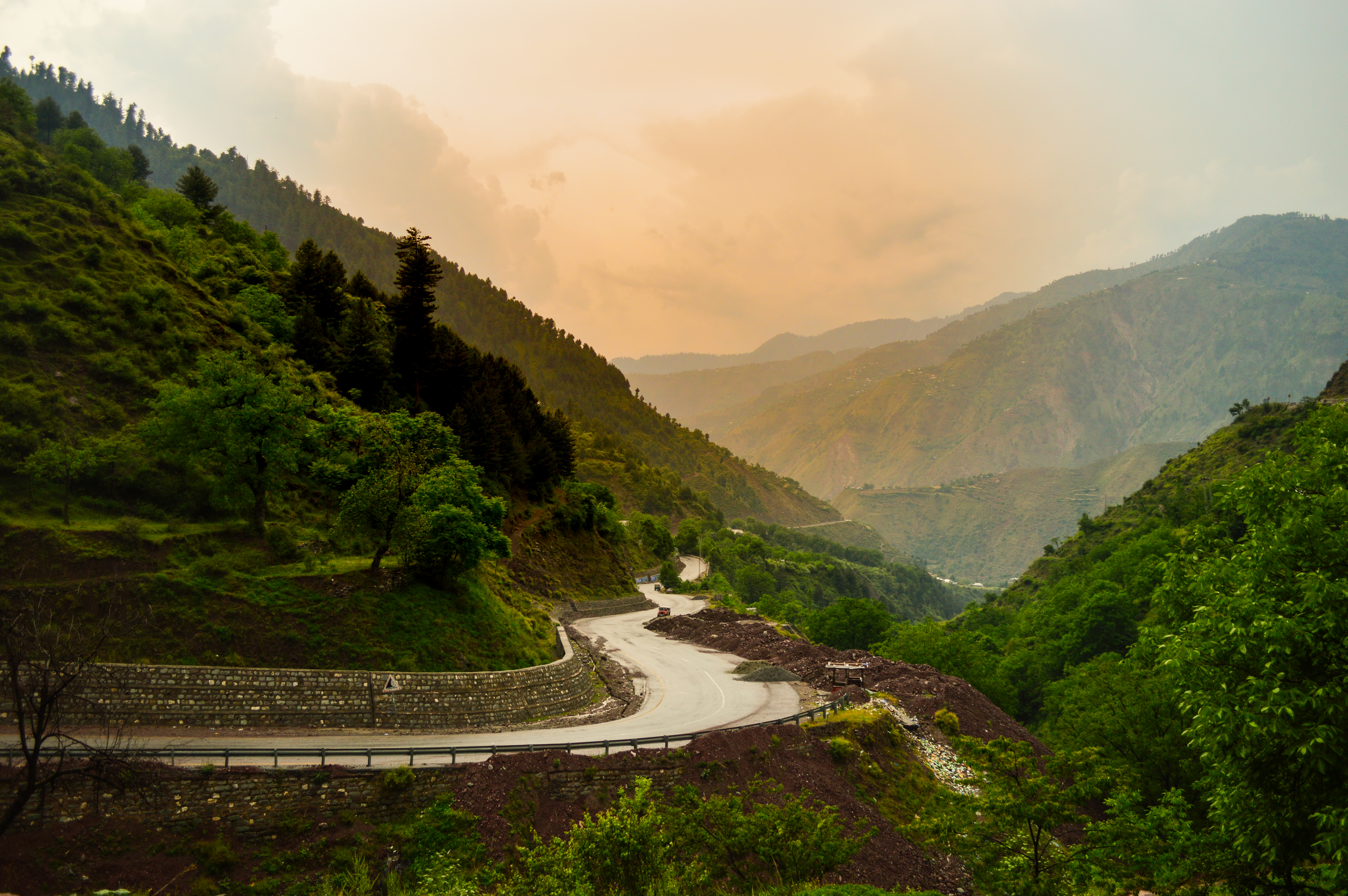
The Road That Opens and Closes
Kaghan exists on a seasonal clock. Glaciers seal the roads each winter, typically from November through February or March, and the Babusar Pass does not reliably open until May. When it does, the valley becomes a single, spectacular highway connecting Mansehra and Abbottabad in the south to the Karakoram Highway and Gilgit-Baltistan in the north. The 2005 Kashmir earthquake destroyed many of the passes leading into the valley, and landslides remain a persistent threat - the Express Tribune reported highway-blocking slides as recently as July 2023. Yet the road keeps getting rebuilt, because the alternative is a detour of hundreds of kilometers. In 2020, the Khyber Pakhtunkhwa Assembly established the Kaghan Development Authority to manage infrastructure and tourism services, a recognition that the valley's popularity has outgrown informal management.
High Ground, Many Peoples
The communities of the Kaghan Valley are as layered as its geography. Syed, Kashmiri, Durrani (Jadoon), Swati, Gujjar, and Mughal families trace their roots here across generations, and the linguistic landscape reflects that diversity: Hindko predominates, but Pashto and Gojari are widely spoken in different pockets of the valley. At the hill station of Shogran, perched on a plateau at 2,362 meters, the view stretches to Malika Parbat, the valley's highest peak, and the Siri Paye meadows flanked by Makra Peak. Farther up, the village of Khanian on the right bank of the Kunhar serves as the gateway to the Kamal Ban Forest and Dana Meadows. Each settlement occupies its own ecological niche - elevation, aspect, proximity to water - and together they form a human corridor as long and varied as the valley itself.
From the Air
Coordinates: 34.83N, 73.52E. The valley runs roughly north-south for 154 km through the Lower Himalayas; best viewed at 15,000-20,000 ft to appreciate its full length. Babusar Pass (13,691 ft) marks the northern terminus. Nearest major airport is Islamabad International (OPIS), approximately 200 km south. The Kunhar River threading through the valley floor is the primary visual reference. Snow-capped peaks line both sides; Malika Parbat is the highest visible summit.