Kaikoura Canyon
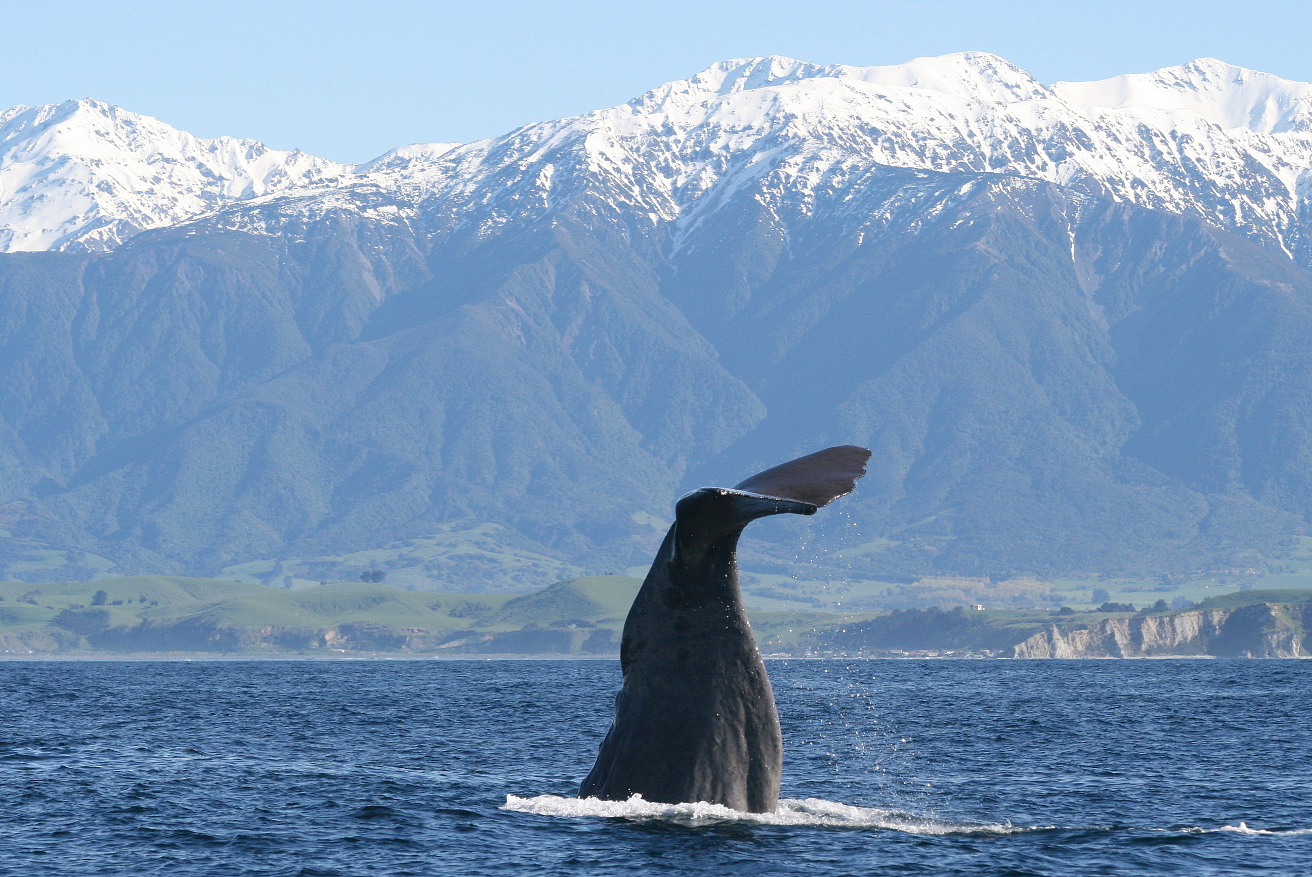
Sperm whales surface barely a kilometre from shore here, which seems impossible until you understand what lies beneath them. The Kaikoura Canyon plunges from 30 metres to over 2,000 metres deep in a 60-kilometre gash through the continental margin, bringing the abyss so close to land that the largest toothed predators on Earth hunt within sight of a small New Zealand coastal town. In 2006, scientists discovered that this canyon teems with 10 to 100 times the density of life found in comparable deep-sea habitats anywhere else in the world.
Where Two Oceans Collide
The canyon's extraordinary productivity begins with a collision of currents. The Southland Current carries cold, nutrient-rich subantarctic water northward along the eastern coast of the South Island. Off Kaikoura, it meets the subtropical East Cape Current flowing south from warmer waters. Where these two bodies of water converge at what oceanographers call a subtropical front, the mixing generates eddies, upwellings, and turbulence that reaches down to the depths of the Hikurangi Trough and the canyon itself. The result is a constant churn of nutrients rising from the deep, fuelling a food chain from plankton to sperm whales. These currents shift with the seasons and respond to the shape of the seafloor, creating a dynamic system where warm water, cold water, and freshwater from rivers form complex, ever-shifting flow patterns south of the Kaikoura Peninsula.
An Abyss Teeming with Life
When scientists from New Zealand's National Institute of Water and Atmospheric Research (NIWA) explored the canyon floor in 2006, what they found astonished the marine biology community. Sea cucumbers, heart urchins, bristle worms, and spoon worms carpeted the canyon floor at densities of around 500 individuals per square metre, ten times higher than anywhere else previously surveyed. The total biomass was estimated at 100 times greater than other deep-sea locations. Fish packed the water column at roughly 5,000 per hectare, ten times the density found in the north Pacific. Deep-sea species recorded in the canyon include the alert pigfish, banded rattail, serrulate rattail, and abyssal rattail, all trawled at depths of 240 to 300 metres. Violet cod have been found far deeper, between 1,500 and 1,705 metres. This is not just a productive canyon. It is one of the richest deep-sea ecosystems ever documented.
The Sediment Bomb
The Kaikoura Canyon also serves as the primary sediment conduit for the entire eastern South Island. Rivers draining the tectonically active Southern Alps carry enormous loads of erosional debris northward along the coast, and the canyon funnels that material into the Hikurangi Channel, a deep-sea channel stretching hundreds of kilometres across the ocean floor. By 2006, an estimated 0.24 cubic kilometres of fine sand and silt had accumulated at the canyon head, perched on a steep slope in one of the most seismically active regions on Earth. Scientists warned that a major earthquake could trigger a submarine landslide, sending that sediment cascading into the deep and potentially generating a locally destructive tsunami. The return period for such an event was estimated at roughly 150 years, and lichen-dating of nearby rockfalls suggested the last one occurred about 175 years earlier.
When the Prediction Came True
On 14 November 2016, the magnitude 7.8 Kaikoura earthquake provided a grim validation of those predictions. An estimated 850 million tonnes of sediment avalanched through the canyon, and the resulting turbidity current travelled more than 600 kilometres along the Hikurangi Channel. The abundant marine life that scientists had so carefully documented was devastated. The thriving ecosystem on the canyon floor was buried. A 7-metre tsunami runup was observed locally in Kaikoura, and later modelling suggested it was consistent with a submarine landslide occurring 10 to 20 minutes after the main rupture. Yet the canyon proved resilient. By September 2017, a NIWA expedition found marine life recovering faster than expected, with high densities of sea cucumbers and urchins already reappearing in some areas. The deep had been scoured clean, and the deep was already filling back in.
From the Air
The canyon head lies at approximately 42.55S, 173.72E, just south-west of the Kaikoura Peninsula. From the air, the canyon is invisible beneath the surface, but its effects are unmistakable: look for sperm whales surfacing close to shore south of Goose Bay, where the canyon comes within 1 km of the coastline. The deep blue water close to land contrasts sharply with the lighter coastal shallows. Kaikoura Aerodrome (NZKK) is the nearest airfield. Christchurch International (NZCH) lies roughly 180 km to the south-west. Best viewed at 2,000-4,000 feet AGL to appreciate how abruptly the continental shelf drops away.