Kalalau Trail
The warning sign at the Hanakapiai stream crossing keeps a tally. Scratched into the wood are hash marks counting the people who have drowned attempting to ford this single crossing, which sits just two miles into the eleven-mile Kalalau Trail. Flash floods arrive without warning. The stream can go from ankle-deep to chest-high in minutes. In February 2013, a woman died in exactly this way while fifty-four other hikers were stranded overnight on the far bank. The Kalalau Trail runs along the Na Pali Coast of Kauai, hugging cliffs that drop hundreds of feet into the Pacific, crossing streams that swell with every rain, and climbing from sea level to 800 feet in barely two kilometers. It has been called the most incredible hike in the United States. It has also stranded, injured, and killed people who underestimated it.
Eleven Miles of Edge
The trail begins at Ke'e Beach on Kauai's north shore and ends at Kalalau Beach, a crescent of sand at the base of a valley walled in by 2,000-foot cliffs. Expert hikers and trail runners can complete the twenty-two-mile round trip in a single day, but the average hiker needs at least two days and a camping permit. The first two miles, from Ke'e Beach to Hanakapiai stream, are moderately strenuous and accessible with a day-use reservation to Ha'ena State Park. Beyond Hanakapiai, the trail enters wilderness, and only hikers with overnight camping permits may legally continue. No day-use permits are issued for the backcountry sections. Violation is a petty misdemeanor under Hawaii law, carrying a criminal record in addition to fines. The regulation exists for good reason: between Hanakapiai and the trail's end at Kalalau, the path narrows, the exposure increases, and the opportunities for rescue diminish with every mile.
The Crossing at Red Hill
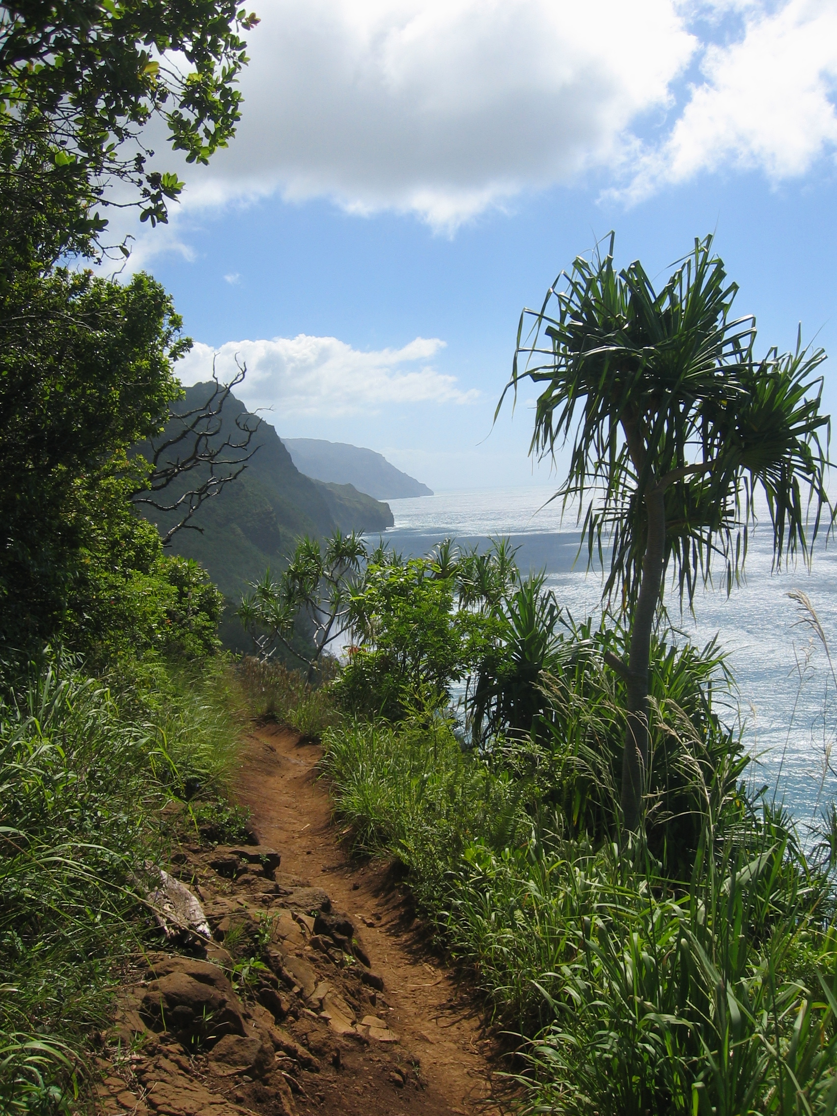
After Hanakapiai Beach, the trail makes its most demanding climb, ascending 800 feet over roughly two kilometers through increasingly remote terrain. The section known as Red Hill, near mile marker seven, has been the site of multiple accidents. In August 2014, a hiker died after falling over the edge and landing on rocks fifty feet below. The trail here is narrow, sometimes barely wider than a boot print, with sheer drops to the ocean on one side and unstable volcanic rock on the other. The midpoint brings Hanakoa Valley, six miles from the trailhead, a hanging valley with a waterfall and stream but no access to any beach. Campers may spend one night here with a valid Kalalau permit. The trail to Hanakoa Falls branches off just before a covered shelter, though it is poorly maintained and easy to lose. Water sources exist along the route, but all stream water carries risk of leptospirosis and requires treatment before drinking.
The Valley at the End
The trail descends Red Hill and crosses Kalalau stream before opening onto Kalalau Beach, where the valley floor spreads nearly a mile wide. Camping permits are limited to five consecutive nights, and only sixty permits are issued for each night, a number that reflects both ecological sensitivity and the practical limits of a place reachable only on foot or by kayak. The valley is more than a campsite. Native Hawaiians farmed taro here for centuries, building terraced fields that still mark the valley floor. The cliffs surrounding the valley shelter rare endemic plants, including Dubautia kalalauensis, found nowhere else in the world. A small waterfall near the camping area provides water for bathing. The isolation is profound but not absolute: helicopter traffic overhead is constant, a reminder that even the most remote places in Hawaii exist within sight of the modern world.
When the Mountain Decides
The trail's history includes a pattern of events that reinforce its reputation. In December 2012, a hiker was pushed from a cliff by another man and critically injured; the perpetrator was arrested months later and sentenced to five years for attempted murder. In April 2014, heavy rains swelled streams across the trail, stranding 121 hikers who required rescue by the Kauai County Fire Department over two days. These are not freak occurrences but expressions of the landscape's fundamental character. The Na Pali Coast receives enormous rainfall, the geology is young and unstable, and the streams respond to weather events with violent speed. The beauty and the danger are the same thing: a coastline so steep and erosion-prone that no road has ever been built along it, leaving only this narrow trail carved into cliffs that the ocean is steadily reclaiming.
From the Air
Located at 22.20N, 159.62W along Kauai's north shore Na Pali Coast. From the air, the trail is a thin line etched into near-vertical sea cliffs, visible as it switchbacks between green ridges. Kalalau Beach and valley are identifiable at the trail's western terminus. Nearest airport: Lihue Airport (PHLI) approximately 15 miles southeast. Princeville Airport (not currently active for commercial flights) is closer. Recommended viewing altitude: 2,000-3,000 feet AGL to appreciate the trail's cliff exposure. Helicopter traffic is heavy along this corridor.