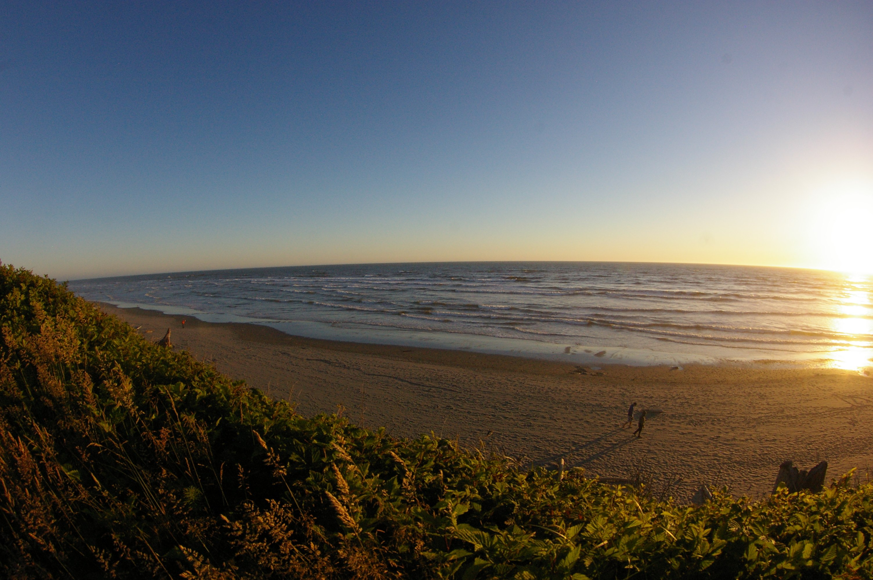
Kalaloch
The Quinault people called it k'le-ok - "a good place to land" - because along this stretch of Washington's wild Pacific coast, safe harbors for dugout canoes were scarce. Between the mouths of the Quinault and Hoh rivers, the shoreline offered few breaks in the cliffs and surf where a boat could be pulled ashore without being smashed. Kalaloch was one of those rare places, and the name stuck through centuries of use, its pronunciation softened by English speakers into something close to "clay-lock." Today the landing looks different - a lodge built from beach driftwood, campground loops tucked along a 50-foot bluff, seven trails winding down to the sand - but the essential character of this place remains what it has always been: a narrow foothold between rainforest and ocean, shaped by water falling from both directions.
Rain Measured in Feet
Kalaloch's weather arrives from the Pacific and stays. Prevailing westerly winds push moisture onshore, where it collides with the Olympic Mountains and falls - relentlessly, extravagantly, in quantities that make even Seattle look arid. Annual rainfall at Kalaloch averages 8.5 feet. Winter months drop more than 17 inches each, the storms rolling in with a regularity that turns the surrounding Hoh and Quinault Rainforests into some of the wettest places in the continental United States. Summer offers a reprieve of sorts - just over 3 inches per month on average - and that narrow window of relative dryness is when most visitors arrive. But the rain is not a flaw in this landscape. It is the landscape. Every moss-draped branch, every fern cascading down the bluffs, every creek cutting through sandstone to the beach exists because of that water.
Twelve Thousand Years of Footprints
Artifacts discovered in Olympic National Park suggest humans have inhabited the Olympic Peninsula for somewhere between 6,000 and 12,000 years. Eight tribes - the Elwha Klallam, Hoh, Jamestown S'Klallam, Makah, Port Gamble S'Klallam, Quileute, Quinault, and Skokomish - maintain reservations along the peninsula's shores today, their presence predating every boundary drawn on every map of this coast. In 1855 and 1856, the Olympic Peninsula tribes ceded their lands and waters to the federal government through a series of treaties that reshaped ownership but could not erase the deep connection between these peoples and this coast. Kalaloch sits just north of the Quinault Indian Nation's reservation, on land that passed through private ownership before becoming part of the national park. Charles W. Becker, Sr., purchased a 40-acre coastal plot here in 1925 and built a lodge and cabins using lumber he milled from driftwood logs that washed ashore - a resourcefulness the Quinault would have recognized.
The Tree That Refuses to Fall
Kalaloch Beach's most famous resident is not a person but a Sitka spruce. Known as the Tree of Life, it grows at the edge of a small gully where a creek drains from the bluffs onto the sand. Erosion has carved away the soil beneath its roots, leaving the tree suspended over the gap like a bridge, its root system exposed in an elaborate web of woody tendrils reaching for earth on either side. Normally, Sitka spruce grow tall and straight. This one is shorter, thicker, its branches bent and windswept into shapes that look deliberately sculpted. The tree has become a landmark in Jefferson County and a magnet for photographers, its improbable survival a ready metaphor for persistence. In early January 2025, the tree slumped roughly five feet after the creek gully eroded further - a reminder that its famous resilience operates on borrowed time. Whether it survives another decade or another century, the Tree of Life embodies the tension that defines this entire coastline: the contest between what grows and what erodes.
A Bluff Between Worlds
Presidents have shaped Kalaloch's fate from a distance. Franklin Roosevelt designated 898,000 acres as Olympic National Park in 1938 and expanded it two years later. Harry Truman added 75 miles of coastal wilderness in 1953, bringing Kalaloch into the park's boundaries. The National Park Service purchased the Becker property in 1978, renaming it Kalaloch Lodge. At its peak, forty rental cabins dotted the bluff, six of them perched directly above the ocean. But the bluff is retreating. Approximately 13 feet of erosion in 2023 and 2024 forced the demolition of seven cabins, the Pacific reclaiming ground one storm at a time. The lodge itself remains safe for now. Kalaloch Campground, with 166 sites, is one of the park's four campgrounds that accepts summer reservations - a concession to the popularity of this narrow strip between forest and surf. Bald eagles circle the bluffs, gray whales pass offshore during migration, and sea otters and orcas are spotted by patient watchers. Olympic National Park earned designation as both an International Biosphere Reserve in 1976 and a World Heritage Site in 1981, recognitions that only confirmed what the Quinault knew when they named this place: it is, indeed, a good place to land.
From the Air
Located at 47.60N, 124.37W on Washington's Pacific coast within Olympic National Park. Kalaloch sits on a 50-foot bluff overlooking the ocean, west of US-101 on the Olympic Peninsula. Look for the lodge and campground structures along the bluff edge, with seven beach access trails visible as breaks in the vegetation. Kalaloch Creek meets the ocean just south of the lodge area. The Quinault Indian Reservation lies to the south, and the Hoh Rainforest to the northeast. Nearest airport is William R. Fairchild International (KCLM) in Port Angeles, approximately 80 miles north. Quillayute Airport (KUIL) near Forks is closer at roughly 30 miles north. The coastline shows dramatic erosion patterns and driftwood-covered beaches visible from low altitude.