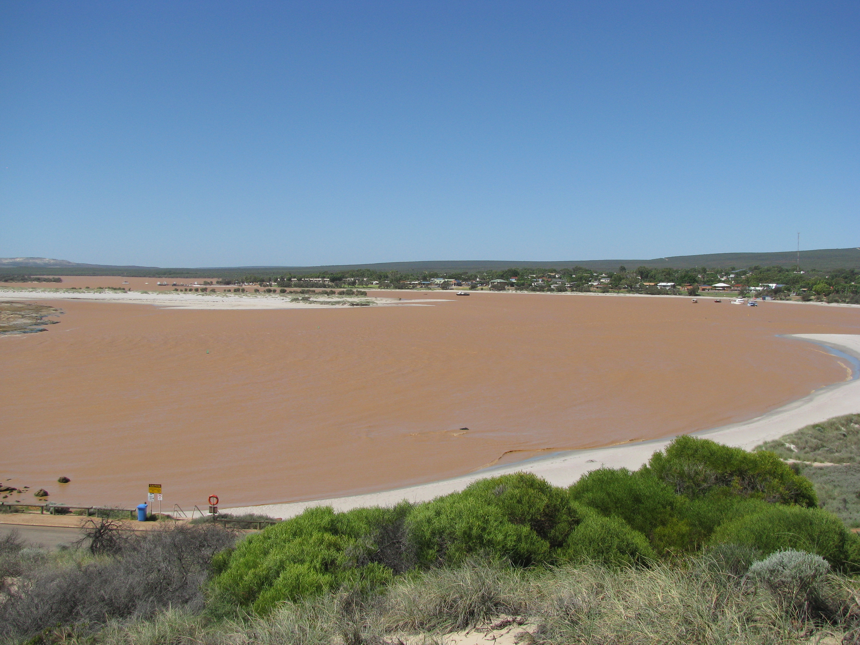
Kalbarri
In the Dreaming of the Nanda people, the Rainbow Serpent Beemarra carved a winding trail across this country before turning north to sleep in the calm waters of Shark Bay. The geological record tells a strangely parallel story. Over 40 million years, the Murchison River -- Australia's second-longest at 820 km -- entrenched itself into an 80-km gorge through Tumblagooda sandstone more than a kilometer thick. Where that gorge meets the Indian Ocean, bright red cliffs frame the little town of Kalbarri, 600 km north of Perth on the remote Mid West coast of Western Australia.
Stone That Remembers Spiders
The Tumblagooda sandstone dates to the late Silurian period, roughly 420 million years ago. It is so barren of body fossils that geologists struggle to date it precisely. What it does preserve are trackways from the following Devonian era, when some of the earliest land creatures scuttled across this territory: spiders, and large ones, leaving their marks in what was then a coastal mudflat. The Nanda people, whose language is so distinct from other Aboriginal tongues that linguists believe the region was isolated even in deep Aboriginal time, gave the river mouth the name Wurdimarlu. Europeans arrived involuntarily in 1629, when two minor conspirators from the infamous Batavia mutiny -- Wouter Loos and Jan Pelgromm -- were marooned at nearby Wittecarra Creek as punishment. They became the first known Europeans to set foot permanently on Australian soil, though their stay was almost certainly brief and fatal.
The Gorge and the Cliffs
Kalbarri National Park, established in 1963, covers two distinct landscapes. Inland, the Murchison River winds through a deep gorge where the Loop bends like a W written while hiccupping, and the Z-Bend offers vertigo-inducing views from its lookout, a short 600-meter walk from the car park. The Kalbarri Skywalk juts over the gorge edge, framing the river far below. A grueling 38-km trail follows the gorge upriver from the Loop -- a four-day commitment through heat and isolation. Along the coast, a line of sea cliffs stretches south of town past Mushroom Rock, Rainbow Valley, and the Natural Bridge, a sea arch at the trail's end. The 8-km Bigurda Trail connects several coastal lookouts, each offering a different angle on waves smashing into ancient red rock.
Cyclone, Whales, and Wildflowers
In April 2021, Cyclone Seroja tore through Kalbarri, flattening trees and damaging buildings across town. By 2022 facilities had reopened, but the missing shade tells the story -- regrown canopies will take years. The climate is fierce: summer temperatures routinely exceed 40 degrees Celsius in the park, closing hiking trails from December through April. Relief comes in May when brief rains trigger an explosion of wildflowers across the desert scrub. The red Kalbarri Catspaw, the Kalbatti spider orchid, and the Murchison hammer orchid carpet ground that was bare weeks before. Offshore, thousands of humpback whales migrate along this coast -- northbound to Kimberley breeding grounds from June to August, then southbound with calves toward Antarctica from September through November. Bryde's whales, southern right whales, and dolphins also work these waters.
Pink Lakes and Convict Roads
South of Kalbarri, Hutt Lagoon is a lurid pink salt lake, its color produced by algae that synthesize beta-carotene. The prawn farms in the lagoon yield predictably pink shellfish. In 1943, a Japanese submarine bombarded nearby Port Gregory, mistaking it for an ammunition factory, and no one noticed for a week until an intercepted radio transmission was decoded. A kilometer south, the Lynton Convict Depot preserves the remains of a village built between 1853 and 1857, when men -- both sentenced convicts and 'ticket of leave' parolees -- were sent to lay roads to the inland mines. The mining proved unprofitable, the supply chain tenuous. The settlement was abandoned after just four years, leaving stone walls to bake in the sun.
A Town Between Extremes
Kalbarri itself is small -- a population of 1,349 at the 2016 census -- and everything clusters within a ten-minute walk of the waterfront. Pelican feeding happens daily around 9 AM on the beachfront at Grey Street, overseen by dedicated volunteers. Boat trips from the marina explore the river, the sea cliffs, and lobster grounds. Surfers head to Jake's Point for a left-hand break that demands experience in big swells. The region's signature wildlife, as any visitor will confirm, is the flies -- relentless, indifferent to swatting. But dusk brings compensation: western grey kangaroos emerge, thorny devils cross warm sand, and tammar wallabies appear at the scrub edge. It is a place defined by heat and distance, where the oldest rocks on the continent meet one of its wildest coasts.
From the Air
Kalbarri sits at 27.72S, 114.42E on the mouth of the Murchison River. The town airfield (no ICAO code) is 10 km east on Hwy 354, accepting light aircraft but offering no fuel. Geraldton Airport (YGEL) is 160 km south. From the air, the red cliff line and river gorge are unmistakable against the desert scrub. Recommended viewing altitude: 3,000-5,000 ft for the gorge; higher for the full coastline panorama.