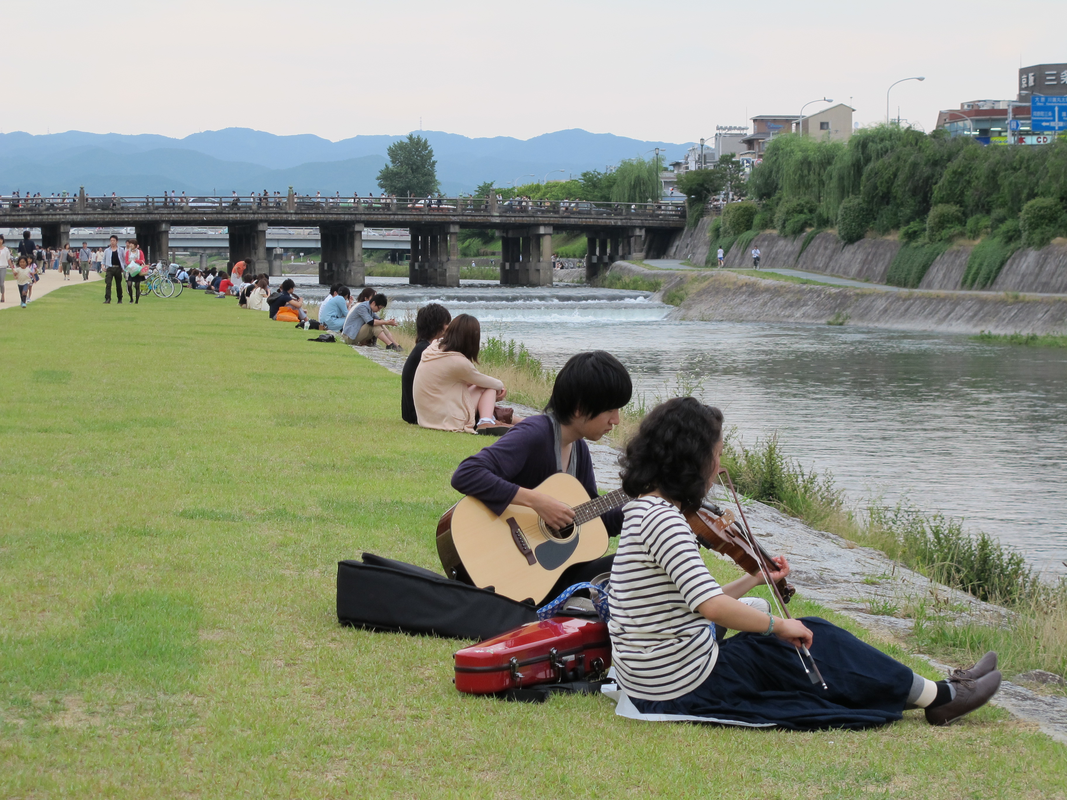
Kamo River
Emperor Shirakawa, who ruled Japan from the late eleventh century, once listed the three things he could not control: the armed warrior monks of Enryaku-ji, the fall of dice, and the water of the Kamo River. Of all the forces that have shaped Kyoto across twelve centuries, this shallow, often placid stream has been among the most persistent. It threads through the city from north to south like a spine, its banks now lined with concrete walkways where couples sit in famously evenly spaced pairs on summer evenings, where joggers trace their routes at dawn, and where restaurants extend wooden balconies over the current during the humid months. Written in kanji, the river's official name means Wild Duck River, a gentle designation for a waterway that has flooded the imperial capital, birthed an entire theatrical tradition, and been physically rerouted to serve the ambitions of empire.
Diverting a River to Build a Nation
When the Heian Capital, the city that would become Kyoto, was established at the end of the eighth century, the Kamo River was not where it is today. Historians believe the main stream originally followed the course of what is now the Horikawa River, running through the heart of the planned capital. This was unacceptable. As historian Herbert E. Plutschow explained, allowing a river to flow through and divide a capital would have symbolized potential disunity of the nation. So the river was moved. Massive engineering works diverted the Kamo to its present course along the capital's eastern edge, with the city's northern boundary set at the confluence of the Kamo and Takano rivers, near today's Imadegawa Street. The river that now seems to define Kyoto's geography was in fact bent to match the city's political geometry. The Kamo rises in the mountains around Mount Sajikigatake in northern Kyoto, flows into the basin at Kamigamo, and runs south through the city's central wards before joining the Katsura River in Fushimi, eventually feeding into the Yodo River system.
Wild Water and Sacred Groves
Despite the eighth-century engineers' best efforts, the Kamo repeatedly flooded the capital. Emperor Shirakawa's exasperated complaint about the ungovernable river was no exaggeration. Before modern concrete reinforcements and drainage systems tamed the seasonal surges, the river's rainy-season floods could inundate the low-lying walkways and threaten surrounding neighborhoods. The merchant Suminokura Ryoi addressed the problem in the early seventeenth century by constructing the Takase River, a parallel canal that carried commercial traffic on a more stable channel while the unpredictable mainstream was left alone. Where the Kamo and Takano rivers merge, a triangular area of land holds the Tadasu River Banks and the entrance to Shimogamo Shrine, one of two ancient Kamo Shrines that sit along the river's course. The other, Kamigamo Shrine, stands upstream near the valley mouth. Between them lies Tadasu-no-mori, a sacred forest that predates the city itself, a remnant of the primeval woodland that once covered the Kyoto Basin.
Swords on the Bridge, Dancers on the Dry Bed
Two of Kyoto's most celebrated cultural moments unfolded along the Kamo River. The first is legendary: the encounter between the young warrior Minamoto no Yoshitsune and the fearsome warrior monk Benkei at Gojo Bridge, likely the Matsubara Bridge of today, during the late Heian period. According to the story, Benkei had been collecting swords from passing warriors on the bridge, and Yoshitsune was the one who finally defeated him, earning Benkei's lifelong loyalty. The second moment is documented fact. In 1603, a woman named Izumo no Okuni gathered a troupe of female dancers and began performing on a makeshift stage erected on the dry riverbed of the Kamo. Those performances became the foundation of Kabuki, one of Japan's most distinctive theatrical traditions. The dry riverbed, exposed when the water ran low, served as natural open-air theater. From one bridge, a legendary samurai partnership; from the stones below, an art form that transformed Japanese culture.
The River's Many Names
Even the Kamo River's name carries layers of meaning. Officially written with the kanji for wild duck, the river is also historically written with characters meaning celebration and luxuriant growth. The first documented appearance of the name using the celebratory characters is in the Yamashiro no kuni fudoki, a provincial gazetteer. An entry dated to 815 in the Nihonkiryaku uses the wild duck characters. Today, convention splits the difference geographically: north of the Takano River confluence, the river is distinguished with one set of kanji, and south of there with another. The name traces to the Kamo clan, who settled the Kamigamo area at the mouth of the valley leading into the Kyoto Basin in ancient times, giving rise to the regional designation Otagi Region Kamo Block. Upstream of Kyoto, the river changes names entirely, becoming the Kumogahatagawa as it passes through Kumogahata village, and further north, the Ojitanigawa all the way to its mountain source.
Craft, Stone, and Summer Light
Beyond its roles in history and legend, the Kamo River sustained Kyoto in practical ways that shaped the city's identity. Its water was a crucial source of relatively pure drinking water for centuries. The river played a central role in Kyo-Yuzen dyeing, the elaborate textile art that produces the vibrantly colored kimono fabrics for which Kyoto is famous. Artisans washed their freshly dyed silks in the Kamo's current, a sight that continued into the modern era. The river also provided the particular stone used as a glaze ingredient in traditional raku pottery, the rough-textured, handmade ceramics intimately tied to the Japanese tea ceremony. Today the Kamo River is less a working waterway than a public living room. In summer, restaurants along the Pontocho district extend wooden platforms called noryo-yuka over the water, where diners eat above the gentle current. Stepping stones placed across the shallow stream invite pedestrians to cross at various points, and the walkways that line both banks serve as Kyoto's most democratic gathering space.
From the Air
The Kamo River is a clearly visible north-south waterway bisecting eastern Kyoto at 34.9314N, 135.7372E. Best viewed at 3,000-5,000 feet AGL, where the river's full course from the northern mountains through the urban grid to its confluence with the Katsura River in the south is visible. The river serves as an excellent visual navigation reference through the dense Kyoto cityscape, with the Takano River confluence forming a distinctive Y-shape in the northern part of the city. Nearest airports: RJOO (Osaka Itami, 20 nm southwest), RJBB (Kansai International, 45 nm south). The green corridor of Tadasu-no-mori forest at the Shimogamo Shrine is a notable visual landmark along the river.