Kamo Site
In 1911, someone digging on the eastern slope of the Itami Plateau unearthed a dotaku, a ritual bronze bell cast two thousand years ago by people who buried these enigmatic objects on hillsides as offerings to ensure bountiful rice harvests. That single bell cracked open a window into one of the Kansai region's most significant ancient settlements. Over the following century, 225 separate excavations at the Kamo site in Kawanishi, Hyogo Prefecture, revealed a moated village stretching 800 meters east to west and 400 meters north to south, with traces of human habitation spanning from the Paleolithic era through the Heian period. Japan designated it a National Historic Site in 2000.
The Bell on the Hillside
Dotaku are among the most distinctive artifacts of the Yayoi period, the era roughly spanning 300 BCE to 300 CE when wet-rice agriculture, metalworking, and settled village life transformed the Japanese archipelago. These clapperless bronze bells were not instruments for making sound. Their walls were cast too thin to ring when struck. Instead, they were ritual objects, often decorated with images of granaries, deer, and dragonflies, the natural enemies of rice-devouring insects. Communities buried them on isolated hillsides, sometimes singly, sometimes in groups that may have symbolized the unity of allied clans. The dotaku found at the Kamo site in 1911 signaled that something far larger lay beneath the plateau's edge, waiting to be uncovered.
Layers Beneath the Plateau
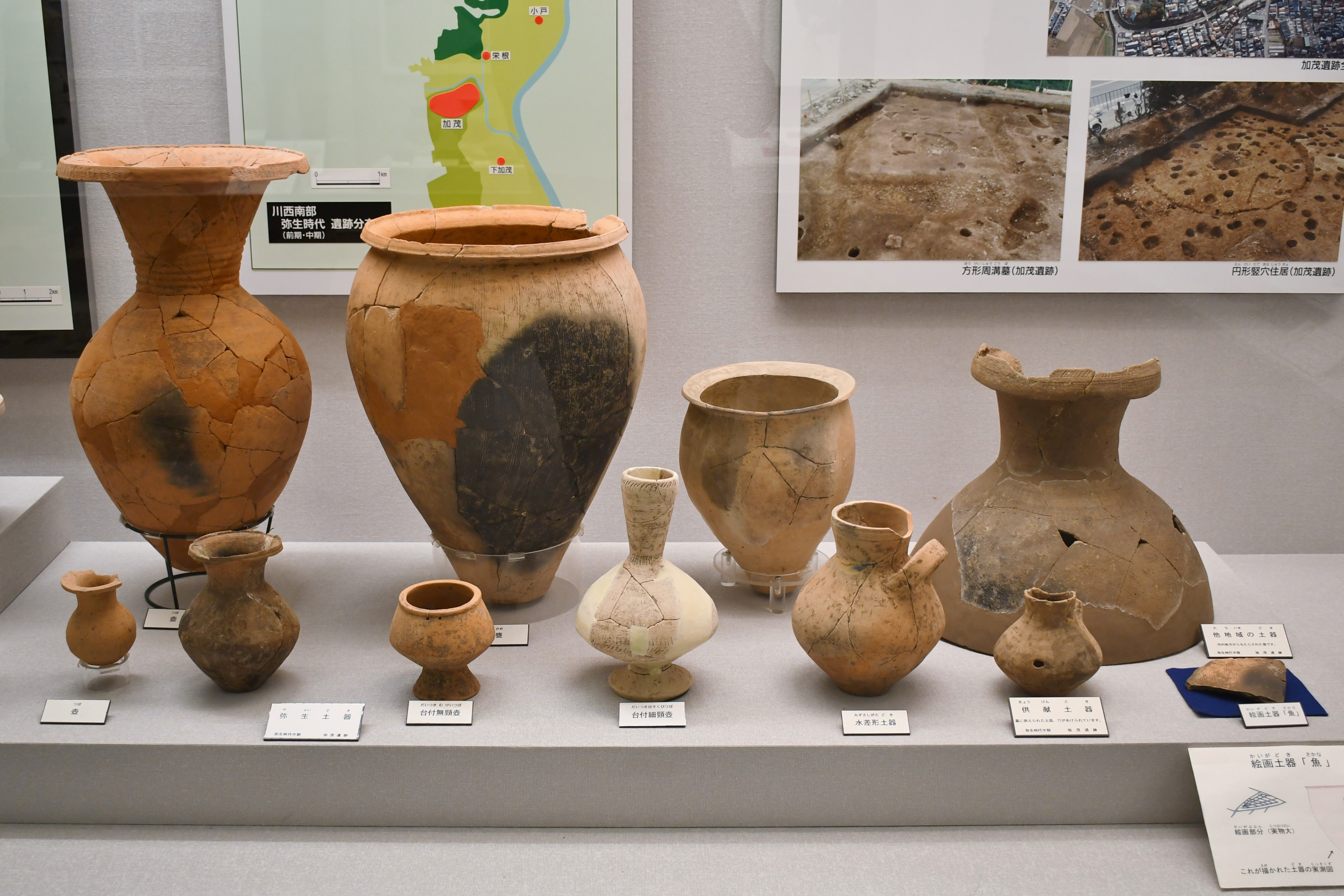
The Kamo site sits at about 40 meters elevation on the edge of the Itami Plateau, where the Ina River flows from the Hokusetsu Hills toward the Nishisetsu Plain. After the initial dotaku discovery, archaeologists found a stone tool production site, evidence that this was not just a farming village but a manufacturing center. Beginning in 1952, systematic excavations continued for over five decades, ultimately cataloguing remains from the Paleolithic period all the way through the Heian period. But the heart of the site belongs to the middle Yayoi period, when the settlement reached its greatest extent. Excavators uncovered six pillar-supported buildings, 40 pit dwellings, 22 square grooved tombs, 12 earthenware coffin burials, and 38 wooden coffin and pit tombs.
Portrait of a Yayoi Village
The layout of the Kamo settlement reveals a community with clear social organization. A moat encircled the entire village, separating the living from the surrounding landscape. The eastern half, situated on higher ground, served as the residential center and yielded the greatest concentration of Yayoi pottery and everyday artifacts. The western portion was reserved for the dead, with tombs clustered together in a distinct funerary zone. In 1992, archaeologists uncovered the foundations of a large pillar-supported building enclosed within a square boundary. Its size and prominent placement suggest it was either the residence of a village chieftain or a structure of religious significance, a ceremonial hall where the community gathered for rituals that may have included the very rites for which the dotaku bells were cast.
From Excavation to Exhibition
The Kamo site has not simply been studied and forgotten. In 1936, a museum opened near the excavation to display the earthenware and stone tools being recovered. A larger facility followed in 1993, exhibiting relics from Kamo and other archaeological sites around Kawanishi city. Together, these institutions preserve a tangible connection to the people who lived on this plateau millennia ago, shaping clay into storage jars, chipping stone into cutting tools, and burying their dead with care in wooden coffins oriented toward the setting sun. The site lies about a 20-minute walk from Kawanishi-Ikeda Station on the JR West Fukuchiyama Line, placing one of Japan's most thoroughly excavated Yayoi settlements within easy reach of modern Osaka.
From the Air
Located at 34.821N, 135.408E on the Itami Plateau in Kawanishi, Hyogo Prefecture, at the very southern tip of the city. The site sits on the plateau edge above the Ina River valley. From the air, look for the suburban development at the plateau's margin where Kawanishi meets the flat plain. Osaka Itami Airport (RJOO) is approximately 4 km to the south-southeast, making this site easily visible on approach. Kansai International Airport (RJBB) lies about 50 km south. Best viewed at 2,000-3,000 ft AGL. The archaeological site itself is not architecturally prominent but the plateau edge and river junction are clearly identifiable.