Kaokoland
There is a place in northwestern Namibia where the last petrol station is 400 kilometers from the end of the road, where river crossings require wading in first to check the depth, and where the most reliable advice for getting unstuck is to wait for someone who knows what they are doing. Kaokoland occupies the northwest corner of Namibia's Kunene Region, and it remains the most remote part of a country already famous for its emptiness. The main town, Opuwo, sits 720 kilometers north-northwest of Windhoek. Beyond Opuwo, tarred roads give way to corrugated gravel, then to unnamed tracks that rental car companies explicitly forbid their vehicles from attempting.
People of the Red Ochre
Kaokoland is the only place where the OvaHimba people still live a fully traditional lifestyle. Closely related to the Herero — both groups speak Otjiherero — the Himba are distinguished by their cultural practices, including the application of otjize, a paste of ochre and butterfat, to skin and hair. Many outsiders assume the OvaHimba live this way because they have no alternative. That assumption is wrong. A healthy head of cattle is worth 10,000 Namibian dollars, and a man eligible to marry might own well over a hundred of them. The choice to maintain traditional ways is deliberate, and the community enforces its own protocols. An elder is recognized by four insignia — chair, hat, stick, and knife — and in any homestead, he is the only one sitting on a proper chair while others use tree stumps, tires, or the sand. Attire carries precise social meaning: the wrong ornament in the wrong place can misrepresent a married woman as single or a teenage boy as an elder.
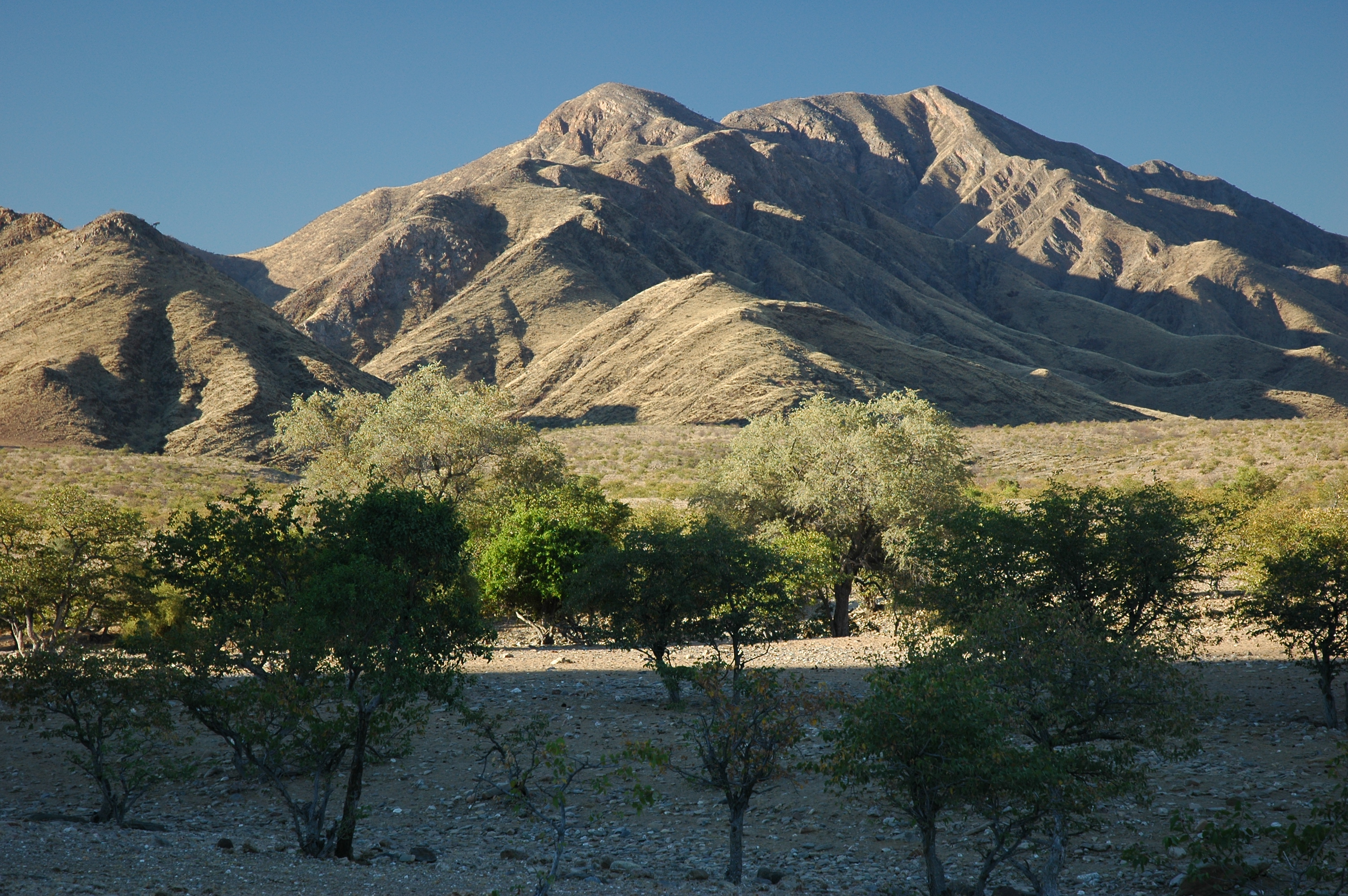
Valleys at the Edge of the World
The landscape of Kaokoland is defined by two immense valleys running north to south. The Marienfluss is known for its grass fairy circles — mysterious barren patches in the vegetation whose origins scientists still debate. At its northern end, the valley reaches the Kunene River, which forms the border with Angola. Parallel to the Marienfluss lies the Hartmannstal, equally dramatic and even more logistically punishing. Driving its full length from the settlement of Puros and back requires carrying enough fuel for over 1,600 kilometers, since deep sand can double consumption and the last petrol is in Sesfontein. Between the valleys, the landscape rolls through places like Onjuva, where the scenery shifts from desert sand to rocky outcrops. Elephants, lions, leopards, and cheetahs move through the dry riverbeds alongside zebras, giraffes, and antelope — desert-adapted wildlife that has learned to survive where water is scarce and unpredictable.
The Rules of the Road
Getting around Kaokoland is itself an undertaking. The C35 from Kamanjab to Ruacana and the C41 to Opuwo are tarred, but everything else ranges from rough corrugated gravel to tracks that barely qualify as passable even by four-wheel drive. The 100-kilometer coastal strip between Terrace Bay and the Angolan border is restricted territory, accessible only with a certified tour guide holding a specific concession. Public transport does not exist. During the rainy season, rivers flood without warning, mud traps even the strongest vehicles, and the standard advice is to camp and wait for water levels to drop — which can happen in a matter of hours. A tow rope, a shovel, a satellite phone, and more food and water than you think you need are not suggestions but necessities. Van Zyl's Pass and Robbie's Pass are among the daring passages that test drivers and vehicles alike.
Where the River Runs With Danger
The Kunene River, Kaokoland's northern boundary, is as beautiful as it is hazardous. Crocodiles and hippos inhabit its waters, and the hippos in particular are both territorial and capable of outrunning a human on land. Outside the settlements, approaching the riverbank is genuinely dangerous. Yet the Kunene is also the region's lifeline, its waters feeding the spectacular Epupa Falls downstream and defining the international border with Angola — a border with no bridge and no crossing point in Kaokoland. The isolation works both ways. It has kept Kaokoland difficult for outsiders to reach, and it has preserved something increasingly rare: a landscape and a culture that have not been smoothed into uniformity by accessibility. Visitors who make the journey — with adequate fuel, patience, and respect — encounter a corner of the world that operates by its own ancient logic.
From the Air
Kaokoland occupies the northwest corner of Namibia's Kunene Region, centered roughly at 18.00°S, 13.00°E. From 10,000–15,000 feet AGL, the terrain reveals dramatic desert valleys (Marienfluss and Hartmannstal) running north-south toward the Kunene River on the Angolan border. There are no major airports; the region has only small airstrips suitable for light aircraft. The nearest significant airport is Ondangwa Airport (FYOA) to the northeast. Opuwo has a small airstrip. Expect clear, hot conditions with occasional thunderstorms during the rainy season (November–April).