Kapiti Island
From the mainland, Kapiti Island looks like a whale surfacing -- ten kilometres of dark ridge rising from the sea, humped and ancient, separated from the Kāpiti Coast by the Rauoterangi Channel. Thirty kilometres north of Wellington, it dominates the western skyline for anyone driving the coastal highway. For centuries, the island has been contested, exploited, and finally, fiercely protected. It was a stronghold of the warrior chief Te Rauparaha, a base for shore whaling, a target for rat eradication campaigns that faced sabotage, and is now one of New Zealand's most important nature reserves. Visitors need a permit from the Department of Conservation just to set foot on it.
Fortress of Te Rauparaha
Kapiti Island's strategic value was obvious to anyone who understood war and the sea. In the early nineteenth century, the Ngāti Toa chief Te Rauparaha led his people south from Kāwhia during the Musket Wars and established Kapiti as his base of operations. The island was virtually unassailable -- its steep flanks and narrow landing beaches made it a natural fortress. From here, Te Rauparaha projected power across the Cook Strait and controlled trade routes between the North and South Islands. The island's Māori history runs far deeper than Te Rauparaha, though. Muaūpoko, Ngāti Ira, and Rangitāne all had connections to the island before Ngāti Toa's arrival. Today, most of Kapiti is Crown-owned, but parts remain in Māori ownership, and the surrounding islets -- Tokomāpuna, Tahoramaurea, and Motungārara -- are Māori-owned as well.
Oil, Bone, and Stone Hearths
Between the 1830s and 1840s, shore whaling operations set up on Kapiti's coast. Te Kahuoterangi Whaling Station is now a heritage site -- when surveyors examined it in 1910, they found twenty stone hearths, the remains of the tryworks where blubber was rendered into oil. Shore whaling in New Zealand was brutal, short-lived work. European whalers and Māori communities often worked side by side in an uneasy interdependence, trading goods and labor while the whale populations lasted. By mid-century, the southern right whales and humpbacks that had drawn the industry to Cook Strait were nearly gone, and the stations fell silent. The stone hearths remain, slowly sinking into the island's coastal scrub, monuments to an industry that consumed its own resource base within a single generation.
War Against the Rats
Kapiti Island's conservation history is a story of escalating ambition. Rats -- introduced by ships and Polynesian voyagers centuries earlier -- had devastated the island's native birds, reptiles, and invertebrates. In 1996, the Department of Conservation launched an aerial poisoning campaign to eliminate them entirely. The operation faced extraordinary resistance: saboteurs cut bait lines and scattered counter-poison, motivated by opposition to the use of brodifacoum. Despite the sabotage, the eradication succeeded, and Kapiti was declared rat-free. The results were dramatic. Lizard encounter rates increased measurably over the following two decades. Native birds that had been clinging to survival -- kiwi, kōkako, saddlebacks -- began to recover. In 2021, North Island kōkako were released on the island, adding another species to Kapiti's growing roster. The island remains predator-free today, checked annually by conservation teams who inspect hundreds of monitoring stations.
Skull Island in the Strait
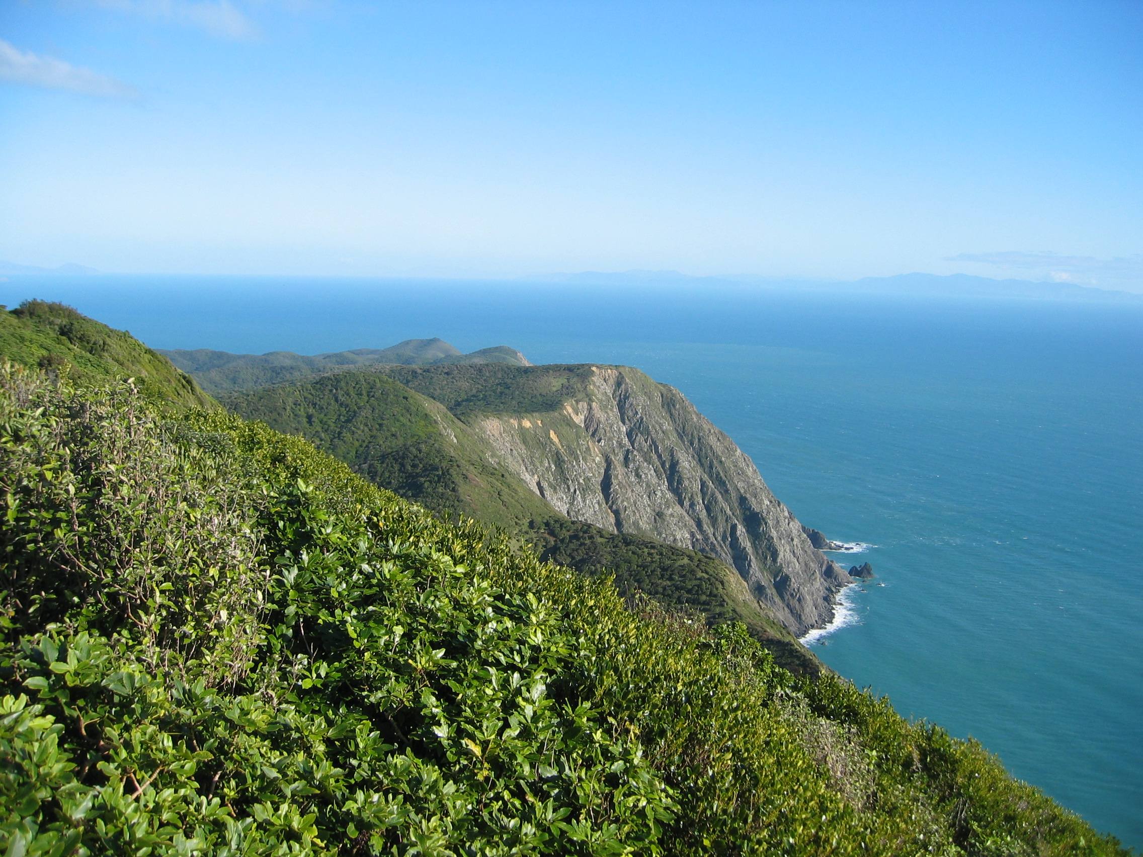
Peter Jackson chose Kapiti Island as a filming location for his 2005 blockbuster King Kong, drawn by the island's dense, primeval bush and dramatic coastal terrain. The island's craggy ridgeline and thick forest canopy doubled convincingly for the fictional Skull Island. In 2021, Kapiti appeared on screen again in Poppy, a film shot along the Kāpiti Coast about a girl with Down syndrome. The island's cinematic appeal is inseparable from its ecological character -- it looks wild because it is wild, and the predator-free environment has allowed the bush to grow dense and tangled in ways that mainland forests, browsed by possums and deer, no longer can. Ōkupe Lagoon, a freshwater lake on the island's northern end, adds to the sense of a self-contained world. Multiple active fault lines run along both sides of the island, a reminder that this landscape is still being shaped by the same tectonic forces that created it.
Fifty Visitors at a Time
Access to Kapiti Island is strictly controlled. The Department of Conservation limits daily visitors and requires permits booked well in advance. Boats depart from Paraparaumu Beach, and the crossing of the Rauoterangi Channel can be rough in the winds that Cook Strait is famous for. Once ashore, visitors walk trails through forest that echoes with birdsong rarely heard on the mainland -- the liquid notes of bellbirds, the raucous calls of kākā, the rustling of kererū launching from branches. At night, little spotted kiwi probe the forest floor, their presence a direct result of translocation programs that moved the birds here from even more remote refuges. The island is 1,965 hectares of what New Zealand's forests sounded like before humans arrived, compressed into a space you can walk across in a day. It is not a museum. It is a working ecosystem, monitored and managed, where the absence of predators is itself an act of ongoing maintenance.
From the Air
Kapiti Island is at 40.86°S, 174.92°E, clearly visible as a large elongated island running north-south off the Kāpiti Coast. It is 10 km long and 2 km wide, with a prominent ridgeline reaching over 500 metres. The Rauoterangi Channel separates it from the mainland. Paraparaumu Airport (NZPP) is directly east on the coast. From cruising altitude, Kapiti is unmistakable -- the largest island between Wellington and the Marlborough Sounds. Several small islets cluster in the channel near the island's eastern shore.