Karachi Harbour
In 1557, the Ottoman captain Seydi Ali Reis warned fellow sailors in his treatise Mir'at ul Memalik to beware of whirlpools near the coast of Sindh. If they found themselves drifting dangerously, he advised, they should seek safety in "Kaurashi" harbour. That name, twisted through centuries and languages, is recognizable today as Karachi. The harbour that Reis described has been a refuge, a prize, and a gateway for over a thousand years.
The Village of Kolachi
The modern city traces its origins to this harbour. In 1728, heavy rains silted up the harbour at nearby Kharak, forcing merchants to relocate. The nineteenth-century historian Seth Naomal Hotchand recorded that a small settlement of 20 to 25 huts existed along the harbour, known as Dibro, situated beside a pool of water called Kolachi-jo-Kun. In 1725, a band of Balochi settlers from Makran and Kalat had already arrived, fleeing droughts and tribal feuds. By 1729, a new settlement called Kolachi-jo-Goth, "The Village of Kolachi," had been established. The gate facing the sea was called Kharadar, the salt gate. The gate facing the Lyari River was called Mithadar, the sweet gate. Salt and sweet: the harbour defined the city from its first walls.
Pirates, Cannons, and Five Defenders
From 1729 to 1783, the strategic location of Kolachi drew constant attention. The town changed hands multiple times between the Khans of Kalat and the rulers of Sind. In 1783, the Talpur Mirs captured it after two prolonged sieges. By 1797, they had constructed a fort mounted with cannons on Manora island at the harbour entrance. The fort was built to repel Qasimi pirates who raided the harbour in the early nineteenth century, though some historians argue piracy was merely a pretext for the British East India Company to seize control of the region. On February 3, 1839, HMS Wellesley opened fire on Manora Fort. When British troops stormed it, they reportedly found it defended by four or five men with no functioning guns. Karachi fell without a real fight.
Cotton, Suez, and Empire
The British recognized what the Mughals, Ottomans, and Balochis had all understood: the harbour's position was everything. They established the Port of Karachi in 1854, and the city rapidly became a transportation hub for British India. New port and rail infrastructure combined with irrigated agricultural land in Punjab and interior Sindh to create a trade engine. When the American Civil War disrupted global cotton supplies, Karachi Harbour became an important cotton-exporting port. The Indus Steam Flotilla and Orient Inland Steam Navigation Company were established to move cotton from interior Sindh to the harbour and onward to textile mills in England. The completion of the Suez Canal in 1869 amplified the harbour's importance further, shrinking the distance between Karachi and European markets.
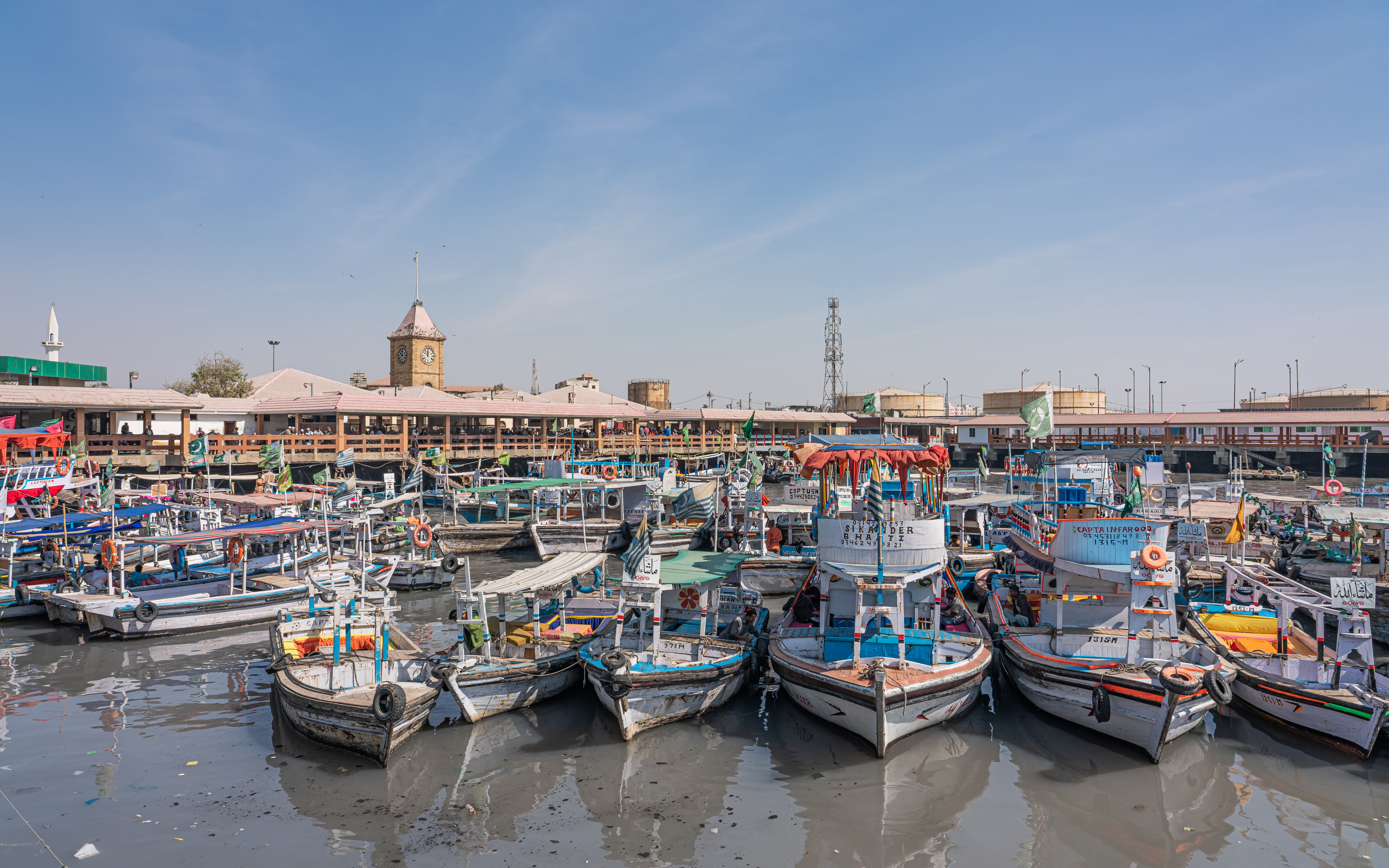
An 11.5-Kilometer Lifeline
Today the harbour stretches 11.5 kilometers, divided into Upper and Lower sections. Mangrove forests line the backwaters of Chinna Creek to the east. The Karachi Fish Harbour, built in 1958, operates along the western edge of the West Wharf. Manora, once an island but now connected to the mainland by natural silting, still guards the harbour entrance with its lighthouse. Fishing villages like Kakapir and Shamspir persist along the western margins, bordered by thick mangroves. The harbour that began as a refuge from whirlpools for Ottoman sailors now handles the cargo of Pakistan's busiest seaport, processing the goods of a nation of over 230 million people.
From the Air
Located at 24.815N, 66.969E at the mouth of the Lyari River delta on the Arabian Sea. The harbour stretches 11.5 km and is clearly visible from altitude, with the Port of Karachi's container cranes marking the eastern shore. Manora peninsula and its lighthouse guard the southern entrance. Jinnah International Airport (OPKC) lies approximately 18 km to the northeast. The sandbar connecting Manora to the mainland is a distinctive geographic feature visible from higher altitudes.