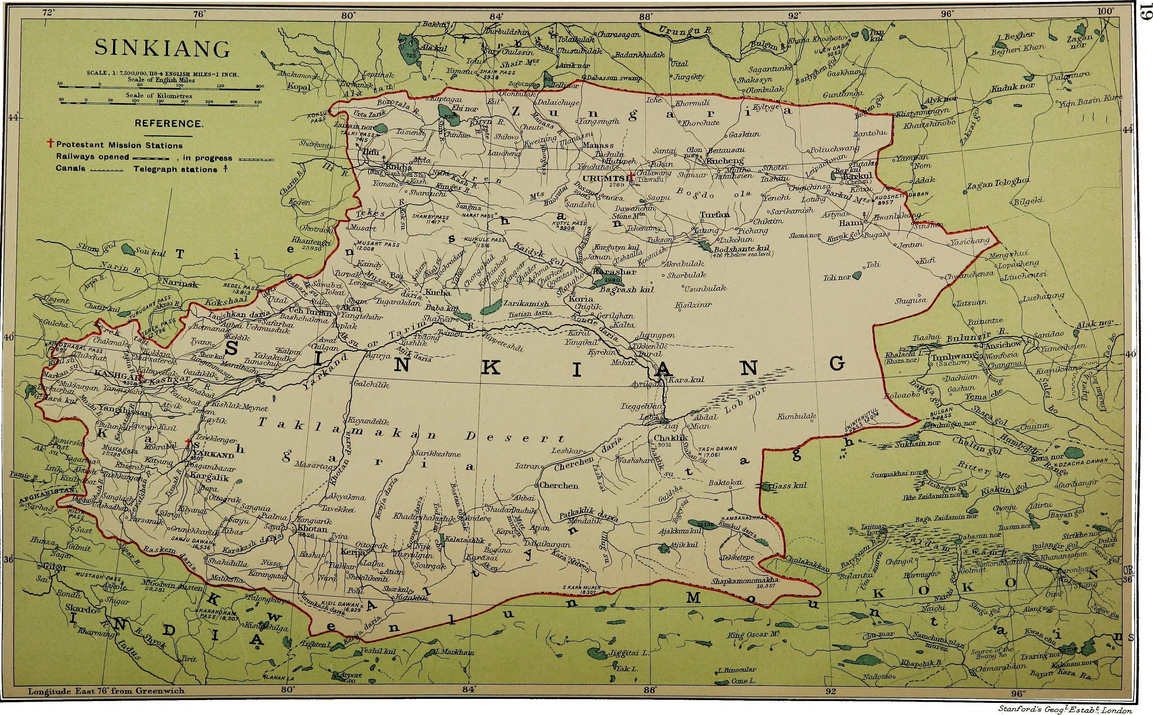
Karakoram Pass
The name means Black Gravel, and it is exactly right. At 5,540 meters, the Karakoram Pass sits in a windswept saddle between two mountains, roughly 45 meters wide, with no vegetation, no ice cap, and no permanent snow -- the relentless winds see to that. For centuries, this bleak notch in the Karakoram Range was the highest point on the caravan route connecting Leh in Ladakh with Yarkand in the Tarim Basin, a crossing where the altitude alone could kill and often did.
A Road Paved with Bones
The caravans that used the Karakoram Pass carried silk, tea, and wool between Central Asia and the Indian subcontinent. What they left behind were bones. The route was notorious for the trail of animal carcasses that lined the approaches -- pack horses, yaks, and camels that succumbed to the altitude, the cold, or the simple absence of anything to eat. There is almost no vegetation on either side of the pass. Traveling south meant three days' march across the Depsang Plains at approximately 5,300 meters, a barren high-altitude plateau with nothing to sustain a caravan except what it carried. The northern approach was marginally kinder, dropping toward the grazing grounds around Shahidullah in the upper Karakash River valley. Despite all this, travelers considered it a relatively easy pass -- the gradual ascent on both sides and the absence of summer snow made it passable for most of the year.
The Paradox of an Easy Pass
Easy is, of course, a relative term when applied to a crossing higher than any summit in the Alps. Temperatures at the pass are extreme. Blizzards strike frequently and without much warning. The winds that keep the saddle clear of snow also make it bitterly, dangerously cold. Yet the Karakoram Pass had advantages that other Himalayan crossings did not: no glaciers to navigate, no technical climbing required, and a reliability of access that kept trade flowing through some of the harshest terrain on Earth. Caravans that survived the crossing emerged into landscapes of startling contrast -- the lush Karakash valley to the north, the austere beauty of Ladakh to the south. Today, no motorable road crosses the pass. It remains closed to all traffic, a trade route that exists now only in memory and on historical maps.
Where Three Nations Meet
The Karakoram Pass sits on the boundary between India's union territory of Ladakh and China's Xinjiang autonomous region, a location that places it at the center of one of Asia's most enduring territorial disputes. The complications trace back to the Simla Agreement of 1972, signed between India and Pakistan, which failed to specify the last 100 kilometers of the ceasefire line from the end of the Line of Control to the Chinese border. That omission left the Siachen Glacier area, immediately southwest of the pass, in a kind of geopolitical limbo. India seized the heights in 1984 with Operation Meghdoot and has held them since.
The Cartographic Tangle
A 1963 boundary treaty between China and Pakistan references a potential tripoint at the Karakoram Pass -- a spot where the borders of India, Pakistan, and China would converge. India, however, was not party to that agreement and has never accepted its terms. The actual de facto tripoint sits roughly 100 kilometers to the west, near Indira Col in the Siachen Muztagh, where the Actual Ground Position Line between Indian and Pakistani forces meets the border with China. Three nations draw the boundaries differently, and the pass itself belongs to no one in any universally accepted sense. The black gravel underfoot is indifferent to the maps drawn over it.
Silence at 18,000 Feet
The Karakoram Pass today is one of the quietest places on Earth. No trucks rumble through. No caravans assemble at its base. The bones of the pack animals have long since been scattered by wind and weather. What remains is the landscape itself: a saddle of dark stone between peaks, swept clean by winds that have not relented in the centuries since the first traders hauled their goods across it. From above, the pass is barely distinguishable from the surrounding terrain -- a subtle dip in a ridge line that extends for hundreds of kilometers. Yet this small depression shaped trade routes, drew borders, and cost lives for generations. Its closure to traffic has not diminished its significance. If anything, it has concentrated it: the Karakoram Pass matters now not for what crosses it, but for what converges around it.
From the Air
Located at 35.51N, 77.82E on the India-China border in the Karakoram Range. Elevation 5,540 m (18,176 ft). The pass sits between the Depsang Plains to the south and the Suget Pass approach to the north. Nearest airport is Leh Kushok Bakula Rimpochee Airport (VILH), approximately 250 km to the south-southwest. Daulat Beg Oldi airstrip, one of the world's highest at 5,065 m, lies to the west. Thoise Airfield serves military operations in the region. Terrain is extremely high-altitude with no vegetation or landmarks at pass level. Severe turbulence, high winds, and icing conditions are common. Recommended viewing altitude: FL350 or above.