Karlsborg Fortress
When Sweden lost Finland to Russia in 1809 and watched Napoleon reshape Europe, the military planners in Stockholm faced an uncomfortable question: what if the enemy reached the capital? Their answer rises from a peninsula on Lake Vattern, one of the largest buildings in northern Europe. Karlsborg Fortress was designed as Sweden's last stand, a place where the king, the parliament, and the nation's gold reserves could retreat and hold out indefinitely. A chandelier made of 276 bayonets hangs in its chapel. The message was clear: Sweden would fight to the end.
The Central Defense Idea
The concept was bold bordering on paranoid. After the Finnish War and the Napoleonic upheaval, Swedish military strategists adopted what they called the central defense idea. If invaders overwhelmed the coastlines and captured Stockholm, the entire apparatus of state would withdraw to the geographic heart of the country. The king would relocate. The Riksdag would convene behind fortress walls. The central bank's gold reserves would be secured in underground vaults. From this impregnable position, Sweden would coordinate resistance until the tide could be turned. Baltzar von Platen chose the Vanas peninsula in 1819, strategically connected to his other great project, the Gota Canal, which would allow supplies and reinforcements to reach the fortress from either coast.
Ninety Years of Construction
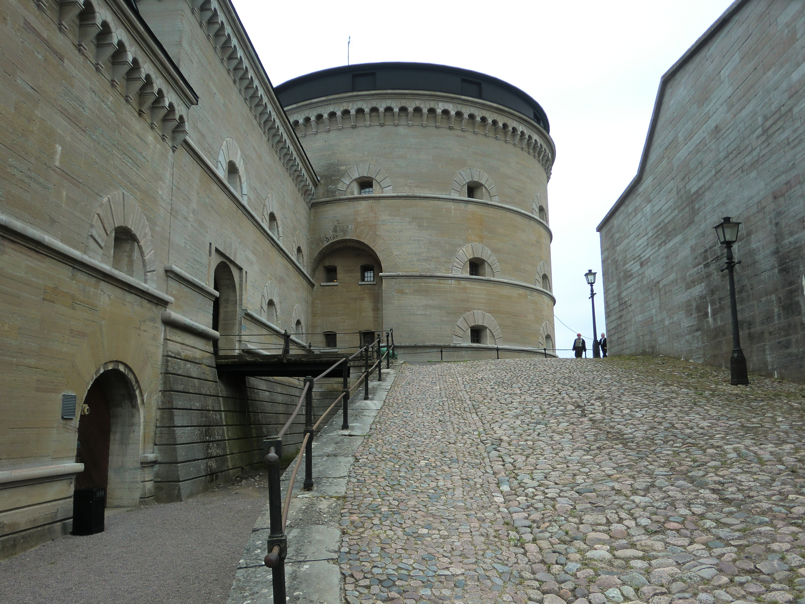
Building a fallback for an entire nation takes time. Construction began in 1819 on 100 hectares of land, with architect Johan av Klen drawing inspiration from Fort Winiary in Posen. Workers quarried limestone from nearby Omberg and raised walls designed to house 6,000 soldiers plus another 8,000 to 10,000 civilians. By 1830, the walls were mostly complete. But funding problems and the relentless advance of artillery technology kept pushing back the completion date. The fortress was not operational until 1870, and the final touches were not applied until 1909. By then, the weapons it was designed to withstand were museum pieces. To compensate, engineers built Vaberget Fortress five kilometers west in the early 1900s, extending the defensive perimeter against modern guns.
A Town Built on Readiness
The fortress never served its apocalyptic purpose. No invading army ever pushed Sweden back to its final redoubt. But Karlsborg Fortress created something lasting: a town. What began as living quarters for fortress personnel grew into a real community, fed by traffic on the Gota Canal that passes through. The fortress officially lost its central defensive role in 1918, after which it became a garrison for the Gota Signal Regiment. In 1984, the Life Regiment Hussars moved in. Today, the Swedish Parachute Ranger School and the Special Operations Group train within its walls. A munitions factory operates next door. The fortress that was built for the worst-case scenario now prepares Sweden's elite soldiers for the challenges of modern warfare.
Sacred Steel
The garrison church occupies the second floor of the central building, the section once designated as the last stand. Originally designed as an emergency assembly hall for the Riksdag in times of crisis, it now serves as a place of worship for military personnel and their families. Look up and you will see the chandelier, 276 bayonets arranged in place of crystal prisms, casting light across a space built for both prayer and defiance. The fortress became a listed building in 1935, preserving not just the architecture but the mindset of a nation preparing for the unthinkable. The Fortress Museum now occupies the floor below the church, documenting the history of Swedish military planning.
Monument to Contingency
From the air, Karlsborg Fortress dominates the Vanas peninsula like a stone ship anchored in Lake Vattern. Its scale is difficult to grasp until you realize that this single structure was meant to contain a government, a treasury, and an army. The lake stretches to the horizon, Sweden's second largest. The Gota Canal connects the waters to the sea. Flying over this landscape, you see the logic of the central defense idea: deep in the interior, surrounded by water, supplied by canal, the fortress would have been a formidable last refuge. Sweden was never forced to test the theory. But Karlsborg stands as a monument to national survival planning, a stone answer to an existential question.
From the Air
Located at 58.53N, 14.53E on the Vanas peninsula, projecting into Lake Vattern in Vastergotland, Sweden. The massive star-fort structure is clearly visible from altitude, with the Gota Canal visible running through the adjacent town. Nearest airport is Skovde Airport (ESGR), approximately 30km west. Lake Vattern, Sweden's second largest lake, dominates the eastern view. Best viewed at 4,000-6,000 feet to appreciate both the fortress scale and its strategic position on the peninsula.