Kasha-Katuwe Tent Rocks National Monument
The Keresan word is kasha-katuwe - white cliffs. Stand among them and the name makes perfect sense. Pale conical spires rise from the desert floor like a gathering of stone tents, some capped with darker boulders that balance improbably on their pointed tips. This is the Pajarito Plateau between Santa Fe and Albuquerque, where volcanic eruptions six to seven million years ago deposited thick layers of ash and rock that wind and water have been sculpting ever since. The Cochiti Pueblo people have known this landscape for centuries. The rest of the world caught up in January 2001, when President Bill Clinton designated it a national monument.
Written in Volcanic Ash
The geology here reads like a disaster story frozen in stone. Between six and seven million years ago, eruptions in the Jemez Mountains volcanic field sent pyroclastic flows racing across the landscape - superheated clouds of gas, ash, and rock fragments traveling at hurricane speed. These flows deposited layer upon layer of volcanic material across the Pajarito Plateau, building up formations geologists assign to the Peralta Tuff. The lighter-colored layers that give the monument its Keresan name are composed of soft pumice and tuff. Over millions of years, rain and wind carved slot canyons through the softer rock while leaving the harder capstones perched atop conical pillars. The tent rocks range from a few feet tall to towering spires, each one a record of differential erosion working at geological timescales.
Cochiti Pueblo's Backyard
Kasha-Katuwe sits on land near Cochiti Pueblo, one of the Keresan-speaking communities that have inhabited the Rio Grande valley for centuries. The monument is co-managed by the Bureau of Land Management and the Cochiti Pueblo tribe, a partnership that reflects the deep connection between this landscape and the people who named it. The surrounding area holds evidence of that long habitation - cliff dwellings tucked into canyon walls, their builders choosing the same sheltered overhangs and alcoves that erosion carved from the volcanic tuff. The Pueblo people understood this terrain long before geologists arrived to classify it.
Four Years of Silence
In March 2020, the monument closed due to the COVID-19 pandemic. It stayed closed for over four years - far longer than most public lands shutdowns. The extended closure reflected both public health concerns and the Cochiti Pueblo community's desire to protect their people. When the monument finally reopened in November 2024, it came with a new reservation system designed to limit annual visitors to approximately 75,000, roughly half the peak of 130,000 visitors the site once received. The change acknowledges what the landscape itself demonstrates: erosion works slowly, but it works constantly, and the tent rocks that took millions of years to form deserve protection from the wear of too many boots on too few trails.
Walking Between the Spires
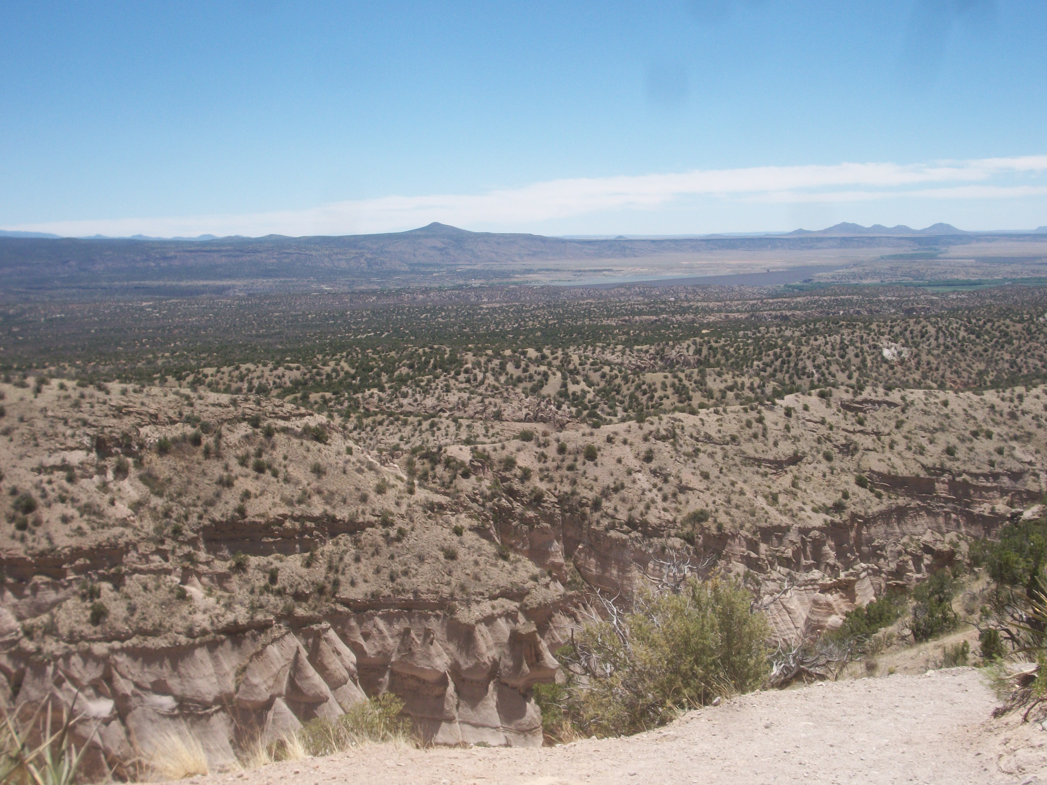
The monument sits between 5,700 and 6,400 feet above sea level, high desert country where the air is thin and the sun is relentless. Slot canyons wind between the formations, their walls narrowing until you can touch both sides at once. Above, the tent rocks rise in pale ranks against a deep blue sky, their capstones casting sharp shadows in the afternoon light. From the higher trails, the view opens up to reveal Cochiti Pueblo lands stretching toward the Rio Grande, with the Jemez Mountains filling the western horizon - the same volcanic range whose ancient eruptions created everything you are standing on. It is a landscape that makes deep time feel tangible, where you can place your hand on the compressed ash of a six-million-year-old catastrophe and feel its texture under your fingers.
From the Air
Located at 35.66N, 106.41W on the Pajarito Plateau, approximately 40 miles southwest of Santa Fe and 50 miles north of Albuquerque. The white tent rock formations are visible from altitude as a distinctive pale patch against the darker surrounding terrain, situated between the Rio Grande valley to the east and the Jemez Mountains to the west. Cochiti Lake is nearby to the southeast. Nearest airports are Santa Fe Municipal (KSAF) approximately 35 miles northeast, and Albuquerque International Sunport (KABQ) approximately 50 miles south. Mountain terrain with variable winds; summer afternoon thunderstorms common over the Jemez range.