Kaunghmudaw Pagoda
Most Burmese pagodas taper upward in layered pyramids, their silhouettes as recognizable as a temple bell. The Kaunghmudaw breaks the pattern. Its dome swells outward in a smooth, pale hemisphere that looks, from the air, like an enormous egg resting on the floodplain northwest of Sagaing. King Thalun ordered its construction in 1636, not as an imitation of the pagodas around him but as a tribute to one 2,500 kilometers away: the ancient Ruwanwelisaya stupa in Sri Lanka, whose curved profile he considered the truest expression of Buddhist architecture.
A Dome Built Around a Giant
Construction began on 25 April 1636, during the Restored Toungoo Kingdom, and took twelve years to complete. But the most intriguing detail of the Kaunghmudaw's origin is the massive Buddha statue sealed inside its base. Carved from solid white marble, the seated figure stands 7.3 meters high, with a head alone measuring 2.4 meters in diameter. Local belief holds that the dome was constructed around the statue rather than the statue being placed inside it afterward. If true, it means the pagoda was conceived not as an empty reliquary but as a shell for something already sacred, its architecture shaped literally by what it protects. The relic chamber is said to contain the lower left tooth relic of the Buddha, eleven hair relics, an alms bowl, and other devotional objects.
Stone Lanterns in Three Languages
The Kaunghmudaw rises 46 meters and measures 274 meters around its base. Its lowest terrace is encircled by 802 stone lanterns, each carved with scenes from the Buddha's life inscribed in three scripts: Burmese, Mon, and Shan. These were not decorative choices. The three languages represented the three main regions of the Restored Toungoo Kingdom, and their presence on the same ring of lanterns was a deliberate statement of unity under Buddhist faith. One hundred and twenty carved figures of nats and devas stand guard along the terrace, spirit guardians drawn from both Buddhist cosmology and the older animist traditions that Burmese Buddhism absorbed rather than erased. The hti, the ceremonial umbrella that crowns the dome, rises 7.92 meters above the summit.
The Color of Purity
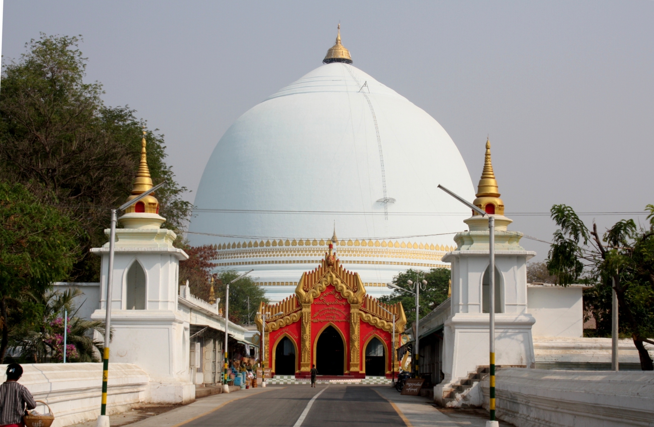
For centuries the Kaunghmudaw has been painted white, following Ceylonese tradition, where white signifies purity. Against the green hillsides of Sagaing, the effect is striking: a pale, luminous form that seems to float above its surroundings, especially at dawn when mist hangs along the Irrawaddy. This whiteness became controversial when Myanmar's military government proposed painting the dome gold, aligning it with the gilded look of most Burmese pagodas. The plan drew sharp criticism from local communities and Buddhist observers who saw it as an erasure of the pagoda's distinct Ceylonese heritage and its centuries-old visual identity. For a structure whose entire design was meant to honor a foreign model, coating it in domestic convention struck many as a contradiction.
Pilgrimage at the Edge of Sagaing
Sagaing is sometimes called Myanmar's spiritual heartland, its hills dotted with hundreds of monasteries and meditation centers. The Kaunghmudaw sits at the northwest edge of this sacred landscape, slightly apart from the cluster of hilltop shrines but no less significant. Pilgrims arrive especially during the annual Kaunghmudaw Pagoda Festival, a celebration that draws devotثees from across the region with religious processions, offerings, and the communal renewal of devotion that Burmese pagoda festivals sustain. For travelers approaching by river or road, the dome is visible well before the rest of Sagaing's skyline comes into view, its rounded profile unmistakable against the angular spires and terraces elsewhere. In a country dense with pagodas, the Kaunghmudaw remains the one that looks like nothing else.
From the Air
Located at 21.93N, 95.94E on the northwestern outskirts of Sagaing, near the Irrawaddy River in central Myanmar. The white hemispherical dome is distinctive from altitude, contrasting with Sagaing's golden hilltop pagodas. Nearest major airport is Mandalay International (VYMD), approximately 35 km southeast. Best viewed at 3,000-5,000 feet AGL for scale. The Irrawaddy River and Sagaing Hill serve as visual landmarks for navigation.