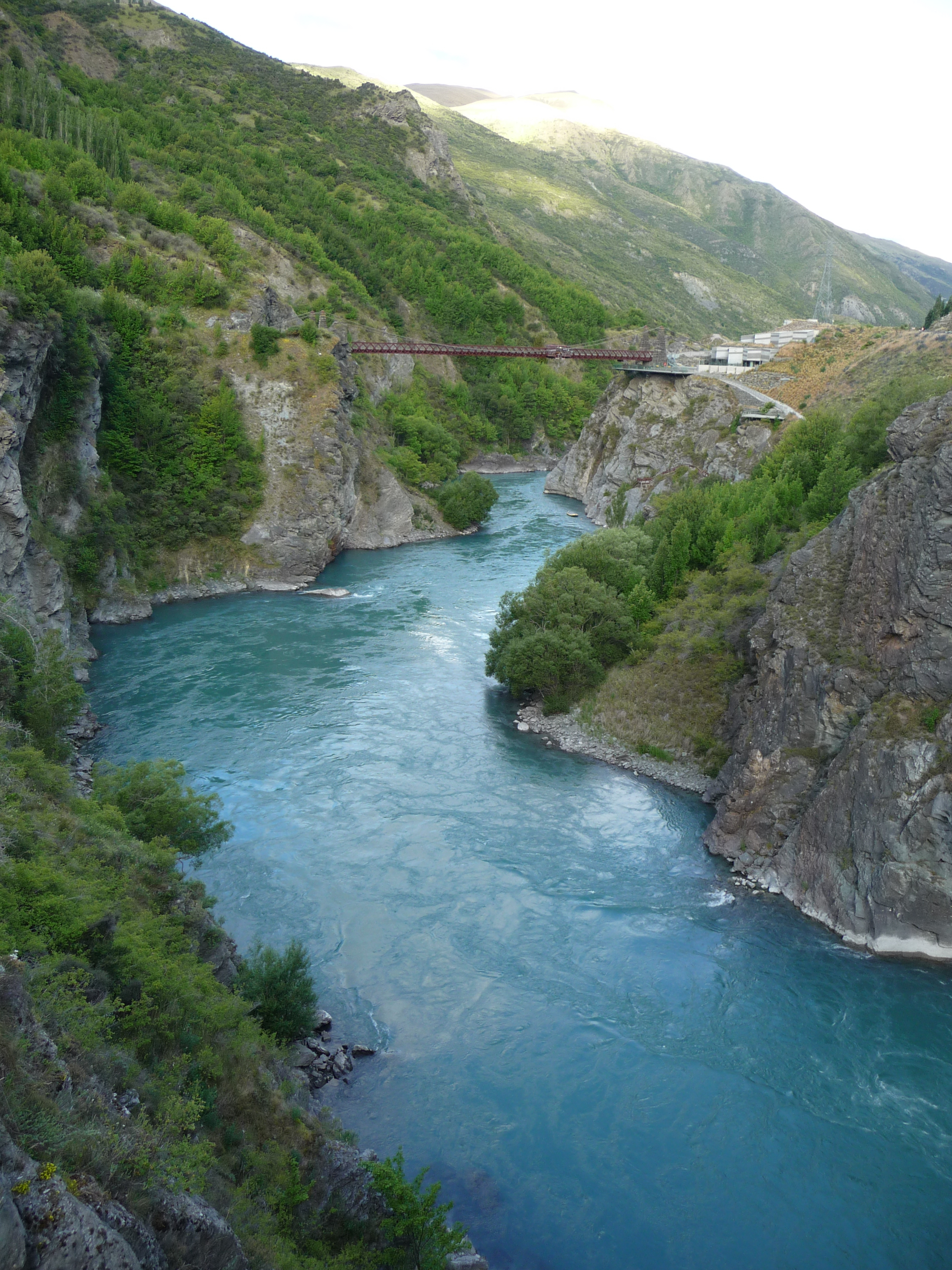
Kawarau Gorge Suspension Bridge
Pilots approaching Queenstown Airport know it as Bungy Bridge -- a mandatory reporting point where general aviation aircraft check in before threading through the mountains toward the runway. That a 19th-century suspension bridge serves as a modern navigation waypoint captures something essential about this structure. The Kawarau Gorge Suspension Bridge has been reinventing its purpose for nearly a century and a half, from goldfield highway to obsolete relic to the place where commercial bungee jumping was born. It hangs 43 meters above the Kawarau River, and it has never stopped being the most interesting way across.
A Road to the Goldfields
By the late 1870s, Central Otago's gold rush was past its initial frenzy but far from finished. Miners, merchants, and machinery still needed to cross the Kawarau River to reach the diggings beyond. Engineer Harry Higginson designed a suspension bridge to span the gorge, and construction was completed in late 1880. The bridge became a critical link in the route from the Wakatipu Basin to the Central Otago goldfields, carrying wagon traffic, livestock, and foot travelers across a river that offered no easy fording. For over 80 years, the bridge served as a working piece of infrastructure. Traffic finally moved to a new highway bridge on State Highway 6 in 1963, and the old suspension bridge entered a quieter chapter -- recognized by the New Zealand Historic Places Trust as a Category I historic place, one of the country's most significant heritage structures.
The Leap That Changed Everything
The bridge might have remained a footnote in goldfield history if not for AJ Hackett and Henry van Asch. In 1988, Hackett -- who had already made headlines by bungee jumping off the Eiffel Tower -- chose the Kawarau bridge as the site for the world's first permanent commercial bungee jumping operation. The appeal was obvious: 43 meters of clear air above a swift river in a dramatic gorge, with the added gravitas of a Victorian-era bridge. The Kawarau became the birthplace of an industry that would spread to every adventure-tourism destination on earth. Today, the AJ Hackett Bungy Company still operates from the bridge, and jumpers still plunge toward the blue-green water below while spectators line the viewing platforms. Ziplines have been added alongside the bungee, but the essential experience remains unchanged -- a willing step off solid ground into empty space.
Where Trails Converge
The bridge sits in a Department of Conservation reserve between the start of the Crown Range Road and the Gibbston wine-growing area, in one of the most scenically concentrated corridors in New Zealand. The Queenstown Trail -- a network of walking and cycling tracks -- crosses the river here, carrying runners, walkers, and mountain bikers over the same deck that once bore gold-laden wagons. The gorge itself is a study in geological force: the Kawarau River has cut deep into schist rock, creating walls that glow gold and grey in the afternoon light. Vineyards climb the sunny terraces above, and the road to the Crown Range -- the highest sealed road in New Zealand -- switchbacks into the mountains just upstream. For pilots, the bridge remains a practical landmark. The Civil Aviation Authority's approach guidance for Queenstown references Bungy Bridge by name, making this heritage structure part of the living airspace as well as the living landscape.
From the Air
Located at 45.01S, 168.90E in the Kawarau Gorge between Queenstown and Cromwell. The bridge is designated as 'Bungy Bridge' by the Civil Aviation Authority of New Zealand and serves as a VFR reporting point for aircraft approaching Queenstown Airport (NZQN), approximately 15 km to the west. The suspension bridge is visible spanning the gorge below State Highway 6's modern bridge. The Crown Range Road climbs into the mountains to the north, and the Gibbston wine region lies to the east. Best viewed at 2,000-4,000 ft when transiting the gorge.