Kealakekua Bay
The name translates to "the god's pathway" in Hawaiian, and for centuries, that is exactly what Kealakekua Bay was. This sheltered indentation on the Big Island's Kona coast served as a corridor between the mortal and the divine, its sheer cliffs housing the bones of Hawaiian royalty in places so inaccessible that their exact locations remain unknown. It was also, on a February morning in 1779, the place where Captain James Cook's luck ran out -- transforming this sacred bay into one of the most consequential collision points between Pacific Island culture and European exploration.
Cliffs of Kings and Gods
Settlement at Kealakekua stretches back over a thousand years. At the bay's south end stands Hikiau Heiau, a massive luakini temple that Cook himself recorded as roughly 16 feet high, 250 feet long, and 100 feet wide. The sheer cliff face above the bay, known as Ka-pali-kapu-o-Keoua -- the sacred cliffs of Keoua -- served as the burial place of Hawaiian royalty. Keoua Nui, sometimes called the "father of kings" because so many rulers descended from him, gave the cliff its name. The inaccessibility of the rock face kept the graves safe from desecration for generations. At the bay's north end, the village of Kaawaloa hosted the Puhina O Lono Heiau and royal residences. Its name means "the distant kava," after the medicinal plant central to religious ritual. Each year, the bay became the focus of extensive Makahiki celebrations, the great harvest festival honoring the god Lono.
The Day Everything Changed
Captain James Cook sighted Kealakekua Bay on the morning of January 17, 1779, sailing the Resolution and Discovery into what he estimated was a community of several thousand people, with many thousands more in the surrounding hills. The timing of his arrival during Makahiki season -- a period associated with Lono -- may have shaped the Hawaiians' initial reception, though the full dynamics of that encounter remain debated by historians. What is not debated is how it ended. After a series of escalating tensions over stolen property and misunderstandings, Cook was killed on the bay's shore on February 14, 1779. The ships that followed told the bay's next chapter: fur traders Nathaniel Portlock and George Dixon anchored in 1786 but refused to go ashore, having witnessed Cook's death firsthand on that earlier voyage. By the 1790s, the bay had become a regular stop for merchant vessels, and Kamehameha was consolidating his control of the island.
Bones, Bibles, and Cattle
George Vancouver arrived in 1793 hoping to broker peace among the islands. He left behind cattle and sheep from California, gifts that would reshape the landscape -- the cattle went feral, becoming such pests that Hawaiian cowboys called paniolo were eventually recruited to manage them. Vancouver also oversaw the construction of the Britania, a 36-foot European-style ship built by his carpenters alongside Hawaiian and British workers. The old religion crumbled in the years after Kamehameha's death in 1819. Wood carvings were burned and temples fell into disrepair. Chiefess Kapiolani, one of the last royals to live on the bay, watched the destruction with heartbreak. In 1829, seeing that the demolition of temples included desecrating ancestral bones at nearby Puuhonua o Honaunau, she rescued the remains of the old chiefs and hid them in the Pali Kapu O Keoua cliffs. Those bones were later moved to the Royal Mausoleum of Hawaii in 1858.
Where Dolphins Rest
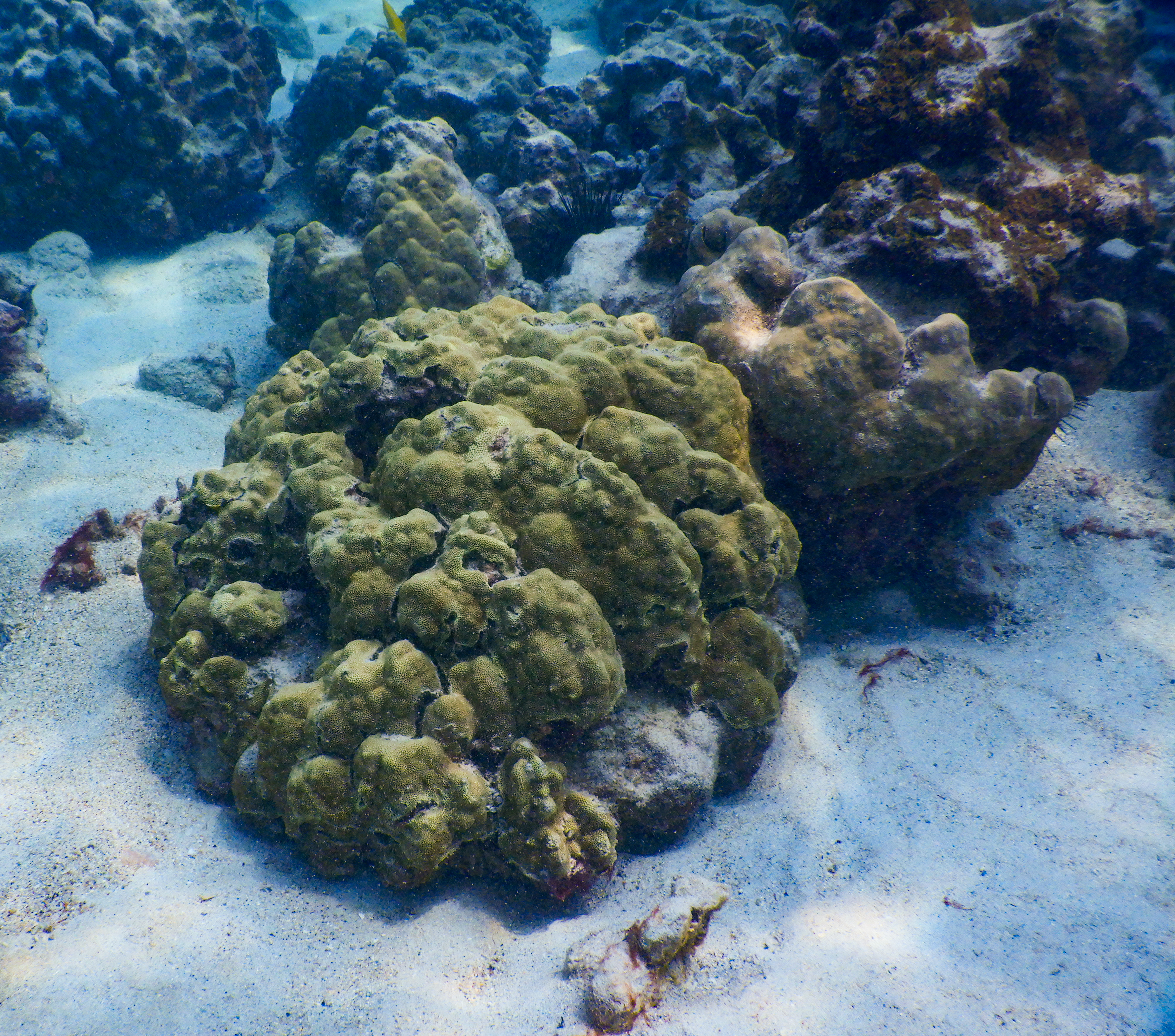
Today Kealakekua Bay is a marine life conservation district, and the transformation from royal seat to ecological sanctuary has been remarkably complete. Hawaiian spinner dolphins frequent the bay each morning, using its calm waters as a resting place and nursery for mothers and calves. Extensive coral reefs thrive in the protected shallows, making it one of the best snorkeling and diving sites in Hawaii. The white obelisk of the Cook Monument stands on the northern shore, reachable only by a steep hour-long hike or a 1.5-mile paddle across the bay -- no road reaches it. Hurricane Iniki stripped most of the beach sand in 1992, but the underwater world remains vibrant. Even the geology surprises: in 1877, a single-day eruption of Mauna Loa occurred underwater within the bay itself, sending blocks of hardened lava floating to the surface while curious onlookers in boats encountered turbulent, heated water.
Sacred Ground, Protected Waters
About 180 acres around the bay were designated as Kealakekua Bay State Historical Park in 1967, and the entire area was added to the National Register of Historic Places in 1973. A narrow one-lane road to the south leads to Puuhonua o Honaunau National Historical Park, which preserves additional sacred sites. The former village of Kaawaloa is now overgrown with kiawe trees, its ancient platforms hidden beneath canopy. State regulations restrict kayaks, paddleboards, and surfboards from entering the bay unless visitors join a licensed local tour operator, a measure designed to protect both the marine ecosystem and the dolphins that depend on these waters for rest. Mark Twain wrote about the bay and Cook's death in his 1872 book Roughing It, and the 1933 song "My Little Grass Shack in Kealakekua, Hawaii" gave the bay a place in American popular culture. But the bay's truest identity predates all of these -- it remains ke ala ke kua, the god's pathway, carved into volcanic rock and open sea.
From the Air
Kealakekua Bay sits at 19.475N, 155.929W on the Kona coast of the Big Island, about 12 miles south of Kailua-Kona. The bay is a distinct semicircular indentation backed by dramatic cliff faces, easily identifiable from the air. Best viewed from 2,000-4,000 feet AGL. The white Cook Monument on the northern shore is a helpful visual reference. Nearest airports: Kona International (PHKO) approximately 12 nm north. Puuhonua o Honaunau National Historical Park is visible just to the south along the coastline.